Category:Maps of Fiji
Appearance
Countries of Oceania: Australia · Fiji · Federated States of Micronesia · Kiribati · Marshall Islands · Nauru · New Zealand · Palau · Papua New Guinea · Samoa · Solomon Islands · Tonga · Tuvalu · Vanuatu
Other areas: American Samoa · Clipperton Island · Cocos (Keeling) Islands · Cook Islands · French Polynesia · Guam · Hawaii · New Caledonia · Niue · Norfolk Island · Northern Mariana Islands · Pitcairn Islands · Tokelau · Wallis and Futuna – Partly: British overseas territories · Overseas France · Indonesia · French Southern and Antarctic Lands · United States Minor Outlying Islands
Other areas: American Samoa · Clipperton Island · Cocos (Keeling) Islands · Cook Islands · French Polynesia · Guam · Hawaii · New Caledonia · Niue · Norfolk Island · Northern Mariana Islands · Pitcairn Islands · Tokelau · Wallis and Futuna – Partly: British overseas territories · Overseas France · Indonesia · French Southern and Antarctic Lands · United States Minor Outlying Islands
Wikimedia category | |||||
| Upload media | |||||
| Instance of | |||||
|---|---|---|---|---|---|
| Category combines topics | |||||
 | |||||
Subcategories
This category has the following 21 subcategories, out of 21 total.
*
- Maps of Suva (6 F)
C
F
- Flag maps of Fiji (5 F)
G
L
M
- Maps of Fiji on stamps (1 F)
- Maps of Rotuma (13 F)
O
- Old maps of Fiji (67 F)
P
S
T
- Topographic maps of Fiji (3 F)
Media in category "Maps of Fiji"
The following 54 files are in this category, out of 54 total.
-
00-249 Rabi.png 1,753 × 1,631; 267 KB
-
ECDM 20140226 Fiji SevereWeather.pdf 1,625 × 1,125; 436 KB
-
ECDM 20140303 World Events.pdf 1,625 × 1,125; 645 KB
-
ECDM 20140313 World Events.pdf 1,625 × 1,125; 250 KB
-
ECDM 20150108 TC ULA.pdf 1,625 × 1,125; 530 KB
-
ECDM 20150310 tropical cyclones.pdf 1,625 × 1,125; 999 KB
-
ECDM 20150312 PAM OLWYN.pdf 1,625 × 1,125; 471 KB
-
ECDM 20150929 Worldevents.pdf 1,625 × 1,125; 459 KB
-
ECDM 20160215 TC.pdf 1,625 × 1,125; 492 KB
-
ECDM 20160216 TC.pdf 1,625 × 1,125; 583 KB
-
ECDM 20160218 TC.pdf 1,625 × 1,125; 729 KB
-
ECDM 20160222 TC.pdf 1,625 × 1,125; 1.01 MB
-
ECDM 20160226 Fiji TC.pdf 1,625 × 1,125; 867 KB
-
ECDM 20160405 World SevereWeather.pdf 1,625 × 1,125; 620 KB
-
ECDM 20160406 Fiji TC ZENA.pdf 1,625 × 1,125; 626 KB
-
ECDM 20160407 World SevereWeather.pdf 1,625 × 1,125; 996 KB
-
ECDM 20180404 Australia-Fiji TCs.pdf 2,479 × 1,754; 1 MB
-
ECDM 20180409 Fiji TC.pdf 2,479 × 1,754; 829 KB
-
ECDM 20180430 South-Pacific TC-Season.pdf 2,479 × 1,754; 1,024 KB
-
ECDM 20190227 TC POLA.pdf 1,625 × 1,125; 560 KB
-
ECDM 20191212 SAMOA Measles.pdf 1,625 × 1,125; 467 KB
-
ECDM 20200117 TC TINO.pdf 1,625 × 1,125; 616 KB
-
ECDM 20200406 TC HAROLD.pdf 1,625 × 1,125; 663 KB
-
ECDM 20200415 TC HAROLD.pdf 1,625 × 1,125; 720 KB
-
ECDM 20201214 TC-YASA.pdf 1,625 × 1,125; 515 KB
-
ECDM 20201217 TC-YASA.pdf 1,625 × 1,125; 778 KB
-
ECDM 20210201 SW Pacific TCs(1).pdf 1,625 × 1,125; 677 KB
-
ECDM DailyMap 20180212 TC GITA.pdf 2,479 × 1,754; 898 KB
-
ECHO DM TC GITA FIJI TONGA 20180213.pdf 2,479 × 1,754; 1.29 MB
-
Ethnic Groups of Fiji.pdf 852 × 791; 1,017 KB
-
Ethnic Map of Fiji.png 1,500 × 1,395; 290 KB
-
Fiji - DPLA - d0c65a99afa08f59556bc94ef3e89ad3.jpg 2,550 × 3,272; 4.95 MB
-
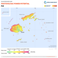
Fiji DNI Solar-resource-map GlobalSolarAtlas World-Bank-Esmap-Solargis.png 1,842 × 1,842; 626 KB
-
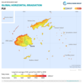
Fiji GHI Solar-resource-map GlobalSolarAtlas World-Bank-Esmap-Solargis.png 1,842 × 1,842; 615 KB
-
Fiji topo.png 2,000 × 1,299; 1.21 MB
-
Fijian Drua Super Rugby franchise area.png 1,517 × 1,578; 44 KB
-
FijiOMCmap.png 933 × 766; 43 KB
-
FLII Fiji.png 1,117 × 856; 181 KB
-
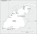
LauIslandsMap.JPG 332 × 385; 26 KB
-
North Fiji Basin 00Ma.jpg 1,433 × 815; 317 KB
-
North Fiji Basin 03Ma.jpg 1,433 × 815; 306 KB
-
North Fiji Basin 06Ma.jpg 1,433 × 815; 291 KB
-
North Fiji Basin 09Ma.jpg 1,433 × 815; 282 KB
-
North Fiji Basin 12Ma.jpg 1,433 × 815; 271 KB
-
North Fiji Basin NOAA.png 1,361 × 769; 2.15 MB
-
Pacific Ocean laea Oceanian countries map.jpg 1,165 × 1,070; 542 KB
-
PAT - Fiji.gif 860 × 975; 42 KB
-
Rewa river one layer.svg 758 × 562; 139 KB
-
Rhipidura personata range at Fiji.png 933 × 766; 35 KB
-
RotumaMap.png 614 × 356; 7 KB
-
Samoa, Tonga and Fiji Map.png 3,440 × 2,372; 783 KB
-
Sophora Busa.JPG 713 × 420; 58 KB
-
Vanuabalavu2.png 425 × 401; 26 KB


