Category:Maps of islands of Vanuatu
Jump to navigation
Jump to search
Subcategories
This category has the following 6 subcategories, out of 6 total.
G
- Maps of Gaua Island (5 F)
M
- Maps of Ambrym (3 F)
- Maps of Erromango (2 F)
- Maps of Tanna (5 F)
- Maps of Éfaté Island (20 F)
Media in category "Maps of islands of Vanuatu"
The following 59 files are in this category, out of 59 total.
-
00-323 Ambae.tif 2,694 × 1,630; 12.58 MB
-
00-325 MALO I.png 1,756 × 2,412; 764 KB
-
04-018b Vanuatu Aneityum Is.tif 1,188 × 1,311; 4.46 MB
-
08-100 Pentecost languages.tif 953 × 1,949; 5.32 MB
-
Melanesien (östliche Hälfte) 1870 Karte.jpg 2,372 × 1,700; 1.73 MB
-
Admiralty Chart No 1570 Malo Island to Efate Island, Published 1894, New Edition 1952.jpg 11,071 × 16,307; 17.96 MB
-
Admiralty Chart No 500 Anchorages in Malekula Island, Published 1895.jpg 9,541 × 7,132; 11.78 MB
-
Ambae island 3D pic.jpg 1,234 × 899; 123 KB
-
Aore US Nautical Chart 1950.jpg 15,020 × 10,418; 58.7 MB
-
BanksAndRowa Islands Map.png 505 × 499; 8 KB
-
Daakaka-region on Ambrym Vanuatu.svg 511 × 358; 131 KB
-
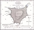
Futuna (Vanuatu) 1901 Nautical Chart.jpg 2,224 × 1,946; 1.14 MB
-
Gauacloseupmap.JPG 545 × 502; 29 KB
-
Gauacloseupmap2.png 545 × 502; 10 KB
-
Hiu.PNG 1,326 × 1,148; 508 KB
-
Lelepa.PNG 1,326 × 1,148; 430 KB
-
Lifou 1870 Karte (cropped).jpg 533 × 477; 124 KB
-
Linua.PNG 1,326 × 1,148; 583 KB
-
Lo Vanuatu.PNG 1,326 × 1,148; 602 KB
-
MalakulaMap Vanuatu.jpg 548 × 480; 36 KB
-
MalakulaMap.png 548 × 480; 9 KB
-
Male Zaliv.PNG 1,326 × 1,148; 584 KB
-
Map of approach to Efate Island.jpg 1,184 × 1,195; 485 KB
-
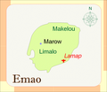
Map of Emao.png 1,326 × 1,148; 407 KB
-
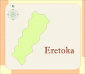
Map of Eretoka.png 1,326 × 1,148; 425 KB
-
Map of Gaua Island.png 545 × 502; 7 KB
-
Map of Maewo Island Vanuatu with villages.jpg 1,080 × 1,989; 197 KB
-
Map of Maewo Island Vanuatu.jpg 631 × 1,080; 107 KB
-
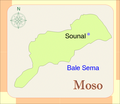
Map of Moso.png 1,326 × 1,148; 429 KB
-
Map of Pele.png 1,326 × 1,148; 390 KB
-
Map of Tegua.png 1,326 × 1,148; 579 KB
-
Map of Toga island.png 1,326 × 1,148; 598 KB
-
Map-Gaua-Vanuatu.png 727 × 544; 37 KB
-
Maéwomap mk.png 550 × 786; 19 KB
-
Maéwomap.JPG 530 × 802; 108 KB
-
Maéwomap.png 550 × 786; 8 KB
-
Mеtoma.PNG 1,326 × 1,148; 601 KB
-
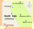
Nguna Vanuatu.JPG 1,268 × 1,097; 263 KB
-
Nh-map-bg.jpg 913 × 1,665; 85 KB
-
Nmwel.PNG 1,326 × 1,148; 582 KB
-
North Vate.PNG 1,326 × 1,148; 422 KB
-
Paamamap.png 547 × 505; 7 KB
-
Pentecostmap.JPG 550 × 847; 39 KB
-
Pentecostmap.png 550 × 847; 9 KB
-
ShepherdIslandsMap.png 568 × 663; 12 KB
-
Tannamap.png 544 × 550; 8 KB
-
TannamapPhilip.png 544 × 550; 22 KB
-
TannamapVanuatu.JPG 544 × 550; 30 KB
-
Toga-island Vanuatu.png 464 × 426; 36 KB
-
Torres-Inseln (Vanuatu).png 381 × 599; 56 KB
-
TorresIslandsMap.png 546 × 858; 10 KB
-
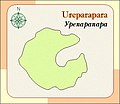
Ureparapara.JPG 436 × 378; 36 KB
-
Vanuatu Efate be.png 600 × 572; 88 KB
-
Vanuatu Torres-islands map.png 700 × 555; 75 KB
-
Vanuatu-Hiw-Toponymic.png 763 × 734; 94 KB
-
Vanuatu-Torres-Banks.png 1,025 × 750; 183 KB
-
Vanuatu-Torres-islands-Toponymic.png 1,340 × 1,398; 99 KB
-
Womtelo Map-Banks-Vanuatu 1000.png 1,001 × 900; 182 KB
-
Épimap.JPG 544 × 414; 28 KB


