Category:Maps of the Cook Islands
Jump to navigation
Jump to search
Subcategories
This category has the following 11 subcategories, out of 11 total.
!
F
M
O
R
T
Pages in category "Maps of the Cook Islands"
This category contains only the following page.
Media in category "Maps of the Cook Islands"
The following 44 files are in this category, out of 44 total.
-
Aitutakisol.png 2,561 × 2,569; 465 KB
-
Aitutakitopo plus.png 897 × 900; 157 KB
-
Atiu location rus.png 1,440 × 900; 30 KB
-
Atiu map rus.png 2,459 × 3,156; 815 KB
-
Atiu map.jpg 1,240 × 902; 119 KB
-
Atiu.png 833 × 968; 177 KB
-
Atiumap.png 1,676 × 1,387; 393 KB
-
Atoll research bulletin (1990) (19722938934).jpg 2,140 × 3,204; 953 KB
-
CK inseln lage3.png 990 × 695; 64 KB
-
Cook Islands languages map.svg 775 × 814; 167 KB
-
Cook-Islands DNI Solar-resource-map GlobalSolarAtlas World-Bank-Esmap-Solargis.png 1,842 × 2,605; 617 KB
-
Cook-Islands GHI Solar-resource-map GlobalSolarAtlas World-Bank-Esmap-Solargis.png 1,842 × 2,605; 627 KB
-
Diplomatic missions in the Cook Islands.svg 940 × 415; 1.43 MB
-
Diplomatic missions of the Cook Islands.svg 940 × 415; 1.43 MB
-
Flag Map Of New Zealand And His Territories.png 462 × 711; 54 KB
-
Foreign relations of the Cook Islands.svg 940 × 415; 1.43 MB
-
Isle Mangeea, Isle Toobouai, I. Wateeoo (19572836145).jpg 3,096 × 3,992; 1.79 MB
-
Kakerori Distribution on Atiu.jpg 2,952 × 2,125; 240 KB
-
Line Islands map.png 2,500 × 3,400; 153 KB
-
Location of Cook Islands.png 600 × 477; 375 KB
-
Mangaia english version.png 1,000 × 745; 314 KB
-
Mangaia.png 739 × 826; 197 KB
-
Mangaiamap.png 2,000 × 1,490; 801 KB
-
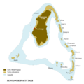
Manuae Atoll map.jpg 1,240 × 902; 261 KB
-
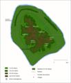
Manuae.png 900 × 655; 68 KB
-
Map of the Cook Islands Federation.png 2,296 × 1,620; 99 KB
-
Mauke Island topo map 2014.jpg 9,438 × 12,343; 6.43 MB
-
Mauke map.jpg 1,240 × 902; 130 KB
-
Mitiaro Island map.jpg 1,240 × 902; 200 KB
-
Mitiaro Island topo map 2014 (cropped).jpg 3,461 × 3,593; 2.08 MB
-
Mitiaro Island topo map 2014.jpg 9,438 × 12,343; 6.87 MB
-
Nassau Island map.jpg 1,232 × 928; 207 KB
-
Pacific Ocean laea Oceanian countries map.jpg 1,165 × 1,070; 542 KB
-
Palmerston Island map.jpg 1,600 × 1,162; 528 KB
-
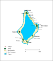
Palmerston.png 2,717 × 3,093; 414 KB
-
Palmerston1.png 2,273 × 2,474; 263 KB
-
PAT - Cook Islands.gif 860 × 975; 36 KB
-
Penrhyn.png 1,626 × 1,580; 333 KB
-
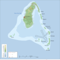
Pukapuka Atoll map.jpg 1,220 × 894; 348 KB
-
Pukapuka.png 2,400 × 1,811; 333 KB
-
Suwarrow map.jpg 1,240 × 902; 221 KB
-
Takutea Island map.jpg 1,240 × 902; 185 KB
-
Wyspy Cooka.png 1,258 × 1,773; 310 KB


