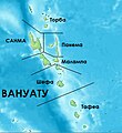
Category:Maps of the provinces of Vanuatu
Jump to navigation
Jump to search
Media in category "Maps of the provinces of Vanuatu"
The following 23 files are in this category, out of 23 total.
-
Malampa (Vanuatu).png 213 × 372; 4 KB
-
Malampa Vanuatu.JPG 444 × 773; 140 KB
-
Penama (Vanuatu).png 213 × 372; 4 KB
-
Penama Vanuatu.jpg 444 × 773; 145 KB
-
Sanma (Vanuatu).png 213 × 372; 3 KB
-
Sanma Vanuatu.jpg 444 × 773; 143 KB
-
Shefa (Vanuatu).png 213 × 372; 4 KB
-
Shefa Vanuatu.JPG 444 × 773; 142 KB
-
Tafea (Vanuatu).png 213 × 372; 4 KB
-
Tafea Vanuatu.jpg 549 × 882; 168 KB
-
Torba (Vanuatu).png 213 × 372; 3 KB
-
Torba Vanuatu.jpg 344 × 599; 105 KB
-
Vanuatu provinces - Malampa.svg 544 × 1,076; 109 KB
-
Vanuatu provinces - Penama.svg 544 × 1,076; 109 KB
-
Vanuatu provinces - Sanma.svg 544 × 1,076; 109 KB
-
Vanuatu provinces - Shefa.svg 544 × 1,076; 109 KB
-
Vanuatu provinces - Tafea.svg 544 × 1,076; 109 KB
-
Vanuatu provinces - Torba.svg 544 × 1,076; 109 KB
-
Vanuatu Provinces Macedonian.JPG 558 × 609; 40 KB
-
Vanuatu Provinces.JPG 558 × 609; 36 KB
-
Vanuatu provinces.svg 544 × 1,076; 108 KB
-
Vanuatu regions.png 213 × 372; 4 KB
-
Адм . деление Вануату (рус.).JPG 213 × 372; 13 KB


