
Category:Maps of Toronto
Most populous urban areas of the world: Ahmedabad [IN] · Alexandria [EG] · Algiers [DZ] · Amman [JO] · Atlanta [US] · Baghdad [IQ] · Bandung [ID] · Bangkok [TH] · Barcelona [ES] · Beijing [CN] · Belo Horizonte [BR] · Bengaluru [IN] · Bogotá [CO] · Boston [US] · Buenos Aires [AR] · Busan [KR] · Cairo [EG] · Chengdu [CN] · Chennai [IN] · Chicago [US] · Chongqing [CN] · Colombo [LK] · Dalian [CN] · Dallas [US] · Dar es Salaam [TZ] · Delhi [IN] · Detroit [US] · Dhaka [BD] · Dubai [AE] · Faisalabad [PK] · Foshan [CN] · Fukuoka [JP] · Guadalajara [MX] · Guangzhou [CN] · Guatemala City [GT] · Hangzhou [CN] · Hanoi [VN] · Harbin [CN] · Ho Chi Minh City [VN] · Hong Kong [CN] · Houston [US] · Hyderabad [IN] · Islamabad [PK] · Istanbul [TR] · Jakarta [ID] · Jinan [CN] · Johannesburg [ZA] · Karachi [PK] · Khartoum [SD] · Kinshasa [CD] · Kolkata [IN] · Kuala Lumpur [MY] · Lahore [PK] · Lima [PE] · London [GB] · Los Angeles [US] · Madrid [ES] · Manila [PH] · Medan [ID] · Mexico City [MX] · Miami [US] · Milan [IT] · Moscow [RU] · Mumbai [IN] · Nagoya [JP] · Nairobi [KE] · Nanjing [CN] · New York City [US] · Osaka [JP] · Paris [FR] · Philadelphia [US] · Pune [IN] · Qingdao [CN] · Rio de Janeiro [BR] · Riyadh [SA] · Saint Petersburg [RU] · San Francisco [US] · Santiago [CL] · São Paulo [BR] · Semarang [ID] · Seoul [KR] · Shanghai [CN] · Shantou [CN] · Shenyang [CN] · Shenzhen [CN] · Singapore [SG] · Surabaya [ID] · Surat [IN] · Suzhou [CN] · Taipei [TW] · Tehran [IR] · Tianjin [CN] · Tokyo [JP] · Toronto [CA] · Visakhapatnam [IN] · Washington, D.C. [US] · Wuhan [CN] · Xi'an [CN] · Yangon [MM] · Zhuzhou [CN]
Wikimedia category | |||||
| Upload media | |||||
| Instance of | |||||
|---|---|---|---|---|---|
| Category combines topics | |||||
| Toronto | |||||
capital and largest city of the province of Ontario, Canada    .jpg)          | |||||
| Spoken text audio | |||||
| Pronunciation audio | |||||
| Instance of |
| ||||
| Named after | |||||
| Location | |||||
| Located in or next to body of water | |||||
| Legislative body | |||||
| Head of government |
| ||||
| Founded by | |||||
| Inception |
| ||||
| Population |
| ||||
| Area |
| ||||
| Elevation above sea level |
| ||||
| Different from | |||||
| official website | |||||
 | |||||
Subcategories
This category has the following 17 subcategories, out of 17 total.
'
- Maps of Etobicoke (3 F)
- Maps of Leaside (4 F)
- Maps of Mimico (9 F)
- Maps of Scarborough, Ontario (17 F)
L
- Locator maps of Toronto (73 F)
N
- Neighbourhood maps of Toronto (163 F)
O
P
S
- Street maps of Toronto (56 F)
T
Media in category "Maps of Toronto"
The following 63 files are in this category, out of 63 total.
-
 2021 Black Visible minority per Census tract, Toronto.png 3,507 × 2,480; 1.08 MB
-
 BikeshareTrips1920x1080.png 1,920 × 1,080; 3.39 MB
-
-
 East York locator.png 1,500 × 1,115; 582 KB
-
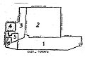 EastToronto1894.jpg 481 × 324; 42 KB
-
 Filipino Distribution in Toronto, 2021 Census.jpg 1,306 × 1,538; 178 KB
-
 Greater Toronto Area map-de.svg 655 × 675; 81 KB
-
 Greater Toronto Area map-es.svg 643 × 500; 263 KB
-
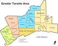 Greater Toronto Area map.svg 643 × 500; 327 KB
-
 Greek Distribution in Toronto, 2021 Census.jpg 1,306 × 1,555; 165 KB
-
 Italian Distribution in Toronto, 2021 Census.jpg 1,266 × 1,507; 162 KB
-
 Jane Street.jpg 600 × 300; 50 KB
-
 Japanese Distribution in Toronto, 2021 Census.jpg 1,306 × 1,596; 181 KB
-
 Jewish Distribution in Toronto, 2021 Census.jpg 1,020 × 1,472; 127 KB
-
 Lower course of the Rouge River, circa 1932.jpg 4,717 × 2,012; 4.02 MB
-
 Map of Don Mills Road, Toronto, Canada.png 420 × 1,085; 61 KB
-
 Map of Toronto Expwys.gif 972 × 720; 134 KB
-
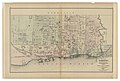
 Map of Toronto in 1834.jpg 1,399 × 1,920; 298 KB
-
 North Toronto map.PNG 1,500 × 1,115; 608 KB
-
 North York Locator.png 1,500 × 1,115; 660 KB
-
 Old Toronto locator.png 1,500 × 1,115; 661 KB
-
 Parkdale provincial electoral district 1943–1951.pdf 1,658 × 1,656; 45 KB
-
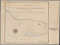
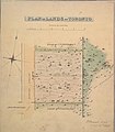 Plan of lands at Toronto, 1848.jpg 1,920 × 2,186; 639 KB
-
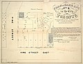 Plan of park lot no. 2, in the city of Toronto, 1855.jpg 1,920 × 1,477; 425 KB
-

-
 Plan of Toronto (I0029237).jpg 7,315 × 3,152; 17.04 MB
-
 Plan of Toronto (I0029237).tif 7,315 × 3,152; 65.97 MB
-
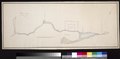
 Plan of Toronto - 1788 (I0030170).jpg 9,768 × 4,771; 29.72 MB
-
 Plan of Toronto - 1788 (I0030170).tif 9,768 × 4,771; 133.35 MB
-
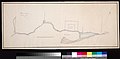
 Plan of Toronto Harbour 1792.jpg 10,351 × 7,819; 4.04 MB
-
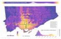
 Population density in Toronto in 1914.jpg 4,943 × 3,503; 4.05 MB
-
 RaymoreDrive1953.png 886 × 570; 69 KB
-
 RaymoreDriveFlood.png 876 × 571; 78 KB
-
 RaymoreDriveMap.png 882 × 567; 70 KB
-
 Regents Park Map.png 720 × 520; 133 KB
-
 Regents Park Map.svg 720 × 520; 155 KB
-
 RunnymedeMap.png 600 × 300; 39 KB
-
 Scarboro RT -- light rail or heavy rail....jpg 1,790 × 2,241; 92 KB
-
 Scarborough locator.png 1,500 × 1,115; 575 KB
-
 Sikh Distribution in Toronto, 2021 Census.jpg 1,129 × 1,728; 144 KB
-
 South Asian Distribution in Toronto, 2021 Census.jpg 1,275 × 1,545; 173 KB
-
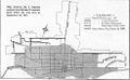
 SouthToronto1894.jpg 458 × 344; 68 KB
-
 Spadina Expressway Route Map.png 1,372 × 2,104; 131 KB
-
 The American journal of science (1917) (18149780602).jpg 3,312 × 1,114; 706 KB
-
 Topographical Map of Toronto.png 3,819 × 2,481; 5.06 MB
-
 Toronto annex.png 514 × 731; 43 KB
-
 Toronto annex.svg 744 × 1,052; 196 KB
-
 Toronto Centre Elections Canada map 35028 (2015 boundaries).gif 800 × 1,086; 242 KB
-
 Toronto Danforth Elections Canada map 35109 (2015 boundaries).gif 800 × 1,079; 292 KB
-
 Toronto neighbourhoods.svg 822 × 592; 88 KB
-
 Toronto Postal Zones.png 1,060 × 811; 210 KB
-
 Toronto Public Library Branches 2022.png 2,048 × 1,536; 3.69 MB
-
 Toronto rail 1921.jpg 981 × 606; 147 KB
-
 Toronto Ridings - 1904.PNG 1,017 × 746; 766 KB
-
 Toronto transit access to jobs 2550x1650.png 2,550 × 1,650; 1.92 MB
-
 Toronto travel times from downtown.png 1,420 × 775; 1.21 MB
-
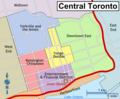 Toronto WV downtown districts map.png 1,600 × 1,322; 631 KB
-
 TorontoAmalgamation1834to1998Animated.gif 2,205 × 1,671; 1.31 MB
-
 Transit use map.png 1,558 × 806; 167 KB
-
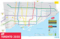 TTC Fantasy Map.jpg 2,664 × 1,728; 1.6 MB
-
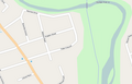
 West Toronto Diamond OSM.png 1,029 × 549; 675 KB
-
 York locator.png 1,500 × 1,115; 665 KB
-
 Yorkdale-Glen Park map.png 561 × 592; 86 KB


.jpg)
.jpg)


.gif)
.gif)


_(18149780602).jpg)