Category:Maps of Chicago
Jump to navigation
Jump to search
- 100 most populous cities of the United States
- 1–25
- Austin
- Boston
- Charlotte
- Chicago
- Columbus
- Dallas
- Denver
- El Paso
- Fort Worth
- Houston
- Indianapolis
- Jacksonville
- Los Angeles
- Nashville
- New York City
- Oklahoma City
- Philadelphia
- Phoenix
- Portland
- San Antonio
- San Diego
- San Francisco
- San Jose
- Seattle
- Washington, D.C.
- 26–50
- Arlington
- Atlanta
- Bakersfield
- Colorado Springs
- Detroit
- Fresno
- Kansas City
- Las Vegas
- Long Beach
- Louisville
- Memphis
- Miami
- Minneapolis
- Oakland
- Omaha
- Raleigh
- Sacramento
- Tucson
- Tulsa
- Wichita
- 51–75
- Anaheim
- Anchorage
- Cincinnati
- Cleveland
- Corpus Christi
- Durham
- Greensboro
- Honolulu
- Irvine
- Jersey City
- Lexington
- Lincoln
- Newark
- New Orleans
- Orlando
- Pittsburgh
- Plano
- Saint Paul
- Santa Ana
- St. Louis
- Tampa
- 76–100
- Boise
- Buffalo
- Chesapeake
- Chula Vista
- Fort Wayne
- Laredo
- Lubbock
- Madison
- Norfolk
- Richmond
- Santa Clarita
- Scottsdale
- St. Petersburg
- Spokane
- Toledo
- Winston-Salem
Wikimedia category | |||||
| Upload media | |||||
| Instance of | |||||
|---|---|---|---|---|---|
| Category combines topics | |||||
| Chicago | |||||
city and county seat of Cook County, Illinois, United States of America | |||||
| Spoken text audio | |||||
| Pronunciation audio | |||||
| Instance of |
| ||||
| Part of | |||||
| Location |
| ||||
| Located in or next to body of water | |||||
| Legislative body | |||||
| Official language | |||||
| Head of government |
| ||||
| Headquarters location |
| ||||
| Founded by | |||||
| Significant event |
| ||||
| Population |
| ||||
| Area |
| ||||
| Elevation above sea level |
| ||||
| Follows | |||||
| IATA airport code |
| ||||
| Different from | |||||
| official website | |||||
 | |||||
Subcategories
This category has the following 9 subcategories, out of 9 total.
Media in category "Maps of Chicago"
The following 200 files are in this category, out of 234 total.
(previous page) (next page)-
2013 Chicago Homicide Map.png 800 × 921; 151 KB
-
Chicago-map504.png 1,495 × 2,039; 210 KB
-
900 West Randolph's neighborhood in 2023.jpg 1,880 × 862; 342 KB
-
A map of Chicago's gangland from authentic sources (NBY 1428).jpg 3,600 × 2,914; 3.05 MB
-
Abandonment (3967108579).jpg 1,536 × 2,048; 510 KB
-
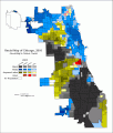
African American Population by Census Tract .gif 850 × 1,100; 41 KB
-
African American Population by Census Tract in Chicago, IL (2011).svg 612 × 792; 3.32 MB
-
African American Population in Chicago.jpg 1,275 × 1,650; 485 KB
-
Along the Magnificent Mile map.svg 990 × 610; 1.6 MB
-
Armour square map.png 759 × 586; 343 KB
-
AUSL Network of Schools Map.png 2,000 × 3,000; 838 KB
-
Black chicago1.png 500 × 375; 31 KB
-
Blank Chicago Community Area Map.png 527 × 567; 37 KB
-
Block 37 marked.png 1,238 × 879; 718 KB
-
Bronzeville - 2.png 422 × 359; 11 KB
-
Bronzeville.png 1,709 × 3,008; 1.51 MB
-
Bronzeville.svg 1,292 × 2,271; 229 KB
-
Calumet Heights with Pill Hill.png 1,279 × 767; 434 KB
-
Calumet Heights.PNG 1,279 × 767; 185 KB
-
Chicago & Illinois Western Railroad - System Index Map.jpg 2,925 × 3,957; 2.36 MB
-
Chicago & Western Indiana Railroad - System Index Map.jpg 4,517 × 3,065; 2.98 MB
-
Chicago - NARA - 102278699.jpg 10,000 × 13,132; 18.5 MB
-
Chicago - NARA - 26335507.jpg 5,920 × 8,449; 6.19 MB
-
Chicago African American population percent by census tract (2011).svg 765 × 990; 3.21 MB
-
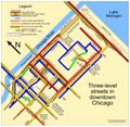
Chicago all levels.png 1,978 × 844; 124 KB
-
Chicago City Council Wards.svg 1,324 × 1,610; 680 KB
-
Chicago City Limits.svg 581 × 602; 6 KB
-
Chicago community areas map.svg 556 × 578; 165 KB
-
Chicago Community Areas.svg 2,118 × 2,576; 501 KB
-
Chicago Crime Map.svg 512 × 288; 931 KB
-
Chicago CSA.svg 556 × 498; 666 KB
-
Chicago Demographics in 1950 Map.jpg 1,984 × 2,972; 1.28 MB
-
Chicago District - NARA - 26335508.jpg 6,176 × 8,478; 5.79 MB
-
Chicago districts map.png 2,518 × 2,644; 424 KB
-
Chicago districts map.svg 1,087 × 1,142; 98 KB
-
Chicago Illinois US street map.svg 1,925 × 1,834; 19.46 MB
-
Chicago Interstates map.png 2,348 × 1,389; 200 KB
-
Chicago interstates.png 600 × 960; 36 KB
-
Chicago lower level.png 1,978 × 826; 103 KB
-
Chicago metro area urban areas 2020.svg 1,053 × 745; 1,019 KB
-
Chicago metropolitan area in Illinois 1950-2010.svg 3,453 × 6,157; 86 KB
-
Chicago neighborhoods map.png 2,000 × 1,599; 406 KB
-
Chicago neighborhoods outline.svg 1,499 × 1,200; 151 KB
-
Chicago overview map print.png 1,709 × 2,438; 196 KB
-
Chicago overview map.png 1,715 × 2,421; 1.33 MB
-
Chicago Pedway map.png 767 × 616; 671 KB
-
Chicago Portage National Historic Site.png 2,134 × 2,159; 1.41 MB
-
Chicago printable tourist attractions map.jpg 1,488 × 2,105; 1.48 MB
-
Chicago proper crime map.jpg 1,700 × 2,123; 1.23 MB
-
Chicago proper ghetto zone.jpg 1,393 × 2,014; 1.68 MB
-
Chicago service level.png 366 × 400; 10 KB
-
Chicago Shape.svg 500 × 500; 8 KB
-
Chicago Streetcar Tunnels.jpg 1,856 × 2,150; 2.95 MB
-
Chicago top down view.png 1,624 × 1,585; 108 KB
-
Chicago upper level.png 1,978 × 838; 104 KB
-
Chicago violent crime map 05-08.png 1,709 × 3,008; 712 KB
-
Chicago violent crime map 2006.png 1,730 × 3,008; 739 KB
-
Chicago violent crime map print.png 1,729 × 3,007; 682 KB
-
Chicago violent crime map.png 990 × 882; 245 KB
-
Chicago Wards Blank.svg 1,053 × 960; 138 KB
-
Chicago Wikivoyage locator maps - Bridgeport-Chinatown.png 733 × 880; 137 KB
-
Chicago Wikivoyage locator maps - Far West Side.png 733 × 880; 138 KB
-
Chicago Wikivoyage locator maps - Hyde Park.png 733 × 880; 138 KB
-
Chicago Wikivoyage locator maps - Lakeview-North Center.png 733 × 880; 138 KB
-
Chicago Wikivoyage locator maps - Lincoln Park-Old Town.png 733 × 880; 138 KB
-
Chicago Wikivoyage locator maps - Near West Side.png 733 × 880; 137 KB
-
Chicago Wikivoyage locator maps - Rogers Park.png 733 × 880; 138 KB
-
Chicago Wikivoyage locator maps - The Loop.png 733 × 880; 137 KB
-
Chicago Wikivoyage locator maps - The Near North.png 733 × 880; 137 KB
-
Chicago Wikivoyage locator maps - The Near South.png 733 × 880; 137 KB
-
Chicago Wikivoyage locator maps - Uptown.png 733 × 880; 138 KB
-
Chicago Wikivoyage locator maps - Wicker Park.png 733 × 880; 137 KB
-
Chicago-map.jpg 1,654 × 1,165; 313 KB
-
Chicago-map501-blank.png 1,570 × 2,114; 233 KB
-
Chicago-map502-isxy.png 445 × 599; 115 KB
-
Chicago-map502b.png 1,570 × 2,114; 382 KB
-
Chicago-map503-water.png 445 × 599; 92 KB
-
Chicago-top-down-view01.jpg 1,624 × 1,585; 1.31 MB
-
Chicago-warner-beers-1875.jpg 2,850 × 3,450; 1.81 MB
-
Chicago2000TractsRace.png 640 × 751; 90 KB
-
Chicago2010TractsRace.gif 596 × 700; 62 KB
-
Chicago2010TractsRace2.gif 596 × 700; 66 KB
-
ChicagoILMap.png 575 × 425; 74 KB
-
Chicagoland crime map.jpg 1,700 × 2,338; 1.81 MB
-
Chicagoland WV map.png 587 × 729; 118 KB
-
Chicagoland, Illinois.png 1,040 × 1,036; 545 KB
-
ChicagolandPP.png 632 × 816; 19 KB
-
Chicagoparkdistrictbound.svg 512 × 663; 660 KB
-
ChicagoPopulationChange9019.svg 765 × 990; 796 KB
-
ChicagoSpireMap.png 960 × 532; 18 KB
-
ChicagoSpireMap.svg 960 × 532; 50 KB
-
Chinatown map.png 924 × 972; 459 KB
-
ChiPitts area.png 300 × 300; 23 KB
-
City map 2015.png 628 × 946; 71 KB
-
City of Chicago Cook County State Attorney Democratic Primary.svg 1,052 × 744; 3.47 MB
-
City of Chicago geography map.png 1,087 × 1,142; 198 KB
-
City of Chicago sides map (1)~2.jpg 1,087 × 1,210; 125 KB
-
City of Chicago sides map.jpg 1,087 × 1,210; 262 KB
-
City of Chicago wards map (2003–2015).svg 800 × 973; 852 KB
-
City of Chicago wards map (2023–).svg 800 × 973; 1.18 MB
-
CREATE program rail project status.pdf 1,275 × 1,650; 622 KB
-
CTA Brown Line.png 750 × 1,050; 82 KB
-
East Lake Shore Drive map.png 422 × 359; 8 KB
-
EdgewaterMap.png 737 × 818; 271 KB
-
Elgin, Joliet and Eastern Railway system map (2008).svg 1,400 × 800; 562 KB
-
Exhibit, Racial Characteristics of Public Elementary Schools - NARA - 12008848.jpg 3,300 × 5,100; 1.68 MB
-
Fooddesert.jpg 816 × 1,056; 554 KB
-
Fountain of Time map.gif 422 × 359; 17 KB
-
Fulton Market District.jpg 1,880 × 863; 806 KB
-
Goose Island Chicago Open Street Map.png 755 × 1,014; 418 KB
-
Great Chicago Fire map with starting point.jpg 3,588 × 5,382; 3.46 MB
-
Harris Theater locator map.PNG 777 × 755; 573 KB
-
Harris Theater locator.PNG 960 × 720; 1,022 KB
-
Holc-chicago.jpg 13,702 × 10,816; 32.9 MB
-
Home Owners' Loan Corp. (HOLC) Neighborhood Redlining Grade in Chicago, Illinois.png 2,306 × 1,681; 3.02 MB
-
Homicides and Trauma Centers in Chicago .svg 1,251 × 712; 177 KB
-
Hyde Park Map.png 1,163 × 1,055; 523 KB
-
Hyde Park Township.PNG 1,206 × 1,146; 979 KB
-
Hyde Park-Kenwood Historic District map.jpg 1,701 × 890; 472 KB
-
IL 19 map.svg 1,475 × 860; 418 KB
-
ILMap-doton-Chicago.PNG 978 × 674; 169 KB
-
Inner Chicago School District Overview.png 249 × 287; 5 KB
-
Joffrey Tower location.png 1,274 × 898; 598 KB
-
Kenwood District map.png 1,274 × 898; 291 KB
-
Kenwood map.png 1,238 × 872; 466 KB
-
Kinzie Street railroad bridge OSM.png 763 × 599; 224 KB
-
Latino chicago1.gif 500 × 375; 30 KB
-
Lincoln Park borders.jpg 1,701 × 1,236; 711 KB
-
Loop Map.png 830 × 872; 511 KB
-
Magnificent Mile map with borders.gif 422 × 359; 19 KB
-
Map Exhibit A-E, Sanitary District of Chicago - NARA - 125849572 (page 4).jpg 6,600 × 10,200; 27.33 MB
-
Map of Chicago Population Evolution 1990-2019.jpg 715 × 954; 92 KB
-
Map of Chicago Portage.JPG 1,016 × 1,179; 472 KB
-
Map of Chicago with artful marker.jpg 600 × 400; 283 KB
-
Map of city of Chicago Ward System by population 1904.jpg 1,011 × 657; 236 KB
-
Map of Northern Illinois.svg 4.png 1,040 × 1,036; 519 KB
-
Map of Northern Illinois.svg 4~2.png 1,040 × 1,036; 549 KB
-
Map of Old Edgebrook.png 561 × 522; 71 KB
-
Map of the USA highlighting Chicagoland.gif 4,200 × 3,105; 1.69 MB
-
Map of Wildwood, Chgcago.png 736 × 744; 199 KB
-
Map(3).png 1,231 × 872; 459 KB
-
MapWorld02UAI.jpg 1,056 × 816; 461 KB
-
MCA neighborhood.png 1,267 × 926; 300 KB
-
Metra map.png 1,709 × 3,008; 1.26 MB
-
Michigan Boulevard District From TIGER.gif 422 × 359; 13 KB
-
Midway closeup map.gif 422 × 359; 16 KB
-
Midway larger map.gif 422 × 359; 12 KB
-
Millennium Park Map labels.png 781 × 587; 53 KB
-
Millennium Park within Grant Park map.GIF 422 × 359; 12 KB
-
NANP312(Chicago)1952.jpg 204 × 204; 26 KB
-
Near North Side locator.png 960 × 720; 828 KB
-
Near North Side.png 929 × 509; 311 KB
-
Near South Side.PNG 859 × 988; 522 KB
-
Near West Side.jpg 1,703 × 1,289; 851 KB
-
Neighborhoods of Chicago.JPG 407 × 605; 60 KB
-
NEIU04.png 2,000 × 1,343; 180 KB
-
North Kenwood District.png 1,275 × 898; 317 KB
-
North Shore (Chicago).svg 627 × 971; 95 KB
-
North Shore of Chicago Map.PNG 499 × 550; 23 KB
-
Olcott's land values blue book of Chicago (1936) (14782028091).jpg 1,752 × 2,526; 739 KB
-
Olcott's land values blue book of Chicago (1936) (14785158835).jpg 1,774 × 2,594; 778 KB
-
Outer Chicago School District Overview.png 240 × 308; 6 KB
-
Petrillo Music Shell.png 1,238 × 879; 628 KB
-
Physical features of the Des Plaines Valley (1909) (14802175293).jpg 1,562 × 2,082; 399 KB
-
Pingtompark map.png 820 × 564; 219 KB
-
Plan thématique Population de Chicago 1990-2019.jpg 669 × 924; 89 KB
-
Pokestop density map in Chicago.png 667 × 378; 132 KB
-
Preliminary comprehensive city plan of Chicago (NBY 6626).jpg 2,744 × 3,600; 2.25 MB
-
Preliminary comprehensive city plan of Chicago (NBY 6629).jpg 2,722 × 3,600; 1.66 MB
-
Preliminary report, Chicago Railway Terminal Commission (1915) (14756759914).jpg 1,332 × 1,858; 594 KB
-
Promontory Point map, Burnham Park, Chicago.png 317 × 607; 94 KB
-
Promontory Point Map.PNG 1,163 × 1,062; 699 KB
-
Ptmp map.png 840 × 824; 201 KB
-
Pui Tak Center with black rectangle.png 1,232 × 900; 826 KB
-
Race and ethnicity 2010- Chicago (5560488484).png 3,009 × 3,009; 5.7 MB
-
Race and ethnicity Chicago.png 3,009 × 3,009; 2.19 MB
-
Race and ethnicity- Chicago (4982044660).png 3,009 × 3,009; 6.31 MB
-
Ratner Center map.PNG 1,163 × 1,062; 699 KB
-
Roanoke Building map marked.gif 422 × 359; 9 KB
-
ROSE WIKIPEDIA MAP CHICAGO COMMUNITY AREAS.svg 612 × 792; 2.95 MB
