Category:Maps of Nanjing
Jump to navigation
Jump to search
Wikimedia category | |||||
| Upload media | |||||
| Instance of | |||||
|---|---|---|---|---|---|
| Category combines topics | |||||
| Nanjing | |||||
capital city of Jiangsu Province, China, former capital of the Republic of China and China's Ming dynasty | |||||
| Instance of |
| ||||
| Named after | |||||
| Location |
| ||||
| Located in or next to body of water | |||||
| Capital | |||||
| Legislative body | |||||
| Head of government |
| ||||
| Party chief representative |
| ||||
| Inception |
| ||||
| Significant event |
| ||||
| Population |
| ||||
| Area |
| ||||
| Elevation above sea level |
| ||||
| Replaces |
| ||||
| Different from | |||||
| Said to be the same as | Tianjing | ||||
| official website | |||||
 | |||||
中文(简体):南京地图
Subcategories
This category has the following 3 subcategories, out of 3 total.
Media in category "Maps of Nanjing"
The following 29 files are in this category, out of 29 total.
-
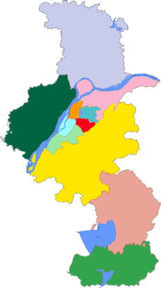
Administrative Division Nanjing.png 1,440 × 2,600; 350 KB
-
Admiralty Chart No 2946 Ch'ang Chiang Sheet 1, Published 1954.jpg 16,467 × 11,310; 35.11 MB
-
Area map, Sun Yat-sen Mausoleum, Nanjing, Jiangsu, China, 2013.jpg 769 × 577; 143 KB
-
Japanese claimed zones.png 1,316 × 802; 727 KB
-
Japanese zones of control.png 1,314 × 829; 871 KB
-
Map of West Qixia.svg 1,179 × 1,056; 850 KB
-
Map-of-heavenly-kingdom-city.JPG 3,072 × 2,304; 1.64 MB
-
Map-of-Ming-Palace.JPG 2,304 × 3,072; 1.34 MB
-
Map-of-Nanjing-Ming-Dynasty.JPG 3,072 × 2,304; 1.47 MB
-
Murasakihigashieria.png 1,382 × 1,600; 646 KB
-
Nanjing and its neighbor cities.png 816 × 752; 97 KB
-
Nanjing Area - Lower Yangtse Valley & Eastern China Map.jpg 400 × 432; 36 KB
-
Nanjing-MAP.png 2,500 × 4,406; 2.27 MB
-
Nanjing.png 1,500 × 1,350; 529 KB
-
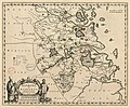
Novvs atlas Sinensis. LOC 2002625249-4.jpg 6,988 × 5,827; 4.66 MB
-
Novvs atlas Sinensis. LOC 2002625249-4.tif 6,988 × 5,827; 116.5 MB
-
Range of Baixia District.png 1,839 × 973; 1.12 MB
-
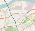
Route design (Nanjing) - Nanjing North Railway Station to Pukou Park.png 865 × 766; 657 KB
-
Subdivisions of Nanjing-China.png 413 × 737; 84 KB
-
Tomb of the Sultan of Brunei - entry sign - P1060698.JPG 2,048 × 1,536; 1.57 MB
-
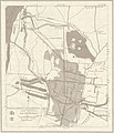
Txu-oclc-10552568-ni50-16-back (cropped).jpg 2,462 × 2,860; 1.34 MB
-
Txu-oclc-10552568-ni50-16-back.jpg 5,000 × 4,454; 2.84 MB
-
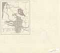
Txu-oclc-6654394-ni-50-7th-ed.jpg 4,351 × 4,580; 5.08 MB
-
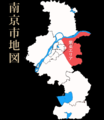
南京都市圈及其规划所包含行政行政区域.png 425 × 621; 32 KB
-
南京铁路枢纽总布置示意图.jpg 2,300 × 3,013; 358 KB
-
明帝国辰光个应天府.JPG 1,200 × 1,600; 805 KB


