Category:Maps of Mumbai
Appearance
- 84 most populous urban agglomerations of India
- Agra
- Ahmedabad
- Amritsar
- Bangalore (Bengaluru)
- Bareilly
- Bhopal
- Bhubaneswar
- Chandigarh
- Chennai
- Coimbatore
- Delhi
- Durgapur
- Guwahati
- Gwalior
- Hyderabad
- Indore
- Jaipur
- Jodhpur
- Kannur
- Kanpur
- Kochi
- Kolkata
- Kollam
- Kozhikode
- Lucknow
- Madurai
- Malappuram
- Mangalore
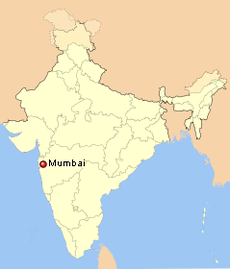
- Mumbai
- Mysore
- Nagpur
- Patna
- Pune
- Siliguri
- Srinagar
- Surat
- Thiruvananthapuram
- Thrissur
- Tiruchirappalli
- Varanasi
- Vijayawada
- Visakhapatnam
- National and state capitals
- Bangalore
- Bhopal
- Bhubaneswar
- Chandigarh
- Chennai
- Dharamshala
- Hyderabad
- Jaipur
- Kolkata
- Lucknow
- Mumbai
- Nagpur
- New Delhi
- Patna
- Shimla
- Srinagar
- Thiruvananthapuram
Wikimedia category | |||||
| Upload media | |||||
| Instance of | |||||
|---|---|---|---|---|---|
| Category combines topics | |||||
| Mumbai | |||||
capital city in Maharashtra, India | |||||
| Instance of |
| ||||
| Part of | |||||
| Named after |
| ||||
| Location |
| ||||
| Head of government |
| ||||
| Inception |
| ||||
| Significant event |
| ||||
| Population |
| ||||
| Area |
| ||||
| Elevation above sea level |
| ||||
| official website | |||||
 | |||||
Subcategories
This category has the following 8 subcategories, out of 8 total.
- Old maps of Mumbai (98 F)
*
- Maps of South Mumbai (10 F)
L
- Locator maps of Mumbai (26 F)
O
- OpenStreetMap maps of Mumbai (23 F)
P
S
- SVG maps of Mumbai (12 F)
Media in category "Maps of Mumbai"
The following 13 files are in this category, out of 13 total.
-
2005-Bombay-flood-map.png 300 × 559; 12 KB
-
Admiralty Chart No 655 Port of Bombay, Published 1958.jpg 11,074 × 16,248; 49.61 MB
-
Bombay tpc 1991.jpg 846 × 1,094; 328 KB
-
Bombaycitydistricts.png 200 × 339; 78 KB
-
Islands of Bombay, 1665.jpg 959 × 1,137; 461 KB
-
Map of Khotachiwadi (3738412136).jpg 994 × 913; 145 KB
-
Mumbai Bengali map1.png 745 × 1,053; 205 KB
-
Mumbai English Wikivoyage map 2.png 3,418 × 4,608; 2.42 MB
-
Mumbai Shape.svg 500 × 500; 6 KB
-
Mumbai Transportation Map.png 3,508 × 4,961; 1.03 MB
-
Mumbaicitydistricts.png 200 × 339; 76 KB
-
VIT campus layout.png 1,280 × 729; 337 KB


