Category:Maps of Yangon
Jump to navigation
Jump to search
Wikimedia category | |||||
| Upload media | |||||
| Instance of | |||||
|---|---|---|---|---|---|
| Category combines topics | |||||
| Yangon | |||||
former capital of Myanmar (Burma) and the current capital of Yangon Region | |||||
| Instance of | |||||
| Location | Yangon Region, Burma | ||||
| Inception |
| ||||
| Population |
| ||||
| Area |
| ||||
| Elevation above sea level |
| ||||
| official website | |||||
 | |||||
Subcategories
This category has only the following subcategory.
P
Media in category "Maps of Yangon"
The following 77 files are in this category, out of 77 total.
-
1886 Rangoon detail of Indo China map in Scottish Geographical Magazine.png 1,262 × 683; 1.8 MB
-
1911 map Rangoon John Murray.png 1,258 × 734; 1.35 MB
-
Rangun, Pergamon World Atlas 1967.jpg 392 × 276; 32 KB
-
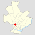
Ahlon Township.svg 1,134 × 1,134; 290 KB
-
Bahan Township.svg 1,134 × 1,134; 290 KB
-
Botataung Township.png 2,487 × 2,505; 494 KB
-
Dagon East tsp in Dagon Myothit district.svg 481 × 475; 50 KB
-
Dagon North tsp in Dagon Myothit district.svg 481 × 475; 50 KB
-
Dagon Seikan tsp in Dagon Myothit district.svg 481 × 475; 50 KB
-
Dagon Township.png 2,491 × 2,569; 490 KB
-
Dagon tsp in Kyauktada district.svg 642 × 659; 19 KB
-
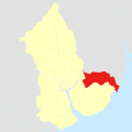
Dala Township.svg 500 × 500; 1.22 MB
-
Dala tsp in Twantay district.svg 695 × 763; 46 KB
-
Dawbon Township.svg 1,134 × 1,134; 290 KB
-
Dawbon tsp in Botahtaung district.svg 685 × 477; 30 KB
-
Downtown Yangon map.svg 1,641 × 1,290; 3.32 MB
-
East Yangon district in Yangon region.svg 428 × 556; 247 KB
-
Hlaing Township.svg 1,134 × 1,134; 290 KB
-
Hlaing tsp in Mayangon district.svg 842 × 848; 48 KB
-
Insein Township.png 2,491 × 2,569; 487 KB
-
Kamayut Township.svg 1,134 × 1,134; 290 KB
-
Kawhmu tsp in Twantay district.svg 695 × 763; 46 KB
-
Kayan Township.svg 500 × 500; 1.22 MB
-
Kungyangon tsp in Twantay district.svg 695 × 763; 46 KB
-
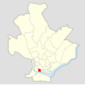
Kyauktada Township.svg 1,134 × 1,134; 290 KB
-
Kyauktada tsp in Kyauktada district.svg 642 × 659; 19 KB
-
Kyimyindaing Township.svg 1,134 × 1,134; 120 KB
-
Lageplan der Universität von Rangun, Myanmar.jpg 3,199 × 4,293; 6.72 MB
-
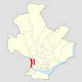
Lanmadaw Township.svg 1,134 × 1,134; 290 KB
-
Lanmadaw tsp in Kyauktada district.svg 642 × 659; 19 KB
-
Latha Township.svg 1,134 × 1,134; 290 KB
-
Latha tsp in Kyauktada district.svg 642 × 659; 19 KB
-
Lower Myanmar districts Map.svg 1,052 × 1,275; 835 KB
-
Map of Rangoon (Baedeker, 1914).jpg 1,577 × 1,051; 1.64 MB
-
Mayangon Township.svg 1,134 × 1,134; 290 KB
-
Mayangon tsp in Mayangon district.svg 842 × 848; 48 KB
-
Mingalataungnyunt tsp in Botahtaung district.svg 685 × 477; 30 KB
-
North Dagon Township.svg 1,134 × 1,134; 290 KB
-
North Oakalapa tsp in Mayangon district.svg 842 × 848; 48 KB
-
North Yangon district in Yangon region.svg 428 × 556; 246 KB
-
Pabedan Township.svg 1,134 × 1,134; 290 KB
-
Pabedan tsp in Kyauktada district.svg 642 × 659; 19 KB
-
Pazundaung Township.svg 1,134 × 1,134; 290 KB
-
Pazundaung tsp in Botahtaung district.svg 685 × 477; 30 KB
-
Rangún, The Strand 1.jpg 2,741 × 3,930; 11.15 MB
-
Sanchaung Township.svg 1,134 × 1,134; 309 KB
-
Seikgyikanaungto tsp in Twantay district.svg 695 × 763; 46 KB
-
Seikkyi Kanaungto Township.svg 1,134 × 1,134; 290 KB
-
Shwepyitha Township.svg 1,134 × 1,134; 290 KB
-
Sirião, Syriam.jpg 2,743 × 2,572; 491 KB
-
South Dagon Township.svg 1,134 × 1,134; 290 KB
-
South Oakalapa tsp in Thingangyun district.svg 665 × 683; 30 KB
-
South Yangon district in Yangon region.svg 428 × 556; 246 KB
-
Taikkyi Township.svg 500 × 500; 1.22 MB
-
Tamwe Township.svg 1,134 × 1,134; 290 KB
-
Tamwe tsp in Thingangyun district.svg 665 × 683; 30 KB
-
Thaketa tsp in Botahtaung district.svg 685 × 477; 30 KB
-
Thingangyun Township.svg 1,134 × 1,134; 120 KB
-
Thingangyun tsp in Thingangyun district.svg 665 × 683; 30 KB
-
Thongwa Township.svg 500 × 500; 1.22 MB
-
Twantay tsp in Twantay district.svg 695 × 763; 46 KB
-
West Yangon district in Yangon region.svg 428 × 556; 246 KB
-
Yangon Districts and townships.png 3,109 × 2,908; 1.01 MB
-
Yangon Downotwn Map 2.svg 1,150 × 1,055; 3.27 MB
-
Yangon Map.png 428 × 577; 201 KB
-
Yangon map.svg 1,688 × 1,393; 2.28 MB
-
Yangon Monuments pl.svg 1,150 × 1,055; 3.71 MB
-
Yangon Rangoon and Environ map 1911.jpg 1,702 × 1,284; 246 KB
-
Yangon Region Districts Map.svg 335 × 289; 247 KB
-
Yangon Townships pl.png 4,145 × 3,877; 1.43 MB
-
Yangon-2008.JPG 370 × 298; 28 KB
-
Yangon-land-use-2008.jpg 640 × 400; 30 KB
-
Yangon-post-88.JPG 430 × 294; 34 KB
-
Yangon-pre88.jpg 640 × 400; 41 KB
-
Yankin tsp in Thingangyun district.svg 665 × 683; 30 KB
-
Yanong-post88.jpg 640 × 400; 43 KB
