Category:Maps of North America
Jump to navigation
Jump to search
Temperate regions: North America · South America · Africa · Europe · Asia · Oceania – Polar regions: Antarctica · Arctic – Other regions: Afro-Eurasia · Eurasia
Wikimedia category | |||||
| Upload media | |||||
| Instance of | |||||
|---|---|---|---|---|---|
| Category combines topics | |||||
 | |||||
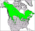
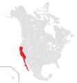
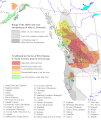
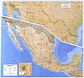
Maps of North America.
Subcategories
This category has the following 59 subcategories, out of 59 total.
Pages in category "Maps of North America"
The following 2 pages are in this category, out of 2 total.
Media in category "Maps of North America"
The following 195 files are in this category, out of 195 total.
-
1972 Great Daylight Fireball Trajectory.png 624 × 469; 18 KB
-
1988 Official 2.png 1,079 × 934; 59 KB
-
2012 Area & Projection Comparisons Calendar (30885483375).jpg 3,300 × 2,550; 1.6 MB
-
2013 Gold Cup final map.png 413 × 362; 10 KB
-
2014 world cup concacaf qualification.png 413 × 362; 9 KB
-
20161007 15 Gare du Palais, Quebec City, QC (40504418095).jpg 3,000 × 4,000; 3.2 MB
-
A map of North America's bioregions, improved from the previous.jpg 993 × 596; 121 KB
-
Aboriginal tobaccos BHL17721464.jpg 2,826 × 3,796; 1.62 MB
-
Adiantum viridimontanum distribution.png 570 × 550; 42 KB
-
Age of Consent - north america2.png 429 × 557; 936 KB
-
Alkoholersterwerbsalter in Nordamerika.png 2,000 × 2,408; 219 KB
-
Alma 1966 track.jpg 773 × 599; 27 KB
-
America del Norte-colorear.png 1,104 × 919; 231 KB
-
America palmares Copa de Oro.png 1,104 × 919; 153 KB
-
AmericaChurchHeadquarters.jpg 1,600 × 1,200; 486 KB
-
Arctext.png 818 × 700; 353 KB
-
Arctic Fibre.PNG 777 × 413; 154 KB
-
Athens County, Ohio - DPLA - 9d4dc78c0d5322573a23575b31c97745 (page 22).jpg 3,576 × 5,634; 1.6 MB
-
Beardmore Relics (map).jpg 974 × 740; 427 KB
-
Biology of New World Microtus (1985) (20388898401).jpg 1,640 × 2,218; 302 KB
-
Bioregions-of-north-america1.png 4,000 × 3,802; 16.25 MB
-
CAmerica.gif 1,800 × 1,350; 385 KB
-
Canada Alaska (orthographic projection).png 2,000 × 2,000; 996 KB
-
Canals and Navigable Rivers of the United States and Canada.jpg 7,812 × 7,904; 8.4 MB
-
Capes in the North America.png 433 × 303; 11 KB
-
Cascadia map and bioregion.png 1,588 × 2,500; 307 KB
-
CDLMapNA.png 1,749 × 1,112; 28 KB
-
CIBU.png 650 × 540; 23 KB
-
Container ship routes to America.png 460 × 464; 292 KB
-
Continental Defense Warning Systems.png 1,260 × 789; 727 KB
-
Convenio Andrés Bello países.jpg 381 × 355; 25 KB
-
Copa de Oro de la Concacaf 2017.png 749 × 623; 19 KB
-
Copa Oro CONCACAF 2017.png 749 × 623; 17 KB
-
Copa Oro CONCACAF 2019 Clasificados.png 749 × 623; 17 KB
-
Coronelli amnord.jpg 1,265 × 929; 303 KB
-
Daily snow record broken in Toronto - 39956521183.jpg 995 × 371; 82 KB
-
Delta mainline domestic network, June 2000 (13288340615).jpg 3,143 × 2,143; 5.62 MB
-
Distribution F.magna North AmericaII.png 1,749 × 1,740; 745 KB
-
Distribution H. leucocephalus.png 599 × 394; 19 KB
-
Distribution of Chronic Wasting Disease in North America.jpg 3,300 × 2,550; 1.63 MB
-
Distribution of Triodanis biflora.png 650 × 540; 20 KB
-
Distribution.png 650 × 540; 20 KB
-
Dumetella carolinensis-map.jpg 410 × 304; 15 KB
-
Escape map.png 602 × 304; 10 KB
-
Escuela de Pastoral paises.jpg 1,041 × 763; 122 KB
-
Europe and North America UNESCO Region (orthographic projection).png 2,254 × 2,254; 773 KB
-
Fictional Californian parallel to United Macedonia.JPG 499 × 610; 63 KB
-
Fraxinus pennsylvanica.png 819 × 644; 158 KB
-
Fraxinus profunda range map 0.png 9,624 × 12,505; 1.2 MB
-
Frontieres-possible-du-lakotah.png 388 × 308; 65 KB
-
Glaucomys volans distribution.svg 1,181 × 1,185; 5.83 MB
-
Golden Cities USA.jpg 1,443 × 937; 303 KB
-
Golf von Kalifornien1.jpg 940 × 1,131; 392 KB
-
Grandes-llanuras-de-norteamerica.jpg 1,200 × 1,200; 186 KB
-
Ground communications distribution system for satellite data (2268-509).jpg 2,500 × 2,320; 733 KB
-
ICSA Conferences Map.png 4,700 × 4,355; 1.54 MB
-
Indigenous-peoples-of-North-America,-Population-Density-and-Territories.png 1,599 × 1,988; 616 KB
-
July13MembershipMAGIRT.jpg 1,920 × 1,080; 481 KB
-
Juniperus communis range map.gif 664 × 580; 19 KB
-
Karte WA-Lärche.png 709 × 491; 449 KB
-
Karte-Prärie-Indianer-Pferd-und-Bison.png 733 × 962; 473 KB
-
Keystone-pipeline-route.png 280 × 420; 137 KB
-
LIIR.png 650 × 540; 20 KB
-
Literal translation of country names.jpg 4,500 × 3,172; 1.49 MB
-
Map by Chief Ochagach for Verendrye.jpg 3,296 × 1,162; 420 KB
-
Map Ethnographic map of North America 1928-1940 - Touring Club Italiano CART-TRC-30.jpg 6,611 × 7,997; 6.1 MB
-
Map of North America (cs).png 2,312 × 1,504; 427 KB
-
Map of North America (Territories identified seperatly).jpg 1,640 × 1,360; 425 KB
-
Map of oldest companies in North America; February 2020.png 1,200 × 1,331; 264 KB
-
Map of populous North America (physical, political, population).jpg 4,061 × 3,287; 3.5 MB
-
Map of the Californias (modern region).png 6,988 × 7,454; 429 KB
-
Map of the Californias (modern region).svg 1,677 × 1,789; 1.19 MB
-
Map of the North American Free Trade Agreement (no borders).png 1,914 × 876; 54 KB
-
Map of the Pacific Northwest.png 5,285 × 6,862; 59.94 MB
-
Map of Wila use.gif 767 × 909; 157 KB
-
Mappamondo- Nord America.jpg 4,272 × 2,848; 1.91 MB
-
MaraSalvatruchaLocation.png 576 × 300; 13 KB
-
March2016BlizzardStormTrack.png 780 × 601; 558 KB
-
Maury Geography 035A North America relief.jpg 2,180 × 2,612; 994 KB
-
Mexico--Boundaries--United States--Maps.jpg 809 × 746; 145 KB
-
Micrantha australis.png 650 × 540; 20 KB
-
Migratory Bird Treaty 5c 1966 issue U.S. stamp.jpg 1,317 × 832; 464 KB
-
Mimus polyglottos-map.jpg 346 × 301; 13 KB
-
Mineral Resources of the United States, 1917-Part I-Metals (1921) (14778841792).jpg 2,144 × 2,820; 742 KB
-
Monarch butterfly US migration.png 1,132 × 885; 921 KB
-
Mural - mapa central - Latinoamérica.jpg 1,440 × 2,560; 1.52 MB
-
Mural - mapa central - Norteamérica.jpg 2,560 × 1,440; 1.57 MB
-
NA Blank.jpg 1,074 × 512; 134 KB
-
NA Blank100px.jpg 100 × 48; 6 KB
-
NA-savanna-map.gif 579 × 555; 225 KB
-
Nacurhsubs.png 618 × 528; 30 KB
-
Nascar race tracks-en.png 1,299 × 829; 1.21 MB
-
Nascar race tracks.png 1,299 × 829; 1.21 MB
-
NERC-map.jpg 3,295 × 2,261; 1,012 KB
-
Net of Longitude.jpg 1,682 × 1,161; 535 KB
-
Ninenations.PNG 416 × 328; 15 KB
-
Noord-en-Zuid-Amerika.PNG 632 × 454; 9 KB
-
Noord-Midden-en-Zuid-Amerika.PNG 632 × 454; 14 KB
-
Nord America culture.png 1,490 × 1,700; 776 KB
-
Nord america ndrangheta 2017 map.jpg 1,712 × 1,992; 185 KB
-
Nordameriko1111x694px.jpg 1,111 × 694; 241 KB
-
Norte-america-quechua.svg 1,789 × 2,154; 197 KB
-
NORTEAMERICA FISICO.jpg 1,299 × 1,100; 983 KB
-
North America (Flag Map) (1840).png 3,976 × 3,006; 1.22 MB
-
North America - DPLA - 06840226b6a3929ba03110582e8b1109.jpg 2,556 × 3,290; 7.31 MB
-
North America - DPLA - 1a79285477fb8bd885d1b313317016c8 (page 1).jpg 2,546 × 3,274; 6.95 MB
-
North America - DPLA - 1a79285477fb8bd885d1b313317016c8 (page 2).jpg 2,546 × 3,274; 6.92 MB
-
North America - DPLA - 64637975cbf4e253e0b7e291a676246c.jpg 2,556 × 3,282; 7.49 MB
-
North America - DPLA - 8e556685a23f340870bcf7aafd2a1f92.jpg 2,552 × 3,282; 7.02 MB
-
North America - DPLA - aa02c75768cc1f3bfd5100e8d8489aa5.jpg 2,552 × 3,276; 8.91 MB
-
North America - DPLA - dd4ccd5c5c5b234842040c8d6031505b.jpg 2,558 × 3,278; 6.78 MB
-
North America - DPLA - ddd51238e2637359c5c5647eaad38fda.jpg 2,562 × 3,280; 7.81 MB
-
North America - DPLA - ed94f065cca0b353e13293592d4486d6.jpg 2,552 × 3,268; 6.83 MB
-
North America - DPLA - fd3ea7b146630b9c10ec8e5fa69c2ad4.jpg 2,554 × 3,274; 8.16 MB
-
North America - Smoking age.png 2,777 × 3,344; 787 KB
-
North America Key.png 646 × 476; 16 KB
-
North America LDS 2006 membership.PNG 619 × 533; 50 KB
-
North America LDS membership.png 619 × 533; 67 KB
-
North America physical map blank.jpg 2,552 × 2,171; 1.78 MB
-
North America Protests 8 JUN 2020.jpg 851 × 590; 169 KB
-
North America satellite globe Pacific Coast Ranges.jpg 514 × 599; 77 KB
-
North America satellite globe.jpg 686 × 800; 94 KB
-
North America satellite orthographic.jpg 1,624 × 1,748; 474 KB
-
LGBT Flag map of North America.png 2,000 × 2,408; 67 KB
-
North America.gif 393 × 600; 80 KB
-
North American Federation.png 1,092 × 761; 133 KB
-
North American Fresh Water Run-Off2.png 799 × 458; 335 KB
-
North American Itinerary, Iveco RV (Germany) (7780238028).jpg 1,063 × 1,600; 377 KB
-
North American Regions with C-values for their flora.tif 1,199 × 1,100; 824 KB
-
Flag-Map of the North American Union.png 775 × 512; 99 KB
-
North American watershed divides.gif 540 × 481; 55 KB
-
NorthAmerica-WaterDivides.png 900 × 900; 370 KB
-
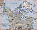
Northwest passage.jpg 2,560 × 960; 1.02 MB
-
Norwegians-in-NorthAmerica -.png 2,289 × 1,744; 191 KB
-
Norwegians-in-NorthAmerica.png 2,289 × 1,744; 192 KB
-
Npslmap.JPG 2,289 × 1,744; 149 KB
-
Npslmap.png 2,289 × 1,744; 136 KB
-
Ocean .png 800 × 800; 199 KB
-
Outline North America (PSF).png 2,156 × 2,032; 100 KB
-
PacNWComparison.PNG 230 × 262; 9 KB
-
Pan American Games host countries map.png 2,000 × 1,938; 282 KB
-
Pan American Games host countries.png 2,000 × 1,938; 293 KB
-
Physical Features of North America map by Tom Patterson v. 1.01, feet.jpg 15,930 × 16,495; 52.77 MB
-
Physical Features of North America map by Tom Patterson v. 1.01, meters.jpg 15,930 × 16,495; 52.71 MB
-
Physical Features of North America map by Tom Patterson, no text.tif 15,927 × 16,492; 222.8 MB
-
Poblamiento de America - Teoría P Tardío.png 724 × 575; 387 KB
-
Provincia Fisiografica Grandes Llanuras de Norteamerica.png 320 × 402; 18 KB
-
Prunus americana map.png 893 × 576; 153 KB
-
Prunus mexicana map.png 734 × 607; 121 KB
-
PSM V30 D013 Map of north america during the ice age.jpg 1,773 × 2,059; 816 KB
-
PSM V82 D441 Culture areas in north america.png 1,652 × 2,021; 207 KB
-
PSM V82 D443 Map of the area of the plains indians.png 1,640 × 1,641; 235 KB
-
PSM V82 D445 Distribution of forests in western united states.png 1,648 × 1,963; 701 KB
-
Põhja-Ameerika.jpg 1,053 × 689; 741 KB
-
Qariidada Woqooyi Ameerika.png 2,485 × 1,523; 541 KB
-
Rhamnus caroliniana map.png 750 × 658; 122 KB
-
Rhododenron maximum map.png 734 × 576; 116 KB
-
Rhus copellina range map.jpg 556 × 720; 62 KB
-
Saint-Dié-des-Vosges-Amérique.jpg 2,048 × 1,536; 957 KB
-
Scottish Colonies in North America.png 2,550 × 3,300; 576 KB
-
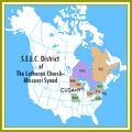
SELCDistrictLCMS.png 486 × 486; 97 KB
-
ShoreZone Coastal Mapping Project.png 730 × 945; 196 KB
-
Snow Deficit (7029632207).jpg 720 × 964; 333 KB
-
State recognition of same-sex relationships (North America) 2014.png 695 × 900; 135 KB
-
The beginner's American history (1891) (14775129071).jpg 2,036 × 3,200; 2.13 MB
-
The Voyage of the 'Fox' in the Arctic Seas BHL33236797.jpg 1,919 × 2,674; 466 KB
-
Timhortonsmap.PNG 626 × 439; 26 KB
-
Tlilia americana map.png 1,025 × 659; 166 KB
-
Toxostorma rufum-Map.jpg 410 × 304; 14 KB
-
Trasa rejsu s-y Vagabond'eux przez Przejście Północno-Zachodnie (1985-1988).jpg 2,830 × 2,354; 9.62 MB
-
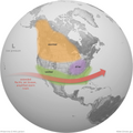
Typical North American winter impacts of El Niño, globe.png 4,800 × 4,800; 8 MB
-
U.S. West Coast.png 940 × 785; 100 KB
-
Ukraine Security Cooperation Agreements NA.svg 384 × 275; 463 KB
-
Ulmus alata map.png 727 × 616; 117 KB
-
Unitedstatemap4567.jpg 2,448 × 3,264; 1.98 MB
-
USDA Map White Byrony (Bryonia alba) North American Disribution.png 650 × 540; 20 KB
-
Very High Resolution Radiometer (VHRR) distribution network (2268-474).jpg 2,483 × 2,500; 875 KB
-
Viburnum nudum - distribution in the US.png 731 × 649; 128 KB
-
West Coast of North America satellite orthographic.png 383 × 1,000; 467 KB
-
Western Interior Seaway - 95Ma (with ancient continents).svg 656 × 927; 563 KB
-
Western Interior Seaway - 95Ma.svg 456 × 927; 567 KB
-
WNS map 2018.jpg 918 × 814; 58 KB
-
WorldTempsOnGlobe.jpg 1,024 × 1,024; 112 KB
-
Worldwide Holdings Group.png 570 × 226; 60 KB
-
Wystepowanie sikory brunatnej.jpg 300 × 300; 72 KB
-
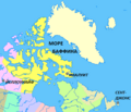
Море Баффина.png 425 × 365; 66 KB
-
Этнічныя працэсы ў Вест-Індыі да 15 стагоддзя.svg 664 × 498; 46 KB
-
Հյուսիսային Ամերիկայի քաղաքական քարտեզ hy.png 1,329 × 1,065; 73 KB
-
北美.jpg 542 × 509; 43 KB


