Category:Maps of Eurasia
Jump to navigation
Jump to search
Wikimedia category | |||||
| Upload media | |||||
| Instance of | |||||
|---|---|---|---|---|---|
| Category combines topics | |||||
| |||||
- Maps centered along the continental boundary or otherwise showing appreciable areas of both Europe and Asia.

Subcategories
This category has the following 16 subcategories, out of 16 total.
*
A
B
C
K
L
M
O
P
S
U
Media in category "Maps of Eurasia"
The following 92 files are in this category, out of 92 total.
-

-
-

-

-
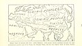
 179 of 'Eclectic Physical Geography' (11200812653).jpg 2,066 × 1,312; 727 KB
-
 Foyers3.png 2,064 × 1,128; 448 KB
-

-

-
 Eurasian steppe belt.jpg 2,048 × 1,529; 1.62 MB
-
 A natural history of the ducks (1922) (14764634162).jpg 2,896 × 1,686; 640 KB
-

-
 Ancient horse remains and their genomic affinities.webp 2,070 × 1,797; 381 KB
-
 Ancient Musical Treasures from Central China MIM Museum Phoenix AZ 140008 (39411265665).jpg 4,032 × 3,024; 3.23 MB
-
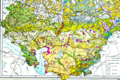
 Andron-ovská kultura (celá Eurasie).png 1,790 × 1,202; 713 KB
-
 AntiEurasia.png 250 × 250; 50 KB
-
 Artemisia Absinthium L..png 1,761 × 1,181; 1.18 MB
-
 ASEM map.svg 1,854 × 1,198; 845 KB
-
 ASEM.PNG 772 × 566; 27 KB
-
 Asia 100bc.jpg 2,053 × 1,196; 760 KB
-
 AZE-ARM-TUR-IRN.png 627 × 605; 38 KB
-
 Azərbaycan-Türkiye kesilmiş versiyon.png 543 × 198; 26 KB
-
 Bolonga zone.png 479 × 456; 97 KB
-
 Bu şəkildə avarların məskunlaşması göstərilir. .png 1,252 × 779; 1.58 MB
-
-
 Craig-retroazimuthal-for-mecca.png 541 × 317; 23 KB
-
 CSTO GUAM in CIS Map.png 800 × 547; 96 KB
-
 East eurasian sccs cultures.jpg 869 × 591; 56 KB
-
 EB 1911 Ptolemy's Map.png 3,916 × 2,166; 3.86 MB
-
 Euraasia.jpg 1,141 × 503; 453 KB
-
 Eurasia and eurasianism hu.svg 1,333 × 692; 298 KB
-
 Eurasia and eurasianism.png 2,000 × 1,038; 643 KB
-
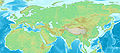
 Eurasia location map - Physical.jpg 2,500 × 2,500; 1.54 MB
-
 Eurasia.jpg 3,326 × 1,372; 6.05 MB
-
 Eurasian continent.jpg 663 × 392; 65 KB
-
 Eurasian Economic Union member states map.png 2,788 × 1,623; 678 KB
-
 Eurasian mass.jpg 3,555 × 1,568; 1.39 MB
-
 EurasiaRegionMap2.png 538 × 186; 9 KB
-
 Europe and North America UNESCO Region (orthographic projection).png 2,254 × 2,254; 773 KB
-
 Europe economical bloc mk.PNG 682 × 209; 5 KB
-
 Europe rail map.PNG 786 × 317; 21 KB
-
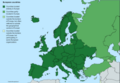 European countries.png 4,592 × 3,196; 1.69 MB
-
 Goldene Horde.png 1,253 × 781; 1.47 MB
-
 Greater Europe.png 4,086 × 1,914; 642 KB
-
 Herodotus's world (Central Asia).png 567 × 493; 542 KB
-
 Horse geographic and genetic affinities.webp 1,049 × 1,476; 221 KB
-

-
 Karte zur Medizinisch-demographischen Deutsch-Neuguinea-Expedition.jpg 2,564 × 1,477; 1.38 MB
-
 Kaspisches Meer Anrainerstaaten.png 846 × 840; 117 KB
-
 EuropeesKazachstan.png 1,357 × 628; 45 KB
-
 Lisbon Vladivostok EU-CIS.svg 1,325 × 400; 482 KB
-
 Länder, in denen Nowruz gefeiert wird.png 554 × 420; 16 KB
-
 Map of Eurasia with Xiaohe, Tarim basin and ancient Silk Road routes.gif 778 × 460; 290 KB
-
 Map of eurasia.png 1,365 × 977; 206 KB
-
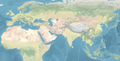 Map of Eurasia.png 4,928 × 2,500; 26.81 MB
-
 Map of overland route from India to Britain (A).jpg 1,669 × 1,019; 291 KB
-
 Map of Upper Paleolithic eyed needles.tif 1,771 × 1,181; 5.26 MB
-
 Map of Warsaw Pact countries.png 607 × 207; 7 KB
-
 MSI 2018.jpg 1,654 × 1,030; 222 KB
-
 NATO PfP Members crop 2023.png 1,920 × 1,170; 411 KB
-
 Neocol forwiki.jpg 1,951 × 968; 463 KB
-
 North Caucasus and Iraq.png 287 × 228; 10 KB
-
 Organization for Cooperation of Railways, Eurasia.png 786 × 317; 17 KB
-
 PD-Stamps in Euroasia.PNG 1,037 × 552; 62 KB
-
 Peking to Paris 1907.PNG 2,000 × 1,226; 102 KB
-
 Peopling of eurasia.jpg 600 × 447; 131 KB
-
 Pontic Caspian climate.png 550 × 436; 167 KB
-
 Pontic steppe region around 650 AD.png 637 × 553; 40 KB
-
 Population genetic affinities, evolutionary history and geographic origins.webp 2,093 × 2,053; 262 KB
-
 Regions of Afro-Eurasia.png 5,023 × 2,971; 2.33 MB
-
 Reisimine Nõukogude Liidus.jpg 4,608 × 3,456; 7.67 MB
-
 Relief map of Eurasia.png 3,269 × 1,624; 4.91 MB
-
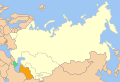
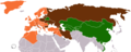
 Russia and Post-Soviet Republics.png 7,192 × 3,318; 1.34 MB
-
 SMGS.png 786 × 317; 17 KB
-
 TA-YUAN.gif 469 × 270; 24 KB
-
 Ta-YuanMap.jpg 1,301 × 778; 102 KB
-
 The East map.svg 7,030 × 3,542; 2.87 MB
-
 The Eastern world.svg 7,030 × 3,542; 3.38 MB
-
 Turkey of Asia; with the exception of enclaves located in Arabia.jpg 2,296 × 1,613; 751 KB
-
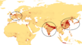
 Turkish Speaking Countries Undergraduate Scholarship Program.jpg 1,469 × 865; 400 KB
-
 Turkishworld.jpg 322 × 157; 8 KB
-
 Two-point-equidistant-asia.jpg 2,048 × 1,529; 1.37 MB
-
 Türk Ülkeleri haritasi.jpg 1,753 × 1,141; 119 KB
-
 U2 GrandSlam.png 941 × 630; 136 KB
-
 West Eurasia.png 7,000 × 3,526; 1.22 MB
-
 Western Regions 1st century BC (ja).png 680 × 425; 633 KB
-
 World Map (500BC).jpg 5,300 × 3,500; 666 KB
-
 ZhangQianTravel.jpg 672 × 504; 53 KB
-
 Ταξίδια του Τζαν Τσιάν.jpg 672 × 504; 137 KB
-
 Моря Євразія.png 2,100 × 1,104; 344 KB
-
 Острова Євразія.png 2,098 × 1,110; 319 KB
-
 Півострови Євразії.png 2,100 × 1,108; 277 KB
-
 高北人Ghobati流浪路線圖.jpg 1,012 × 533; 154 KB
_north_east.jpg)
.jpg)
.jpg)
.jpg)

.jpg)
.jpg)

_(14764634162).jpg)
.jpg)

.jpg)
.png)


.png)


.png)


.jpg)


.png)
.jpg)


.jpg)