Category:CIA World Factbook maps of North America
Jump to navigation
Jump to search
Media in category "CIA World Factbook maps of North America"
The following 19 files are in this category, out of 19 total.
-
 "Arctic region" CIA World Factbook.jpg 461 × 600; 360 KB
-
 "Political Central America" CIA World Factbook.jpg 851 × 660; 156 KB
-
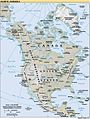
 "Political North America" CIA World Factbook.jpg 454 × 600; 341 KB
-
 America.png 379 × 552; 64 KB
-
 Arctic big ce.svg 1,010 × 1,267; 1.52 MB
-
 Arctic region - Polish version 1.png 2,106 × 2,755; 1.44 MB
-
 Arctic region - Polish version 2.png 506 × 662; 215 KB
-
 Arctic region - Polish version 3.png 1,053 × 1,377; 590 KB
-
 Arctic region - Polish version SVG.svg 612 × 792; 23.05 MB
-
 Cartina fisica dell'America del Nord.jpg 506 × 671; 71 KB
-
 Map North America.PNG 453 × 600; 576 KB
-
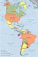 N&SAmerica-pol.jpg 964 × 1,455; 1.32 MB
-
 North america hr.pdf 841 × 1,114; 2.08 MB
-
 North america tr.png 1,052 × 1,393; 1.88 MB
-
 North america tr.svg 1,052 × 1,393; 824 KB
-
 North America-ru.png 944 × 1,262; 1.26 MB
-
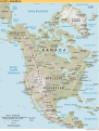
 North America.png 673 × 865; 709 KB
-
 North america.svg 506 × 669; 960 KB
-
 Political Map of the Americas.jpg 960 × 1,449; 399 KB


