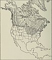
Category:Geological maps of North America
Jump to navigation
Jump to search
Subcategories
This category has the following 11 subcategories, out of 11 total.
*
+
B
- Bakken Formation maps (6 F)
- Bearpaw Formation maps (1 F)
G
- Geological maps of Greenland (14 F)
N
- Maps of the Niagara Escarpment (1 P, 3 F)
S
V
Media in category "Geological maps of North America"
The following 99 files are in this category, out of 99 total.
-
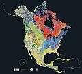
Geologic map of North America.jpg 10,347 × 16,122; 91.23 MB
-
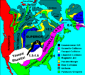
NAstruct.gif 415 × 496; 72 KB
-
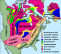
North America Geological Tapestry.gif 540 × 503; 84 KB
-
North america rock metamorphic.jpg 644 × 526; 162 KB
-
North america rock plutonic.jpg 644 × 526; 158 KB
-
North america rock sedimentary.jpg 644 × 526; 137 KB
-
North america rock types (ka).jpg 644 × 2,146; 686 KB
-
North america rock types.jpg 644 × 2,146; 641 KB
-
North america rock volcanic.jpg 644 × 526; 161 KB
-
North america terrain 2003 map.jpg 3,300 × 2,938; 1.66 MB
-
North america terrain 2003 time scale.jpg 672 × 1,077; 324 KB
-
North america terrain 2003.jpg 3,790 × 2,922; 1.9 MB
-
USGS Geologic Map of North America.jpg 7,000 × 6,798; 25.48 MB
-
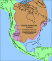
World geologic provinces North America cropped.png 563 × 406; 327 KB
-
Animation Relief USA 2.gif 510 × 369; 325 KB
-
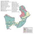
Animikie Group, Marquette Range and Huronian supergroups2.PNG 692 × 776; 183 KB
-
Annual report (1872) (17803829554).jpg 1,672 × 2,850; 842 KB
-
Big Horn Basin Geologic Map.png 745 × 844; 462 KB
-
Canadianshield.gif 500 × 520; 98 KB
-
Cascade Range subdivisions map-es.svg 403 × 693; 2.99 MB
-
Cascade Range subdivisions map-fr.svg 403 × 693; 3.07 MB
-
Cascade Range subdivisions map-it.svg 403 × 693; 2.49 MB
-
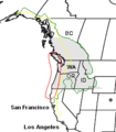
CascadiaComparison.PNG 230 × 262; 10 KB
-
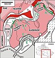
Circum-Superior Belt map.jpg 549 × 576; 175 KB
-
Geologic Map Dominican Republic.png 1,348 × 592; 1.7 MB
-
Duluth complex.jpg 280 × 280; 18 KB
-
Duluthcomplexmap.png 525 × 415; 510 KB
-
FigS11-1.gif 327 × 548; 56 KB
-
Generalized geology of Trinidad.png 814 × 570; 115 KB
-
Geologic Map Antigua Barbuda.png 634 × 433; 377 KB
-
Geological domain of Superior Craton.pdf 4,166 × 4,166; 776 KB
-
Geological domains of Superior Craton.png 5,556 × 5,556; 1.33 MB
-
Geology of Lake Superior.jpg 600 × 404; 55 KB
-
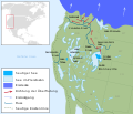
Glacial Lake Chicago (14,000 YBP) 7a.jpg 1,528 × 1,069; 358 KB
-
Glacial Period (4843358055).jpg 2,305 × 2,997; 665 KB
-
Glenn Pool geologic map.jpg 1,016 × 937; 254 KB
-
Great Lakes Tectonic Zone map.png 384 × 231; 46 KB
-
Great Lakes Tectonic Zone map.PNG 233 × 104; 6 KB
-
Grenada Basin Map.jpg 628 × 549; 138 KB
-
Grenville extent.gif 1,110 × 890; 91 KB
-
Grenville Province.jpg 803 × 591; 80 KB
-
Grenville-Extent.png 555 × 445; 31 KB
-
Haiti Erdbeben 120110.jpg 2,270 × 1,571; 447 KB
-
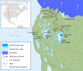
Lake Bonneville map de cropped.svg 522 × 376; 44 KB
-
Lake Bonneville map de.svg 663 × 570; 352 KB
-
Lake bonneville map.svg 663 × 570; 352 KB
-
Lake Bonneville Pleistoceen.jpg 680 × 588; 181 KB
-
Map showing the glaciated area of North America – Geology (1907) (14589819089).jpg 2,276 × 3,236; 1.34 MB
-
Michigan Basin 2.jpg 357 × 360; 47 KB
-
NA basement rocks.gif 483 × 427; 19 KB
-
NEPTUNE Canada overview map.jpg 544 × 445; 220 KB
-
NOAA Ocean Explorer Bermuda Geologic Map.png 654 × 500; 187 KB
-
North america and scandinavia basement rocks.png 484 × 429; 15 KB
-
North america basement rocks.png 484 × 429; 31 KB
-
North america craton nps.gif 512 × 599; 32 KB
-
North America subduction.jpg 291 × 374; 20 KB
-
North America subduction1.jpg 291 × 374; 19 KB
-
North American provinces and orogens.PNG 497 × 583; 237 KB
-
Northern Canada and Greenland Paleogene tectonics.jpg 448 × 1,613; 304 KB
-
NPS virgin-islands-geologic-map.jpg 4,264 × 2,866; 1.5 MB
-
NPS Voyageurs National Park geologic map.pdf 6,600 × 5,100; 13.81 MB
-
NPS Voyageurs National Park schematic geologic map.png 449 × 331; 125 KB
-
NPS voyageurs-geologic-map.jpg 4,628 × 3,116; 2.14 MB
-
Carte hydrogeologique de la Republique d'Haiti (NYPL Hades-1909306-1817746).tiff 15,325 × 11,271; 494.2 MB
-
Ontario Paleoriver and the Bedford Shale.jpg 743 × 590; 93 KB
-
Pacific NW Volcanos, faults.jpg 719 × 539; 144 KB
-
Peri-Gondwana Terranes.png 996 × 639; 238 KB
-
PlateMovementEaNoPac.png 988 × 768; 253 KB
-
Proterozoic Superior craton dike swarms.png 733 × 574; 313 KB
-
Saint Lawrence County Geologic Map.jpg 2,802 × 2,102; 874 KB
-
San andreas fault system los angeles basin.png 576 × 780; 201 KB
-
Sk-terrain.jpg 914 × 872; 942 KB
-
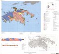
St. John, USVI, geologic map.pdf 6,564 × 5,991; 2.53 MB
-
Tectonic forces in Cascadia.png 800 × 425; 113 KB
-
The Bahama Islands (1905) (19730641514).jpg 3,312 × 1,484; 747 KB
-
The environment of Camp Grant (1918) (14598067779).jpg 2,284 × 2,656; 1.56 MB
-
The environment of Camp Grant (1918) (14598215697).jpg 1,656 × 2,520; 832 KB
-
The environment of Camp Grant (1918) (14761730336).jpg 2,444 × 4,816; 2.29 MB
-
The environment of Camp Grant (1918) (14784728025).jpg 2,128 × 3,012; 2.35 MB
-
The Quarterly journal of the Geological Society of London (12712041204).jpg 1,631 × 1,290; 468 KB
-
USGS Lake Superior syncline.png 1,007 × 679; 603 KB
-
USGS Professional Paper 144, Plate 2.jpg 6,748 × 7,128; 5.43 MB
-
USGS Saint Lucia geologic map.png 1,312 × 590; 457 KB
-
ValVerdeOuchita.png 1,748 × 1,226; 745 KB
-
WaitsRiverFmMap.png 2,315 × 2,917; 473 KB
-
Wichita Uplift fault map.png 1,259 × 902; 105 KB
-
North america with-Williston.jpg 3,300 × 2,938; 1.45 MB
-
Wyoming, Mojave, Yavapai, Mazatzal, Trans-Hudson.gif 705 × 1,000; 95 KB
-
Yucatan Platform geologic view.svg 765 × 990; 3.67 MB
-
Yucatan Platform political view.svg 765 × 990; 3.45 MB
-
Yukon-Tanana terrane 0Ma.jpg 975 × 815; 353 KB


