Category:Maps of the Caribbean
Jump to navigation
Jump to search
Use the appropriate category for maps showing all or a large part of the Caribbean. See subcategories for smaller areas:
| If the map shows | Category to use |
|---|---|
| the Caribbean on a recently created map | Category:Maps of the Caribbean or its subcategories |
| the Caribbean on a map created more than 70 years ago | Category:Old maps of the Caribbean or its subcategories |
| the history of the Caribbean on a recently created map | Category:Maps of the history of the Caribbean or its subcategories |
| the history of the Caribbean on a map created more than 70 years ago | Category:Old maps of the history of the Caribbean or its subcategories |
Subcategories
This category has the following 24 subcategories, out of 24 total.
!
*
A
B
C
F
G
H
L
M
T
Y
Pages in category "Maps of the Caribbean"
The following 3 pages are in this category, out of 3 total.
Media in category "Maps of the Caribbean"
The following 133 files are in this category, out of 133 total.
-
1884 Caribbean Islands.jpg 2,116 × 3,225; 1.17 MB
-
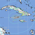
2020 Caribbean earthquake ShakeMap2.png 700 × 699; 196 KB
-
500px-CaribbeanIslands-1-.png 500 × 300; 139 KB
-
Admiralty Chart Catalogue 1967 Page 107 Index T.jpg 8,555 × 6,836; 8.53 MB
-
Adventure 10feb1922-- Forced Luck--map.png 482 × 326; 16 KB
-
Alice Shoal location.png 509 × 609; 910 KB
-
America centrale.jpg 1,000 × 600; 120 KB
-
AMERICAS-II-route.png 235 × 270; 13 KB
-
Amérique centrale-Mexique-Caraïbes.png 800 × 498; 438 KB
-
Antilleanconfederationmap.png 6,000 × 6,000; 2.11 MB
-
Association of Caribbean States membership.svg 492 × 352; 1.05 MB
-
Atoll research bulletin (1962) (19722533744).jpg 3,664 × 1,884; 696 KB
-
Atoll research bulletin (1992) (20158719110).jpg 2,992 × 2,134; 971 KB
-
Battle of the Saintes plan.jpg 1,000 × 718; 60 KB
-
Bay of Honduras.jpg 3,500 × 2,780; 2.27 MB
-
Bug carte.png 324 × 286; 40 KB
-
Bulletin - United States National Museum (1964) (20319661028).jpg 2,832 × 1,612; 287 KB
-
Bulletin - United States National Museum (1964) (20481497026).jpg 2,896 × 1,726; 272 KB
-
BVI 2009-273 (3692273152).jpg 3,456 × 2,592; 851 KB
-
CACM.png 253 × 174; 5 KB
-
Caribbean general map.png 1,699 × 1,000; 388 KB
-
Caribbean in green.png 2,306 × 1,310; 390 KB
-
Caribbean Initiative Area.png 1,067 × 800; 1.09 MB
-
Caribbean Map File (PSF) grayscale.png 279 × 210; 14 KB
-
Caribbean Map File (PSF).jpg 278 × 209; 18 KB
-
Caribbean Migration Patterns.png 327 × 333; 41 KB
-
Caribbean Sea and West Indies.png 395 × 268; 21 KB
-
Caribbean spanish names.PNG 1,861 × 1,085; 77 KB
-
Caribbean- Regional Overview (2227).png 1,122 × 793; 321 KB
-
CaribbeanIslandGroups.png 394 × 286; 4 KB
-
CaribbeanIslands PT.png 1,500 × 900; 530 KB
-
CaribbeanIslands.png 1,500 × 900; 577 KB
-
Caribe estadounidense.png 3,472 × 2,048; 253 KB
-
Caribes.png 419 × 445; 6 KB
-
Caribisch gebied.jpg 3,002 × 2,298; 2.06 MB
-
CARICOM Map 2010.png 800 × 406; 46 KB
-
Caricom Member states fully labeled Neutral.png 2,978 × 1,781; 531 KB
-
Caricom Member states fully labeled.png 2,978 × 1,781; 556 KB
-
CARICOM-Common-Passport.png 253 × 174; 5 KB
-
CARICOM-OECS-Members.png 253 × 174; 4 KB
-
CARICOM-Single-Market.png 253 × 174; 5 KB
-
CARIFTA and the rest of the Commonwealth Caribbean 1971-1972.png 2,000 × 1,600; 219 KB
-
Central America - Caribbean Area - DPLA - 573842b26bc82d70666dfd854d2dda3d.jpg 4,279 × 3,326; 1.41 MB
-
Central America and the Caribbean - DPLA - d02576d63aab2221d8a539b439e6e84b.jpg 3,280 × 2,554; 1.05 MB
-
Central america carribiean hr.pdf 2,352 × 1,820; 2.2 MB
-
Central america.jpg 2,882 × 2,162; 836 KB
-
CFU countries location map.png 750 × 650; 78 KB
-
Chart No 761 West India Islands and Caribbean Sea Sheet 1, Published 1960.jpg 16,276 × 11,073; 53.78 MB
-
CIA map Central America & Caribbean.png 1,390 × 1,044; 1.6 MB
-
CIA map of the Caribbean.png 1,291 × 892; 1.45 MB
-
Cities in Central America South.png 1,344 × 743; 55 KB
-
Civil union map Central America and the Caribbean Islands.svg 733 × 502; 61 KB
-
Cofresi's Domain 2008 version.jpg 556 × 228; 30 KB
-
Columbus fourth voyage es.jpg 1,001 × 630; 133 KB
-
Columbus second voyage es.jpg 1,001 × 563; 93 KB
-
Columbus third voyage es.jpg 901 × 638; 93 KB
-
Comunidad de Estados Latinoamericanos y Caribeños-2020-Miembros.png 1,068 × 1,051; 26 KB
-
CONCACAF Nations League (League A, B. C).png 777 × 577; 67 KB
-
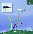
Diana Nyad routes.jpg 514 × 534; 41 KB
-
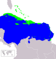
Distribution of Phyllops falcatum.png 1,276 × 853; 24 KB
-
ECFS-route.png 358 × 343; 34 KB
-
ECHO Caribbean Basemap A3 Landscape v2.png 4,959 × 3,509; 702 KB
-
Español caribeño1.png 319 × 314; 52 KB
-
Geographic Areas Reference Manual Figure 7-1.png 724 × 623; 131 KB
-
Geographic Areas Reference Manual Figure 7-9.png 549 × 686; 116 KB
-
Great Hurricane (1780) areas affected.JPG 403 × 286; 9 KB
-
Great Hurricane (1780) areas affected.png 394 × 286; 6 KB
-
Homosexuality laws in Central America and the Caribbean Islands.svg 733 × 502; 60 KB
-
Hurricane warning breakpoints (Caribbean).gif 895 × 692; 132 KB
-
Jamaica Passage.png 706 × 345; 320 KB
-
Karte Karibik für Klexikon.jpg 2,000 × 1,344; 851 KB
-
Karte Karibik Inseln (zh).png 1,024 × 636; 70 KB
-
Karte Kirchenprovinzen und Diözesen der Karibik - es.png 3,035 × 2,185; 1.57 MB
-
Karte Kirchenprovinzen und Diözesen der Karibik Suriname Neutral.png 4,371 × 3,147; 1.9 MB
-
Karte Kirchenprovinzen und Diözesen der Karibik.png 3,035 × 2,185; 1.53 MB
-
La Soufriere Ash Plume.jpg 532 × 511; 70 KB
-
Le Tour du monde-02-p051.jpg 1,223 × 838; 259 KB
-
Leeward Islands.jpg 399 × 302; 32 KB
-
Lesser Antilles 250m.jpg 838 × 1,120; 424 KB
-
LocationWHCaribbean.png 800 × 800; 32 KB
-
Major-Cities-in-the-Caribbean.png 800 × 565; 39 KB
-
Map of Caribbean.png 2,768 × 1,578; 569 KB
-
Map of the Caribbean (24998329138).jpg 1,500 × 1,005; 362 KB
-
Map of the Caribbean from The World Factbook 2006.jpg 2,172 × 1,480; 447 KB
-
Map of the Territorial Waters in the Caribbean.png 1,713 × 1,118; 340 KB
-
Map-caribbean languages big.JPG 2,189 × 1,496; 287 KB
-
Map-Latin America and Caribbean.png 390 × 450; 11 KB
-
Mapofindiansinthecaribbean.png 1,524 × 980; 194 KB
-
Miembros asociacion estados caribe.PNG 262 × 185; 4 KB
-
Miembros asociacion estados del caribe.PNG 1,357 × 628; 54 KB
-
Miembros banco centroamericano integracion economica.PNG 1,359 × 630; 54 KB
-
National Atlas 1970 - Perspective views of the outlying areas.jpg 1,810 × 2,369; 2.02 MB
-
Olumpic Caribbean.png 643 × 600; 78 KB
-
OpenSeaMap-Chart-Bundle-Area-Caribbean-2016-05.PNG 955 × 625; 201 KB
-
Peck correction 2003.tif 8,037 × 4,996; 153.18 MB
-
Peter Martyr map 1511 Maine copy.jpg 7,597 × 5,161; 32.09 MB
-
Petrocaribe-Map.png 253 × 174; 12 KB
-
Pietro Martire d'Anghiera Map of the Caribbean 1511 JCB.jpg 3,268 × 2,247; 932 KB
-
Ports of New Orleans - Biloxi - Mobile.png 514 × 444; 12 KB
-
Puerto Rico Bank and major geological features.jpg 641 × 706; 197 KB
-
Puerto Rico, Bahía de San Juan; San Juan Bay, 1992 (LOC).jpg 10,080 × 7,351; 94.83 MB
-
Saw40.jpg 1,200 × 720; 142 KB
-
SouthernCaribbeanIslands.PNG 840 × 425; 175 KB
-
States of the Caribbean (Tonga).jpg 880 × 574; 285 KB
-
TCS-1-route.png 419 × 445; 8 KB
-
The Bell System technical journal (1922) (14755685102).jpg 3,376 × 2,618; 2.68 MB
-
The Caribbean - DPLA - 7a4f0f62888ff0fcf383b06ff6fdd123.jpg 2,556 × 3,292; 4.62 MB
-
The Caribbean - DPLA - d4ef4aab46148739d7da0b5c91906dfb.jpg 2,556 × 3,284; 4.96 MB
-
The Caribbean - DPLA - dd9f0d14776dfa1fef23501c6df05868.jpg 2,552 × 3,272; 4.83 MB
-
The Caribbean forester (1960) (19911945714).jpg 3,552 × 2,472; 2.47 MB
-
The Caribbean forester (1960) (20525702732).jpg 3,600 × 2,582; 3.03 MB
-
The Caribbean forester (1961) (20347857619).jpg 3,312 × 2,474; 2.44 MB
-
The Caribbean forester (1962) (19911981914).jpg 3,344 × 2,385; 597 KB
-
The Caribbean forester (1962) (20346599458).jpg 3,568 × 2,627; 2.22 MB
-
The Caribbean forester (1963) (19911983294).jpg 3,488 × 2,495; 2.63 MB
-
The Lesser Antilles arc.webp 1,299 × 1,657; 362 KB
-
UBICACION DEL ZULIA.gif 514 × 356; 33 KB
-
Upwelling zones.jpg 1,112 × 441; 90 KB
-
Veliki Antili.png 2,590 × 1,012; 1.3 MB
-
VenezuelaJS.png 948 × 685; 84 KB
-
West-Indies.png 350 × 189; 1 KB
-
Yucatánski prolaz.png 1,875 × 1,228; 686 KB
-
Zombie cocktail gianni zottola.jpg 1,500 × 1,002; 1.34 MB
-
Zong Massacre map.png 3,000 × 1,963; 241 KB
-
加勒比概图.png 1,258 × 885; 320 KB


