Category:Maps of Northern America
Jump to navigation
Jump to search
Subcategories
This category has the following 2 subcategories, out of 2 total.
B
J
- Jesusland map (9 F)
Media in category "Maps of Northern America"
The following 21 files are in this category, out of 21 total.
-
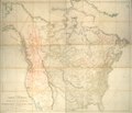
A map exhibiting all the new discoveries in the interior parts of North America. NYPL465250.tiff 8,909 × 7,687; 195.96 MB
-
Afwijkend noorden Canada en VS (flipped).png 491 × 442; 564 KB
-
Afwijkend noorden Canada en VS.png 491 × 442; 692 KB
-
BlankMap-USA-states-Canada-provinces highlighting OCA Archdiocese of Canada.png 1,785 × 1,744; 65 KB
-
Canada USA time.svg 1,730 × 1,730; 191 KB
-
ChipotleDistributionDecember2007.PNG 600 × 431; 77 KB
-
ChipotleDistributionDecember2009.PNG 600 × 431; 55 KB
-
ChipotleDistributionDecember2010.PNG 600 × 431; 55 KB
-
ChipotleDistributionDecember2011.PNG 600 × 431; 54 KB
-
ChipotleDistributionFebruary2011.PNG 600 × 431; 55 KB
-
ChipotleDistributionMay2010.PNG 600 × 431; 55 KB
-
ChipotleDistributionOctober2010.PNG 600 × 431; 55 KB
-
ChipotleDistributionOctober2011.PNG 600 × 431; 54 KB
-
Container-deposit legislation in US and Canadian states.svg 512 × 512; 117 KB
-
GKCoyoteMap.jpg 892 × 536; 81 KB
-
Invasion in the United States.png 650 × 540; 20 KB
-
Koppen-Geiger Map Northern America present.svg 1,816 × 850; 12.96 MB
-
MAP OF IRP JURISDICTIONS.png 536 × 377; 132 KB
-
NORPASS map.svg 2,800 × 3,200; 326 KB
-
Northern America (orthographic projection).svg 550 × 550; 676 KB


