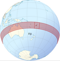
Category:Locator maps of Fiji
Jump to navigation
Jump to search
Subcategories
This category has the following 2 subcategories, out of 2 total.
!
B
- Bilateral maps of Fiji (51 F)
Media in category "Locator maps of Fiji"
The following 15 files are in this category, out of 15 total.
-
2015.01.31 wikiatlas orthographic locator.png 400 × 402; 81 KB
-
Fiji (orthographic projection).svg 550 × 550; 318 KB
-
Fiji - Location Map (2013) - FJI - UNOCHA.svg 250 × 250; 893 KB
-
Fiji and oceania.jpg 371 × 303; 16 KB
-
Fiji-Central.png 250 × 189; 3 KB
-
Fiji-Eastern.png 250 × 189; 3 KB
-
Fiji-Lomaiviti.png 250 × 189; 9 KB
-
Fiji-Northern.png 250 × 189; 3 KB
-
Fiji-Rotuma.png 250 × 189; 3 KB
-
Fiji-Western.png 250 × 189; 3 KB
-
LocationFiji.png 248 × 113; 5 KB
-
LocationRotuma.png 250 × 158; 7 KB
-
Map of Fiji.png 512 × 439; 40 KB
-
Rabi Island.jpg 750 × 554; 115 KB
-
World Factbook (1982) Fiji.jpg 765 × 588; 82 KB


