Category:Locator maps of the Faroe Islands
Jump to navigation
Jump to search
Subcategories
This category has the following 3 subcategories, out of 3 total.
L
- Locator maps of places in the Faroe Islands (1 P, 131 F)
S
Media in category "Locator maps of the Faroe Islands"
The following 14 files are in this category, out of 14 total.
-
Denmark Dependencies.jpg 401 × 237; 42 KB
-
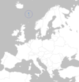
Europe map faroe.png 700 × 730; 27 KB
-
Europe-Faroe Islands.svg 2,045 × 1,720; 7.43 MB
-
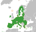
European Union Faroe Islands Locator.svg 1,760 × 1,560; 718 KB
-
Faroeislands w1 locator.svg 1,000 × 1,000; 126 KB
-
Faroeislands w2 locator.svg 1,000 × 1,000; 226 KB
-
Faroes compared to denmark.png 608 × 491; 24 KB
-
LocationFaroeIslands.png 608 × 385; 11 KB
-
Map of faroe islands in europe - danish caption.png 1,433 × 1,068; 536 KB
-
Map of faroe islands in europe - english caption.png 1,433 × 1,068; 547 KB
-
Map of faroe islands in europe - faroese caption.png 1,433 × 1,068; 543 KB
-
Map of faroe islands in europe - german caption.png 1,433 × 1,068; 538 KB
-
Map of faroe islands in europe, flights and ferries.png 1,433 × 1,068; 601 KB
-
World Factbook (1982) Faroe Islands.jpg 589 × 588; 86 KB


