Category:Locator maps of Sweden
Jump to navigation
Jump to search
Subcategories
This category has the following 6 subcategories, out of 6 total.
Media in category "Locator maps of Sweden"
The following 42 files are in this category, out of 42 total.
-
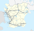
Almunge-Norrtalje-Vallentuna.jpg 563 × 578; 225 KB
-
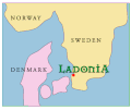
Big map ladonia.gif 316 × 265; 8 KB
-
Bjurfors1.jpg 234 × 516; 26 KB
-
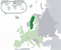
EU location SWE.png 1,600 × 1,200; 475 KB
-
EU location SWE.svg 1,600 × 1,200; 2.47 MB
-
EU-Sweden.svg 2,045 × 1,720; 7.33 MB
-
Europe location SWE.png 1,600 × 1,200; 463 KB
-
Europe map sweden.png 1,231 × 929; 41 KB
-
Europe se.svg 680 × 520; 795 KB
-
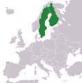
Finland and Sweden.svg 1,236 × 1,245; 84 KB
-
Gnällbältet, locations on map.png 2,000 × 2,311; 566 KB
-
Isveç cb.png 342 × 400; 15 KB
-
Kiruna Municipality Karesuando.png 372 × 840; 15 KB
-
Kungshamn in southern Sweden.svg 744 × 1,052; 49 KB
-
Location Sweden EU Europe.svg 2,056 × 1,710; 2.17 MB
-
Location Sweden.svg 680 × 520; 511 KB
-
LocationSweden.png 250 × 115; 3 KB
-
LocationSweden.svg 1,000 × 500; 2.76 MB
-
LocationSwedenGotland.png 500 × 500; 8 KB
-
LocationSwedenInEurope.png 415 × 422; 6 KB
-
LocationSwedenKarlskrona.png 500 × 500; 14 KB
-
Map of Europe with Sweden in orange color.png 1,236 × 1,245; 45 KB
-
Map of NordBalt.jpg 350 × 171; 60 KB
-
Mapsample se og norrkoping.svg 196 × 284; 67 KB
-
Metropolitan Gothenburg ver.2.PNG 493 × 564; 48 KB
-
Pagatagen.svg 2,039 × 1,845; 225 KB
-
Roslagen.PNG 457 × 932; 35 KB
-
Schweden Lund.png 214 × 502; 8 KB
-
Sjuharad Region Vastergotland.PNG 573 × 553; 40 KB
-
Smålandsleden locator map.jpg 562 × 412; 65 KB
-
Svpmap savolaks.png 275 × 400; 17 KB
-
Svpmap vastergotland.png 275 × 400; 17 KB
-
Sweden - Location Map (2013) - SWE - UNOCHA-pt.svg 251 × 251; 1.19 MB
-
Sweden - Location Map (2013) - SWE - UNOCHA.svg 251 × 251; 1.19 MB
-
Sweden Värmland Torsby location map.svg 512 × 854; 71 KB
-
Swedenrachelrocket72.jpg 500 × 388; 54 KB
-
Sweeden euro locations.png 250 × 481; 47 KB
-
Tremplins tournée nordique.png 331 × 473; 68 KB
-
Trollkyrka.PNG 295 × 332; 9 KB
-
Vindelfjallen Nature Reserve in map of Sweden.png 999 × 2,387; 941 KB
-
Ämtbjörk.png 251 × 479; 46 KB
-
Årjäng Värmland locater map.svg 512 × 854; 70 KB

