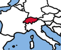
Category:Locator maps of Switzerland
Jump to navigation
Jump to search
Subcategories
This category has the following 5 subcategories, out of 5 total.
Media in category "Locator maps of Switzerland"
The following 30 files are in this category, out of 30 total.
-
2010 Fiesch derailment location.png 714 × 488; 125 KB
-
Andorra Switzerland Locator.png 594 × 486; 15 KB
-
Bailliage Trachselwald.png 656 × 760; 255 KB
-
Bernese Highlands locator map.png 1,371 × 871; 94 KB
-
Europe location CH.png 1,245 × 1,245; 44 KB
-
Europe location CHE.png 1,600 × 1,200; 458 KB
-
Europe map switzerland.png 1,231 × 929; 51 KB
-
Great circle Switzerland.jpg 900 × 900; 150 KB
-
Isviçre cb.png 256 × 214; 10 KB
-
L'Alto Olgiatese in provincia di Como..jpg 482 × 703; 35 KB
-
La zona della Valle Intelvi.png 482 × 703; 320 KB
-
Location Switzerland Europe.png 2,056 × 1,800; 365 KB
-
LocationSwitzerland.png 250 × 115; 6 KB
-
LocationSwitzerland.svg 1,000 × 500; 2.76 MB
-
Seigneurie Champvent 1324.png 2,952 × 2,954; 1.27 MB
-
Seigneurie Champvent.png 2,952 × 2,954; 1.27 MB
-
Seigneurie La Mothe.png 2,952 × 2,954; 1.27 MB
-
Swiss Confederacy (1714).svg 450 × 456; 894 KB
-
Switzerland (orthographic projection).svg 553 × 553; 299 KB
-
Switzerland - Location Map (2013) - CHE - UNOCHA.svg 250 × 250; 968 KB
-
Switzerland Wikivoyage locator maps - Bernese Highlands.png 1,094 × 700; 470 KB
-
Switzerland Wikivoyage locator maps - Graubünden.png 1,094 × 700; 467 KB
-
Switzerland Wikivoyage locator maps - Metropolitanregion Zürich.png 1,094 × 700; 468 KB
-
Switzerland Wikivoyage locator maps - Ticino.png 1,094 × 700; 470 KB
-
Switzerland Wikivoyage locator maps - Wallis.png 1,094 × 700; 469 KB
-
Switzerland Wikivoyage locator maps - Western Switzerland.png 1,094 × 700; 463 KB
-
Switzerland Wikivoyage locator maps - Zentralschweiz.png 1,094 × 700; 467 KB
-
Switzerlandrachelrocket72.jpg 500 × 388; 53 KB
-
VALLE ITELVI.jpg 482 × 703; 35 KB
-
World Factbook (1982) Switzerland.jpg 585 × 585; 82 KB


