Category:Locator maps of Wales
Jump to navigation
Jump to search
This is a repository of location maps for settlements and places of interest in Wales, for use both in articles themselves and as the map image in the infoboxes. The template files are shown below, as are the general listing of location maps. The Hi-Res templates should be used unless there is a good reason not too.
Subcategories
This category has the following 4 subcategories, out of 4 total.
!
C
W
Media in category "Locator maps of Wales"
The following 30 files are in this category, out of 30 total.
-
 UK wales.png 290 × 396; 10 KB
-
 BIThumbMap WAL.png 663 × 1,069; 113 KB
-
 CelticNationsMap.jpg 464 × 678; 58 KB
-
 Chwe Chenedl Geltaidd syml.png 360 × 711; 12 KB
-
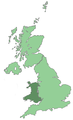
 Devolved areas of the United Kingdom.png 4,765 × 6,618; 2.01 MB
-
 Europe location WAL alt.png 300 × 225; 19 KB
-
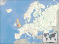 Europe location WAL.png 1,600 × 1,200; 712 KB
-
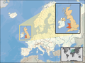 Europe location WAL2.png 1,600 × 1,200; 803 KB
-
 KembraRU.png 200 × 246; 7 KB
-
 Location map Map Llwybr Cymru5.png 2,000 × 2,390; 4.51 MB
-
 LocationWales.PNG 250 × 115; 6 KB
-
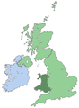
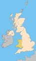
 Map of Wales within the United Kingdom.png 290 × 346; 35 KB
-
 Map Wales Location UK.jpg 480 × 430; 26 KB
-
 South Wales Central results in 2011.png 300 × 350; 17 KB
-
 Uk map home nation wales.png 643 × 1,075; 63 KB
-
 Uk map only wales.png 241 × 396; 7 KB
-
 Uk map wales.png 643 × 1,075; 62 KB
-
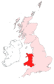 Wales in United Kingdom edit.png 2,000 × 3,090; 283 KB
-
 Wales locator.png 414 × 494; 71 KB
-
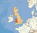
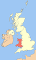
 Wales Map British Isles.PNG 968 × 646; 77 KB
-
 Wales Map EU.PNG 1,600 × 1,200; 580 KB
-
 Wales Map EU.png 1,600 × 1,200; 765 KB
-
 Wales Map Europe.PNG 1,600 × 1,200; 566 KB
-
 Wales outline map with UK.png 2,326 × 2,824; 969 KB
-
 Welsh mountains Bala to Trallwng.jpg 548 × 266; 59 KB
-
 Welsh mountains Bermo a Betws-y-Coed a'r Bala.jpg 340 × 220; 34 KB
-
 Welsh mountains Dolgellau a Machynlleth.jpg 394 × 235; 29 KB
-
 Welsh mountains Llanymddyfri a Threfynwy.jpg 795 × 308; 84 KB
-
 Welsh mountains Ynis Mon and Phen Llyn.jpg 402 × 470; 39 KB
-
 West Wales.png 386 × 480; 49 KB


