Category:Locator maps of Estonia
Jump to navigation
Jump to search
Subcategories
This category has the following 9 subcategories, out of 9 total.
Media in category "Locator maps of Estonia"
The following 26 files are in this category, out of 26 total.
-
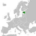
Blank map of Europe Estonia1929-1938.svg 450 × 456; 483 KB
-
Estonia - Location Map (2013) - EST - UNOCHA.svg 251 × 251; 995 KB
-
Estonia Electoral District - Russian Constituent Assembly election, 1917.png 1,280 × 756; 72 KB
-
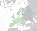
Estonia EU Europe.jpg 800 × 665; 40 KB
-
Estonia in Russian Empire (1914).svg 581 × 343; 310 KB
-
Estoniarachelrocket72.jpg 500 × 399; 53 KB
-
Estoniarachelrocket72.webp 240 × 200; 8 KB
-
EU location EST.png 1,600 × 1,200; 469 KB
-
EU location EST.svg 1,600 × 1,200; 2.47 MB
-
EU-Estonia.svg 2,045 × 1,720; 7.33 MB
-
EUR location EST.PNG 1,600 × 1,200; 578 KB
-
Europe ee.svg 680 × 520; 795 KB
-
Europe location EST.png 1,600 × 1,200; 711 KB
-
Europe map estonia.png 1,231 × 929; 41 KB
-
Kihnu-pos.jpg 2,187 × 1,358; 116 KB
-
Lake Peipus.png 782 × 444; 106 KB
-
Location Estonia EU Europe.png 2,056 × 1,800; 375 KB
-
LocationEstonia.png 250 × 115; 4 KB
-
LocationEstonia.svg 1,000 × 500; 2.76 MB
-
LocationEstoniaInEurope.png 1,245 × 1,245; 53 KB
-
Muhu-pos.jpg 2,187 × 1,358; 118 KB
-
Naissaar-pos.jpg 2,187 × 1,358; 116 KB
-
Parnumaa Pulli kyla.png 360 × 364; 36 KB
-
Republic of Estonia 1933.svg 450 × 456; 519 KB
-
Suomi Viro.png 1,236 × 1,245; 90 KB
-
Väinameri location map.svg 1,668 × 1,084; 355 KB


