Category:Locator maps of Greece
Jump to navigation
Jump to search
Subcategories
This category has the following 11 subcategories, out of 11 total.
Media in category "Locator maps of Greece"
The following 61 files are in this category, out of 61 total.
-
Agrafa1.JPG 800 × 700; 64 KB
-
Armenia, CIS and Greece, UE Locator map.png 1,425 × 625; 36 KB
-
Cassandreia location.jpg 567 × 613; 59 KB
-
CN logo Maps.png 601 × 660; 130 KB
-
Elis, Grecia.jpg 321 × 339; 18 KB
-
Enotita Nison.png 800 × 679; 149 KB
-
Enotita Pirea.png 800 × 679; 149 KB
-
EU location GRE.png 1,600 × 1,200; 471 KB
-
Europe location GRE.png 1,600 × 1,200; 711 KB
-
Europe map greece.png 1,231 × 929; 41 KB
-
GR-Attika.png 1,004 × 826; 269 KB
-
GR-Epirus.png 1,004 × 826; 269 KB
-
GR-Ion-Ins.png 1,004 × 826; 269 KB
-
GR-Kreta.png 1,004 × 826; 269 KB
-
GR-Maked.png 1,004 × 826; 267 KB
-
GR-Mittelgr.png 1,004 × 826; 268 KB
-
GR-Pelop.png 1,004 × 826; 268 KB
-
GR-Thess.png 1,004 × 826; 268 KB
-
GR-Thrak.png 1,004 × 826; 269 KB
-
GR-Ägäis-Ins.png 1,004 × 826; 268 KB
-
Greece Mani Peninsula labeled.gif 200 × 208; 6 KB
-
Greece Pavlopetir map.png 618 × 587; 126 KB
-
Greece2world.png 451 × 675; 88 KB
-
Greecerachelrocket72.jpg 500 × 388; 54 KB
-
Greek map 01-Samos.png 848 × 832; 441 KB
-
Griekenland Paxos.jpg 295 × 286; 11 KB
-
Grieķijas atrašanās vieta Eiropā.png 2,044 × 1,718; 468 KB
-
Gulf of Corinth.png 200 × 204; 16 KB
-
Gulf of Patras.png 200 × 204; 16 KB
-
Kaart Griekenland Kassandra.png 328 × 351; 17 KB
-
Kaart Griekenland Pelion.png 328 × 351; 17 KB
-
Kaart Griekenland Sithonia.png 328 × 351; 17 KB
-
Kaart Griekenland Volos.png 328 × 351; 17 KB
-
Kithairon.png 183 × 159; 5 KB
-
Leibethra.png 213 × 211; 7 KB
-
Llac copais abans segle XIX.jpg 800 × 539; 726 KB
-
Location of Tyrnavos in Greece.png 402 × 350; 57 KB
-
Location-RioAntirio-AK.png 200 × 204; 13 KB
-
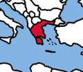
LocationGreece.png 248 × 113; 3 KB
-
LocationGreece2.png 1,000 × 500; 149 KB
-
LocationGreeceInEurope.png 415 × 422; 10 KB
-
LocationKarpathos2.PNG 624 × 350; 108 KB
-
LocMap of WH Acropolis-Athens.png 275 × 275; 6 KB
-
Map of Vrilissia Point Out.jpg 1,944 × 1,284; 595 KB
-
Messenian Gulf.png 800 × 700; 35 KB
-
Meteora Mapka.png 729 × 600; 117 KB
-
Papadates map.png 720 × 593; 676 KB
-
PE Kavalas.png 800 × 679; 136 KB
-
PE Magnisias.png 800 × 679; 136 KB
-
PE Sporadon.png 800 × 679; 136 KB
-
PE Thasou.png 800 × 679; 136 KB
-
Podarcis milensis distribution map.png 1,746 × 1,406; 290 KB
-
Rodi location map.png 626 × 580; 108 KB
-
Saniresortloc.PNG 200 × 204; 18 KB
-
Thermi-belediyesi.jpg 249 × 203; 5 KB
-
Thessaloniki and Cassandreia.png 514 × 480; 77 KB
-
Thirins location map.png 635 × 578; 109 KB
-
Thraki old.JPG 250 × 115; 7 KB
-
Vrilissia-spot.jpg 980 × 882; 133 KB
-
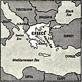
World Factbook (1982) Greece.jpg 587 × 587; 108 KB
-
Yunanistan cb.png 263 × 228; 10 KB
