Category:Locator maps of Europe
Jump to navigation
Jump to search
Subcategories
This category has the following 17 subcategories, out of 17 total.
Media in category "Locator maps of Europe"
The following 55 files are in this category, out of 55 total.
-
Atlantic Arc.jpg 250 × 424; 13 KB
-
Atlantic-Europe.jpg 712 × 880; 114 KB
-
BEL-GER-FRA-NED.png 467 × 466; 14 KB
-
Blaue-banane.png 767 × 534; 22 KB
-
Blue Banana.png 767 × 534; 24 KB
-
Brabant in the world.png 742 × 838; 60 KB
-
Carte Kunstdependancen.jpg 1,237 × 2,479; 482 KB
-
Carte spirale 2009.png 2,126 × 2,126; 1,023 KB
-
Centre of Europe.jpg 4,040 × 3,592; 1.14 MB
-
Diplomacylogo.png 256 × 256; 2 KB
-
EasternEurope1.png 329 × 218; 7 KB
-
Eur lisbon vladivostok.PNG 678 × 207; 8 KB
-
Europa equidistant kegel 15emeridiaan.PNG 461 × 393; 10 KB
-
Europa EUR LAmbert conform kegel 10e meridiaan.PNG 447 × 459; 14 KB
-
Europa EUR Lambert conform kegel 15emeridiaan.PNG 432 × 446; 14 KB
-
Europa niet geprojecteerd.PNG 782 × 431; 16 KB
-
Europa RD-stelsel met breedtegraden onder-landen.PNG 557 × 550; 17 KB
-
Europa RD-stelsel-zonderbreedtegraden.PNG 555 × 548; 14 KB
-
Europa RD-stelsel.PNG 563 × 548; 24 KB
-
Europamithaupstaedten.pdf 1,445 × 1,235; 1.23 MB
-
Europe Locator Map Empty (2).png 1,170 × 768; 19 KB
-
Europe Locator Map Empty.png 1,170 × 768; 18 KB
-
Europe locator map.png 606 × 442; 6 KB
-
Europe Wikivoyage locator maps - Balkans region.png 1,270 × 1,161; 80 KB
-
Europe-sud-dégradé.jpg 807 × 561; 315 KB
-
Europe-sud-fleuves.jpg 807 × 561; 307 KB
-
Europe-sud-latitudes.jpg 807 × 561; 325 KB
-
Europe-sud-onu.jpg 807 × 561; 299 KB
-
Europe-sud-relief.jpg 807 × 561; 307 KB
-
Europe-sud-systeme juridique.jpg 807 × 561; 230 KB
-
European countries above 49th parallel.png 2,296 × 1,598; 386 KB
-
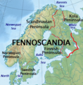
Fennoscandia-location.png 615 × 627; 764 KB
-
Globo Europe.png 1,723 × 874; 232 KB
-
Gran Europa Oriental.PNG 995 × 1,043; 72 KB
-
Historical map of the Casuari in the time of Ptolemy.png 1,280 × 1,024; 63 KB
-
Hrvatska-Slovenija map.jpg 3,295 × 3,367; 833 KB
-
Kaufland Europe.png 2,833 × 2,167; 337 KB
-
Lage der Europaregion.png 1,905 × 1,178; 1.27 MB
-
Lagekarte DE-DK-FI-NO-SE.png 1,063 × 889; 169 KB
-
Latin Arch.png 343 × 282; 9 KB
-
Lichtensteinrachelrocket72.jpg 500 × 470; 58 KB
-
Location of Europe.png 1,380 × 702; 40 KB
-
Maltarachelrocket72.png 474 × 379; 41 KB
-
Modern puppet states.png 1,531 × 1,244; 182 KB
-
N-euro.png 483 × 503; 68 KB
-
Netherlandsrachelrocket72.jpg 500 × 388; 127 KB
-
Ostsee NO physisch.png 5,592 × 4,097; 4.42 MB
-
Pannonian Location in Europe.png 1,550 × 912; 3.01 MB
-
Sanmarinorachelrocket72.png 474 × 379; 41 KB
-
Scand+Baltic.png 6,207 × 4,087; 4.69 MB
-
Südosteuropa.png 900 × 732; 466 KB
-
W-euro.png 272 × 259; 7 KB
-
Wereld from space NL-als-centrum.PNG 757 × 749; 32 KB
-
ევროპა.jpg 1,200 × 1,142; 135 KB


