Category:Signs in the East Riding of Yorkshire
Jump to navigation
Jump to search
Ceremonial counties of England: Bedfordshire · Berkshire · Buckinghamshire · Cambridgeshire · Cheshire · Cornwall · Cumbria · Derbyshire · Devon · Dorset · Durham · East Riding of Yorkshire · East Sussex · Essex · Gloucestershire · Greater London · Greater Manchester · Hampshire · Herefordshire · Hertfordshire · Kent · Lancashire · Leicestershire · Lincolnshire · Merseyside · Norfolk · North Yorkshire · Northamptonshire · Northumberland · Nottinghamshire · Oxfordshire · Rutland · Shropshire · Somerset · South Yorkshire · Staffordshire · Suffolk · Surrey · Tyne and Wear · Warwickshire · West Midlands · West Sussex · West Yorkshire · Wiltshire · Worcestershire
City-counties: Bristol · City of London
Former historic counties:
Other former counties:
City-counties: Bristol · City of London
Former historic counties:
Other former counties:
Subcategories
This category has the following 16 subcategories, out of 16 total.
B
C
E
P
R
W
Media in category "Signs in the East Riding of Yorkshire"
The following 200 files are in this category, out of 1,180 total.
(previous page) (next page)-
 158 Squadron memorial (geograph 6907659).jpg 1,024 × 683; 543 KB
-
 158 Squadron Memorial at Lissett (geograph 6653921).jpg 1,024 × 694; 108 KB
-
 16 - 22 The Weir.jpg 6,016 × 4,016; 18.61 MB
-
 207 Queen Street, Withernsea - geograph.org.uk - 683772.jpg 640 × 410; 60 KB
-
 50049 "Defiance" Common Lane, Welton LC 221222.jpg 2,149 × 1,102; 523 KB
-
 50049 Defiance Welton LC 221222.jpg 3,973 × 2,025; 1.4 MB
-
 A barn on Feoffee Common Lane (geograph 3130991).jpg 800 × 600; 251 KB
-
 A Barrier To Progress - geograph.org.uk - 252802.jpg 640 × 480; 102 KB
-
 A bridge over the Hudson Way - geograph.org.uk - 826449.jpg 640 × 433; 309 KB
-
 A corner of Welton Water - geograph.org.uk - 775408.jpg 640 × 370; 213 KB
-
 A field bridge over Ottringham Drain - geograph.org.uk - 1084841.jpg 640 × 480; 143 KB
-
 A footpath across Withernsea golf course (geograph 2257040).jpg 800 × 600; 348 KB
-
 A footpath off Queen Street, Withernsea (geograph 2259107).jpg 800 × 600; 243 KB
-
 A little shop in Wawne, East Yorks. - geograph.org.uk - 803845.jpg 640 × 576; 218 KB
-
 A new house in Leconfield - geograph.org.uk - 799246.jpg 640 × 454; 191 KB
-
 A permissive path off Priory Road, Cottingham (geograph 3341235).jpg 800 × 600; 142 KB
-
-
 A quick snack - geograph.org.uk - 793577.jpg 480 × 640; 108 KB
-
 A Relic of the Ferry Boat Inn - geograph.org.uk - 287510.jpg 640 × 427; 76 KB
-
 A ride past North Ferriby church (geograph 4975716).jpg 640 × 427; 92 KB
-
 A road at last (geograph 1981644).jpg 800 × 600; 175 KB
-
 A unnamed bungalow on the A1174 (geograph 2023082).jpg 800 × 600; 252 KB
-
 A walk from Hessle Square No20 (geograph 2006198).jpg 800 × 600; 159 KB
-
 A wet frog attracts interest at Melton West Business Park (geograph 5318668).jpg 5,376 × 3,024; 1.87 MB
-

-
 A1033, Camerton - geograph.org.uk - 1107053.jpg 640 × 426; 190 KB
-
 A1079 at power lines east of Wilberfoss (geograph 6824618).jpg 1,024 × 723; 184 KB
-
 A164 entering Beverley (geograph 3802130).jpg 2,744 × 1,850; 3.5 MB
-
 A166-B1248 junction, Wetwang, E Yorks (geograph 4457525).jpg 640 × 460; 180 KB
-
 A63 Newsholme, Looking South East - geograph.org.uk - 235983.jpg 426 × 640; 145 KB
-
 AA road sign, The Swan Inn, Seaton - geograph.org.uk - 5540280.jpg 1,110 × 833; 204 KB
-
 Above Hempholme Lock (geograph 5558769).jpg 1,024 × 768; 136 KB
-
 Absolutely Purrfect Cattery on Long Lane (geograph 4399984).jpg 1,600 × 1,062; 894 KB
-
 Absolutely Purrfect Cattery on Long Lane (geograph 4399985).jpg 1,600 × 1,062; 820 KB
-
 Access road to Lissett wind farm from Lissett Lane (geograph 7510597).jpg 5,152 × 3,864; 5.58 MB
-
 Access temporarily denied - geograph.org.uk - 664395.jpg 640 × 480; 309 KB
-
 Access to fishing pond (geograph 5274471).jpg 1,024 × 768; 331 KB
-
 Aerodrome Footpath - geograph.org.uk - 688280.jpg 640 × 479; 103 KB
-
 Aire Street swing bridge, Goole - geograph.org.uk - 579268.jpg 427 × 640; 100 KB
-
 Aldbrough Gas Storage, Bail Bridge - geograph.org.uk - 524159.jpg 640 × 468; 98 KB
-
 Alfred Bean Hospital - geograph.org.uk - 1280626.jpg 640 × 480; 85 KB
-
 Alfred Bean Hospital - geograph.org.uk - 149702.jpg 640 × 480; 83 KB
-
 All Saints Church Londesborough 4.jpg 640 × 377; 160 KB
-
 All Saints Church Londesborough 7.jpg 638 × 482; 104 KB
-
 All Saints Church, Hessle - geograph.org.uk - 319315.jpg 640 × 412; 122 KB
-
 All Saints Church, Kilnwick 2016 (geograph 5253556).jpg 640 × 480; 78 KB
-
 All Saints Infants School Hessle.jpg 640 × 480; 193 KB
-
 Allerthorpe Business Park - geograph.org.uk - 1053406.jpg 640 × 427; 222 KB
-
 ALLISON McVETY 7372433132.jpg 1,577 × 2,322; 870 KB
-
 Along Skeffling Road (geograph 6909172).jpg 1,024 × 683; 584 KB
-
 Along the A165 - geograph.org.uk - 72574.jpg 640 × 480; 84 KB
-
 Along The River Humber - geograph.org.uk - 400548.jpg 640 × 480; 132 KB
-
 Along The River Humber - geograph.org.uk - 400599.jpg 640 × 476; 112 KB
-
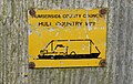 An old Hull Country Way marker on Park Lane (geograph 4399867).jpg 1,600 × 1,016; 735 KB
-
 Another field going for housing (geograph 4881133).jpg 4,608 × 3,456; 5.84 MB
-
 Approaching Beverley Pastures - The Westwood (geograph 4322285).jpg 5,121 × 3,596; 4.4 MB
-
 Approaching Hempholme Lock (geograph 5558476).jpg 1,024 × 768; 127 KB
-
 Arable and Flat Land - geograph.org.uk - 1094122.jpg 640 × 480; 67 KB
-
 Arched Gateway to Cave Castle Hotel - geograph.org.uk - 758057.jpg 640 × 589; 242 KB
-
 Ark Seeds - geograph.org.uk - 1168595.jpg 640 × 480; 221 KB
-
 Arnold Manor, Arnold.jpg 640 × 480; 124 KB
-
 Arram Grange - geograph.org.uk - 84961.jpg 640 × 480; 106 KB
-
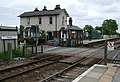
 Arram Level Crossing - geograph.org.uk - 85731.jpg 640 × 480; 105 KB
-
 Arram Station - geograph.org.uk - 470019.jpg 640 × 438; 93 KB
-
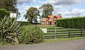 Ashfield Farm - geograph.org.uk - 1013124.jpg 640 × 377; 184 KB
-
 Aske Mews, Bricknell Avenue Estate, East Riding of Yorkshire (geograph 6845363).jpg 5,456 × 3,632; 2.07 MB
-
 At Wyton Bar - geograph.org.uk - 18671.jpg 640 × 480; 82 KB
-
 Autherd Garth, Walkington - geograph.org.uk - 614454.jpg 640 × 480; 179 KB
-
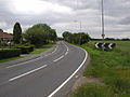
 B1249 near Wold House - geograph.org.uk - 252893.jpg 640 × 426; 251 KB
-
 Barff House - geograph.org.uk - 75115.jpg 640 × 480; 181 KB
-
 Barmby Marsh water treatment works (geograph 2324590).jpg 1,600 × 1,200; 306 KB
-
 Barmby Marsh Water Treatment Works (geograph 3435946).jpg 4,000 × 2,248; 1.9 MB
-
 Barmby on the Marsh school.jpg 598 × 405; 123 KB
-
 Barmston Beach Holiday Park - geograph.org.uk - 1277701.jpg 640 × 480; 51 KB
-
 Barmston Main Drain (geograph 6404892).jpg 1,024 × 768; 148 KB
-
 Barmston Main Drain Outfall (geograph 7443302).jpg 2,935 × 1,768; 1.21 MB
-
 Barn and post box Saltmarshe.jpg 640 × 480; 102 KB
-
 Barn at Green Lane Farm (geograph 4338636).jpg 1,024 × 664; 218 KB
-
 Beach's Café on Seaside Road, Withernsea (geograph 5083240).jpg 1,200 × 799; 274 KB
-
 Beck Bridge, Ottringham - geograph.org.uk - 296878.jpg 462 × 640; 117 KB
-
 Beck Lane Keyingham.jpg 640 × 473; 144 KB
-
 Beeford - geograph.org.uk - 73579.jpg 640 × 480; 88 KB
-
 Beevers bridge. - geograph.org.uk - 1701888.jpg 640 × 480; 58 KB
-
 Bench and phone box, Kirk Ella (geograph 6889570).jpg 768 × 1,024; 1.37 MB
-
 Benningholme Grange - geograph.org.uk - 1170208.jpg 640 × 426; 192 KB
-

-
-
 Beverley Grammar School (geograph 3210599).jpg 4,075 × 2,911; 2.67 MB
-
 Beverley Parks (geograph 1981649).jpg 800 × 600; 198 KB
-
 Beverley Parks Crossing (geograph 5399449).jpg 640 × 426; 57 KB
-
 Beverley Parks Sewer, Lakeminster Park (geograph 5099752).jpg 1,600 × 1,065; 813 KB
-
 Beverley Road - geograph.org.uk - 278008.jpg 640 × 480; 71 KB
-
 Beware of the Bull - geograph.org.uk - 198102.jpg 640 × 480; 109 KB
-
 Bielby Church.jpg 640 × 425; 75 KB
-
 Birdforth Mews off Dent Road, East Riding of Yorkshire (geograph 6845258).jpg 5,456 × 3,632; 3.17 MB
-

-
 Blue Bell Cottage - geograph.org.uk - 666450.jpg 640 × 480; 69 KB
-
 Bolton House - geograph.org.uk - 255553.jpg 640 × 428; 158 KB
-
 Boynton Village Hall.jpg 640 × 480; 65 KB
-
 Bracken Cottages near Kilnwick (geograph 5950887).jpg 1,600 × 1,064; 817 KB
-
 Brand New Lock Gate for Wansford Lock - geograph.org.uk - 1318063.jpg 640 × 426; 122 KB
-
 Breighton Airfield Entrance - geograph.org.uk - 1199423.jpg 640 × 440; 40 KB
-
 Bricknall Avenue toward junction with B1233 Hull Road (geograph 5699511).jpg 4,608 × 3,456; 5.23 MB
-
 Bridge at New Clough (geograph 5562469).jpg 800 × 600; 148 KB
-
 Bridge HUL1-21 - geograph.org.uk - 528867.jpg 640 × 480; 113 KB
-
 Bridge Number 05 - geograph.org.uk - 1562276.jpg 640 × 480; 99 KB
-
 Bridge over Scurf Dike (geograph 5558825).jpg 1,024 × 768; 199 KB
-
 Bridge over the Hudson Way - geograph.org.uk - 683352.jpg 640 × 473; 175 KB
-
 Bridge Rolls - Square (geograph 2530037).jpg 480 × 640; 88 KB
-
 Bridleway - SE974628 - geograph.org.uk - 154235.jpg 640 × 480; 136 KB
-
 Bridleway along Etton West Wood - geograph.org.uk - 1436710.jpg 640 × 535; 91 KB
-
 Bridleway at Little Wauldby Farm (geograph 5220654).jpg 1,200 × 772; 387 KB
-
 Bridleway at TA071409 - geograph.org.uk - 191872.jpg 480 × 640; 125 KB
-
 Bridleway Intersection - geograph.org.uk - 565298.jpg 640 × 475; 161 KB
-
 Bridleway near Sigglesthorne Grange - geograph.org.uk - 1463703.jpg 640 × 480; 124 KB
-
 Bridleway to Elloughton - geograph.org.uk - 121540.jpg 640 × 480; 180 KB
-
 Bridleway to Hasholme - geograph.org.uk - 129228.jpg 640 × 480; 139 KB
-
 Bridleway To Kilham - geograph.org.uk - 378544.jpg 480 × 640; 161 KB
-
 Bridleway to Wauldby Manor Farm - geograph.org.uk - 579771.jpg 640 × 480; 83 KB
-
 Bridleway towards Lavender Dale (geograph 6512672).jpg 1,600 × 1,065; 523 KB
-
 Bridlington 20, Beverley 3 (miles) - geograph.org.uk - 1222430.jpg 640 × 538; 461 KB
-
 Bridlington Market - geograph.org.uk - 1348980.jpg 455 × 640; 99 KB
-
 Bridlington North Beach - geograph.org.uk - 2728663.jpg 480 × 640; 87 KB
-
 Bridlington North Beach - geograph.org.uk - 5912633.jpg 640 × 465; 71 KB
-
 Bridlington railway station 2006 06 25.JPG 3,264 × 2,448; 912 KB
-
 Bridlington Road in Skipsea (geograph 6908085).jpg 1,024 × 683; 413 KB
-
 Bridlington Road, Driffield - geograph.org.uk - 121951.jpg 640 × 480; 98 KB
-
 Broomfleet railway station.jpg 640 × 456; 96 KB
-
 Broomfleet Signal Box.jpg 640 × 480; 60 KB
-
 Brough Golf Club - geograph.org.uk - 130187.jpg 640 × 480; 172 KB
-
 Brough Railway Station - October 2022 Evening.jpg 3,024 × 4,032; 2.4 MB
-
 Brough Road, South Cave (A1034) - geograph.org.uk - 1602181.jpg 640 × 480; 88 KB
-
 Building at Welton Garth (geograph 3828866).jpg 3,766 × 2,462; 1.53 MB
-
 Bungalow on Beverley Road (A1174) (geograph 4349890).jpg 640 × 480; 83 KB
-
 Burnby Lane, near Pocklington - geograph.org.uk - 1568827.jpg 640 × 447; 199 KB
-
 Burstwick (Ski) Pond - geograph.org.uk - 1344601.jpg 640 × 480; 126 KB
-
 Burstwick Village Store and Post Office (geograph 6366652).jpg 640 × 448; 57 KB
-
 Burton Agnes Hall 04.jpg 3,888 × 2,592; 4.91 MB
-
 Burton Agnes Hall Gatehouse.jpg 3,888 × 2,592; 4.83 MB
-
 Burton Constable Main Entrance - geograph.org.uk - 18694.jpg 640 × 360; 83 KB
-
 Bus stop and shelter on Kingston Road (B1232) (geograph 6116493).jpg 5,184 × 3,888; 4.47 MB
-
 Businesses on Dunswell Road (geograph 5236710).jpg 1,200 × 799; 305 KB
-
 Businesses on Dunswell Road (geograph 5236714).jpg 1,200 × 799; 287 KB
-
-
 Camping (and glamping) at Yapham Holds Farm (geograph 5717935).jpg 1,600 × 1,200; 641 KB
-
 Can you smell the donuts^ - geograph.org.uk - 761833.jpg 640 × 480; 68 KB
-
 Canal junction - geograph.org.uk - 1184374.jpg 640 × 480; 50 KB
-
 Cans Dale - geograph.org.uk - 149672.jpg 640 × 480; 130 KB
-
 Car park at the Victoria Inn, Wetwang (geograph 3907644).jpg 800 × 532; 249 KB
-
 Car park Barmby barrage. - geograph.org.uk - 537246.jpg 640 × 480; 123 KB
-
 Caravan park, Withernsea (geograph 1842464).jpg 503 × 640; 184 KB
-
 Caravan sales Hutton Cranswick.jpg 640 × 427; 256 KB
-
 Caravan site entrance - geograph.org.uk - 666514.jpg 640 × 480; 63 KB
-
 Carpenters Arms Fangfoss.jpg 640 × 428; 129 KB
-
 Carr Lane towards Willerby Square (geograph 4478954).jpg 2,448 × 1,624; 1.23 MB
-
 Cartwright Lane, Beverley, Yorkshire (geograph 4720913).jpg 3,264 × 2,448; 2.54 MB
-
 Cassandra House Signage - geograph.org.uk - 667882.jpg 515 × 640; 91 KB
-

-
 Castle HIll hospital, Cottingham - geograph.org.uk - 910858.jpg 640 × 480; 37 KB
-
 Castle Hill, Bransholme - geograph.org.uk - 774257.jpg 450 × 640; 92 KB
-
 Castle Road - geograph.org.uk - 87520.jpg 640 × 480; 125 KB
-
 Cattery and Horse Riding Centre - geograph.org.uk - 1217387.jpg 640 × 480; 89 KB
-
 Cattle, Keldgate Road (B1230), Westwood Pasture (geograph 6561604).jpg 2,000 × 887; 1.88 MB
-
 Catton Park on Ling Lane (geograph 3131098).jpg 800 × 600; 343 KB
-
 Cemetery Entrance, Eppleworth Road - geograph.org.uk - 390401.jpg 640 × 480; 151 KB
-
 Chalk quarry works buildings - geograph.org.uk - 1325270.jpg 640 × 474; 344 KB
-
 Chalkland Way - geograph.org.uk - 1636150.jpg 480 × 640; 63 KB
-
 Chalkland Way at Nettle Dale (geograph 6578632).jpg 1,600 × 1,065; 717 KB
-
 Chancery Court, Brough - geograph.org.uk - 754513.jpg 640 × 481; 116 KB
-
 Chapel Hill, Welton (geograph 4380173).jpg 4,000 × 2,248; 6.32 MB
-
 Charcoal Making, Millington Woods - geograph.org.uk - 728810.jpg 640 × 401; 228 KB
-
 Cheval Cafe at Willerby Hill Riding School (geograph 3685893).jpg 640 × 427; 61 KB
-
 Chicken Shed near Watton (geograph 5933193).jpg 1,024 × 768; 232 KB
-
 Children's play area Kilnwick (geograph 6206514).jpg 4,608 × 3,456; 4.5 MB
-
 Church Road, North Ferriby - geograph.org.uk - 891661.jpg 640 × 590; 226 KB
-
 Church Tower from Nuns Walk - geograph.org.uk - 1093985.jpg 480 × 640; 83 KB
-

-
 Clearway lorries at Melton Bottom (geograph 5251645).jpg 1,200 × 799; 535 KB
-
 Cliff Lane Bempton - geograph.org.uk - 1207522.jpg 640 × 480; 63 KB
-
 Cliff Road, Mappleton - geograph.org.uk - 269678.jpg 640 × 480; 82 KB
-
 Closed building site, Hessle (geograph 6425897).jpg 1,024 × 768; 909 KB
-

-
 Coach & Horses at Welwick (geograph 5572090).jpg 800 × 537; 76 KB
-
 Coach and Horses Dunswell.jpg 640 × 389; 188 KB
-
 Coastal erosion - geograph.org.uk - 514965.jpg 640 × 389; 96 KB
-

-
 Coastguard Houses, Ulrome - geograph.org.uk - 810223.jpg 640 × 469; 74 KB
-
 Coastguard Houses, Ulrome, East Yorks. - geograph.org.uk - 794518.jpg 640 × 480; 132 KB
-
 Cold Harbour Farm - geograph.org.uk - 448217.jpg 640 × 470; 154 KB
-
 College of Agriculture - geograph.org.uk - 99936.jpg 640 × 480; 120 KB
-

-
 Common Lane Bridge (geograph 5677100).jpg 1,024 × 768; 181 KB
-
 Common Lane bridge over Holderness Drain (geograph 4976938).jpg 4,608 × 3,456; 6.06 MB
-
 Common Lane, Welton (geograph 4956874).jpg 1,600 × 1,065; 691 KB
-
 Communications Mast at Beacon Hill (geograph 4776895).jpg 4,000 × 3,000; 2.99 MB
-
 Converted Chapel, Wansford - geograph.org.uk - 1280724.jpg 640 × 480; 73 KB
-
 Cottingham Bowling Club - panoramio.jpg 1,300 × 642; 358 KB
-
 Cottingham Station IMG 9726 - panoramio.jpg 1,067 × 1,600; 606 KB
-
 Country Golf Driving Range - geograph.org.uk - 1209291.jpg 640 × 471; 291 KB
-
 Crab on the Corner (geograph 6423390).jpg 2,928 × 3,034; 1.53 MB
.jpg)
.jpg)


.jpg)


.jpg)
.jpg)


.jpg)
.jpg)


.jpg)
.jpg)
.jpg)
.jpg)
.jpg)
.jpg)

.jpg)
.jpg)
.jpg)


.jpg)
.jpg)
.jpg)
.jpg)

.jpg)


.jpg)


.jpg)


.jpg)
.jpg)
.jpg)
.jpg)


.jpg)


.jpg)
.jpg)


.jpg)
.jpg)

.jpg)
.jpg)


.jpg)


.jpg)
.jpg)
.jpg)
.jpg)
.jpg)


.jpg)


.jpg)


.jpg)
.jpg)


.jpg)

.jpg)


.jpg)


.jpg)
_-_geograph.org.uk_-_1222430.jpg)


.jpg)


_-_geograph.org.uk_-_1602181.jpg)
.jpg)
_(geograph_4349890).jpg)

_Pond_-_geograph.org.uk_-_1344601.jpg)
.jpg)


_(geograph_6116493).jpg)
.jpg)
.jpg)

_at_Yapham_Holds_Farm_(geograph_5717935).jpg)


.jpg)

.jpg)


.jpg)
.jpg)


,_Westwood_Pasture_(geograph_6561604).jpg)
.jpg)


.jpg)

.jpg)

.jpg)
.jpg)
.jpg)


_(29)_(26558357180).jpg)


.jpg)
.jpg)
.jpg)


.jpg)
.jpg)
.jpg)


.jpg)
.jpg)
_-_geograph.org.uk_-_1223514.jpg)
.jpg)