Category:Signs in Surrey
Jump to navigation
Jump to search
Ceremonial counties of England: Bedfordshire · Berkshire · Buckinghamshire · Cambridgeshire · Cheshire · Cornwall · Cumbria · Derbyshire · Devon · Dorset · Durham · East Riding of Yorkshire · East Sussex · Essex · Gloucestershire · Greater London · Greater Manchester · Hampshire · Herefordshire · Hertfordshire · Kent · Lancashire · Leicestershire · Lincolnshire · Merseyside · Norfolk · North Yorkshire · Northamptonshire · Northumberland · Nottinghamshire · Oxfordshire · Rutland · Shropshire · Somerset · South Yorkshire · Staffordshire · Suffolk · Surrey · Tyne and Wear · Warwickshire · West Midlands · West Sussex · West Yorkshire · Wiltshire · Worcestershire
City-counties: Bristol · City of London
Former historic counties:
Other former counties:
City-counties: Bristol · City of London
Former historic counties:
Other former counties:
Subcategories
This category has the following 13 subcategories, out of 13 total.
- Church signs in Surrey (41 F)
- Signs in Guildford (32 F)
G
H
N
- National Trust signs in Surrey (52 F)
- No dogs signs in Surrey (2 F)
P
R
- Railway station signs in Surrey (107 F)
S
- Surrey County Council signs (2 F)
T
- Thorpe Park signs (13 F)
V
Media in category "Signs in Surrey"
The following 107 files are in this category, out of 107 total.
-
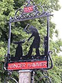 Abinger01LB.jpg 2,112 × 2,816; 2.27 MB
-
 American Battle Monuments Commission - geograph.org.uk - 2245879.jpg 1,024 × 768; 206 KB
-
 Betchworth Gospel Hall, Station Road, Betchworth (July 2013) (Signboard).JPG 2,200 × 1,800; 743 KB
-
 Bethel Baptist Church, Rushden Way, Upper Hale, Farnham (May 2015) (Sign).JPG 2,200 × 1,800; 607 KB
-
 Bethel Strict Baptist Chapel, Chapel Road, Tadworth (August 2013) (Signboard).JPG 1,600 × 2,000; 644 KB
-
 Board in The Old Town Hall - geograph.org.uk - 1306610.jpg 480 × 640; 90 KB
-
 Bourne Hall - geograph.org.uk - 3044290.jpg 4,288 × 3,216; 3.7 MB
-

-
 Brethren Meeting Room, Mint Gardens, Dorking (July 2013) (Sign).JPG 1,800 × 1,200; 503 KB
-
 Brethren Meeting Room, New Pond Road, Artington, near Guildford (April 2015) (1).JPG 4,608 × 3,456; 4.41 MB
-
 Brethren Meeting Room, Old Frensham Road, Lower Bourne, Farnham (May 2015) (Sign).JPG 2,400 × 1,800; 806 KB
-
 Brethren Meeting Room, Petworth Road, Wormley (June 2015) (Sign).JPG 3,400 × 3,000; 2.39 MB
-
 Brethren Meeting Room, Whitmore Way, Horley (June 2013) (Sign).jpg 1,400 × 1,000; 505 KB
-
-
 Bridleway leaves byway near Tilford - geograph.org.uk - 1352199.jpg 640 × 360; 82 KB
-
 Christmas Pie Sign.JPG 1,112 × 771; 125 KB
-

-
 Church of the Epiphany, Mansfield Drive, Merstham (June 2013) (Signboard).JPG 2,500 × 1,900; 904 KB
-
 Victorian Handyside VR Post Box, Cobham KT11 - Flickr - sludgegulper.jpg 2,133 × 1,600; 908 KB
-
 Direction Sign to Witley Gospel Hall, Little London, Witley (May 2014) (1).jpg 3,648 × 2,736; 2.21 MB
-
 Direction Sign to Witley Gospel Hall, Little London, Witley (May 2014) (2).jpg 2,736 × 3,648; 2.51 MB
-
 Dorking (Surrey), United Reformed Church - geograph.org.uk - 428731.jpg 640 × 480; 113 KB
-
 Dormansland Baptist Church, Dormans High Street, Dormansland (May 2013) (Sign).jpg 2,200 × 1,000; 868 KB
-
 DRMC Headley Court MOD 45153393.jpg 3,000 × 1,996; 1.27 MB
-
 Entrance to Shepperton Studios - geograph.org.uk - 42289.jpg 640 × 480; 109 KB
-
 Epsom and Ewell entrance sign.jpg 1,200 × 1,600; 584 KB
-
 Epsom and Walton Downs - geograph.org.uk - 2225548.jpg 2,560 × 1,920; 1.83 MB
-
 Estate Agents Signs, Ewell - geograph.org.uk - 4454428.jpg 640 × 480; 124 KB
-
 Farnham Park - geograph.org.uk - 3560996.jpg 640 × 430; 77 KB
-
 Fire Warning - geograph.org.uk - 315975.jpg 480 × 640; 32 KB
-

-
 Foot and Mouth 2007 - geograph.org.uk - 521716.jpg 640 × 480; 163 KB
-
 Foot and Mouth Precautions - geograph.org.uk - 547181.jpg 480 × 640; 106 KB
-
 Former Brethren Meeting Hall, West Street, Farnham (May 2015) (2).JPG 2,000 × 1,600; 559 KB
-
 Friends Meeting House, The Street, Capel (July 2013) (Signboard).JPG 2,400 × 1,800; 874 KB
-

-
 Grove Meeting Room, The Grove, Horley (June 2013) (Sign).JPG 1,600 × 1,000; 370 KB
-

-
 Haslemere Olympics 2012 sign.JPG 2,112 × 2,816; 2.97 MB
-
 Haslemere Town Well 06.jpg 3,000 × 4,000; 3.13 MB
-
 Haslemere Town Well DSCN0616.jpg 5,184 × 3,888; 8.39 MB
-
 Horsell Common - geograph.org.uk - 1921659.jpg 640 × 480; 306 KB
-
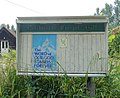
 Information board about Nonsuch Place in Nonsuch Park - geograph.org.uk - 3613690.jpg 4,000 × 3,000; 4.07 MB
-
 Information board, New Zealand Garden, Savill Garden - geograph.org.uk - 2348805.jpg 2,395 × 1,600; 1.29 MB
-

-
 Jubilee Woodland, Tadworth 01.jpg 4,000 × 3,000; 6.04 MB
-
 Kent Hatch Road enters Surrey - geograph.org.uk - 1755851.jpg 3,072 × 2,304; 2.85 MB
-
 Laleham Village - geograph.org.uk - 160014.jpg 640 × 480; 139 KB
-
 Lawn Maintenance Sign At RHS Wisley Garden Surrey UK.jpg 1,135 × 756; 682 KB
-
-
 Lock Keeper's Cottage, Triggs Lock - geograph.org.uk - 101689.jpg 640 × 554; 138 KB
-
 Looking Down Hawk's Hill - geograph.org.uk - 690426.jpg 640 × 480; 141 KB
-
-
 Lyne Farm - geograph.org.uk - 73320.jpg 640 × 480; 132 KB
-
 Mount Zion Chapel, Church Road, Leatherhead (July 2013) (Signboard).JPG 1,400 × 2,000; 869 KB
-
 Newlands Corner.jpg 790 × 528; 419 KB
-
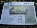
 Nonsuch Palace - geograph.org.uk - 3369952.jpg 2,560 × 1,920; 1.79 MB
-
 Nonsuch Park - Stoneleigh Entrance Pathway - geograph.org.uk - 3369949.jpg 2,560 × 1,920; 1.76 MB
-
 Notice in Farnham Park - geograph.org.uk - 3179651.jpg 800 × 600; 142 KB
-
 Noticeboard in Victoria Street - geograph.org.uk - 1362527.jpg 640 × 421; 62 KB
-
 Notices, Mogador - geograph.org.uk - 2310621.jpg 640 × 410; 90 KB
-
 Old sign on Chertsey Bridge - geograph.org.uk - 793870.jpg 640 × 427; 274 KB
-
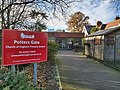 Potters Gate Primary School, Farnham.jpg 4,032 × 3,024; 4.37 MB
-
 RHS Wisley Garden Surrey 23.jpg 800 × 533; 62 KB
-
-
 Sign Outside Newsagents Chobham Village Surrey UK.jpg 759 × 1,134; 72 KB
-
 Sign, Reigate Hill Footbridge - geograph.org.uk - 3401017.jpg 424 × 640; 339 KB
-
 Signs in Well Lane - geograph.org.uk - 1101183.jpg 480 × 640; 98 KB
-
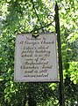
 St Andrew's Church, Brighton Road, Kingswood (August 2013) (Signboard).JPG 2,000 × 1,800; 688 KB
-
 St Catherine's Hill, Guildford 12.jpg 2,560 × 1,920; 2.1 MB
-
 St George's Church, Esher Park Avenue, Esher (June 2015) (Sign).JPG 3,400 × 4,600; 3.82 MB
-
 St Mary's Church, Church Road, Long Ditton (June 2015) (Noticeboard).JPG 3,800 × 3,400; 3.5 MB
-
 St Mary's Church, Long Ditton.Notice board.jpg 2,632 × 1,855; 1.14 MB
-
 St Michael's Chapel of Ease, Crabtree Lane, Westhumble (July 2013) (Signboard).JPG 2,400 × 1,800; 800 KB
-
 St Michael's Church, Church Street, Betchworth (July 2013) (Sign).jpg 1,800 × 1,200; 986 KB
-

-
 St Peter's Church, Beales Lane, Wrecclesham (May 2015) (Sign).jpg 2,200 × 1,800; 1.54 MB
-
 St Philip's Church, Nutley Lane, Reigate (June 2013) (Signboard).JPG 1,800 × 2,400; 819 KB
-

-
 Staines HighSt 44–48 SW.jpg 1,028 × 1,280; 591 KB
-
 Stanwell HighSt 20 fireplace.jpg 1,280 × 914; 658 KB
-
 Stanwell OaksRd 28 west.jpg 1,280 × 718; 657 KB
-
 Stanwell StDavid ChurchHall.jpg 1,280 × 719; 466 KB
-

-
 Surrey.jpg 1,175 × 795; 123 KB
-
 The First Keep - geograph.org.uk - 4149403.jpg 1,024 × 683; 109 KB
-
 The northern entrance to Nonsuch Park - geograph.org.uk - 2556337.jpg 3,872 × 2,592; 6.03 MB
-
 This Way to the Viewpoint - geograph.org.uk - 684190.jpg 480 × 640; 139 KB
-
 Tilford Rural Life Centre 41.JPG 2,112 × 2,816; 1.47 MB
-
 Tunmore Fields (notice of dedication) - geograph.org.uk - 1407936.jpg 640 × 427; 105 KB
-

-
 Village Sign, Bisley - geograph.org.uk - 1598008.jpg 480 × 640; 79 KB
-
 Welcome to Reigate Town Centre - geograph.org.uk - 2593335.jpg 425 × 640; 87 KB
-
 Welcome to the Bishop's Palace - geograph.org.uk - 4149735.jpg 1,024 × 683; 135 KB
-
 Westhall Road Brethren Meeting Room, Whyteleafe (Information Sign).JPG 1,200 × 800; 393 KB
-
 White Rose Lane Local Nature Reserve - geograph.org.uk - 1185018.jpg 640 × 480; 150 KB
-
 Former St Peter's Church, Potters Way, Woodhatch (June 2013).JPG 2,400 × 1,600; 1.1 MB
-
 Balcombe Road, Horley - geograph.org.uk - 201863.jpg 640 × 480; 87 KB
-

-
 Kneecappings or Armed Dwarves^ - geograph.org.uk - 291868.jpg 480 × 640; 111 KB
-
 Logmore Green Road End - geograph.org.uk - 589247.jpg 480 × 640; 164 KB
-
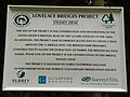 Lovelace Bridges Project - geograph.org.uk - 583267.jpg 640 × 480; 102 KB
-
 Notice at Pages Acre - geograph.org.uk - 584567.jpg 640 × 480; 118 KB
-

-
 Parish Council Noticeboard - geograph.org.uk - 225692.jpg 640 × 480; 152 KB
-

-


_(Signboard).JPG)
_(Sign).JPG)
_(Signboard).JPG)


_(Sign).JPG)
_(Sign).JPG)
_(1).JPG)
_(Sign).JPG)
_(Sign).JPG)
_(Sign).jpg)
_(Sign).JPG)


_(Signboard).JPG)
_(Signboard).JPG)

_(1).jpg)
_(2).jpg)
,_United_Reformed_Church_-_geograph.org.uk_-_428731.jpg)
_(Sign).jpg)


_(Demolition_and_Rebuild_Plans).JPG)


_(2).JPG)
_(Signboard).JPG)
,_Grove_Road,_Horley_(August_2016)_(Signboard).JPG)
_(Sign).JPG)


_(Signboard).JPG)

_(Signboard).JPG)


,_Frensham_(June_2015).JPG)


_(Signboard).JPG)

_(Sign).JPG)
_(Noticeboard).JPG)

_(Signboard).JPG)
_(Sign).jpg)
_(Signboard).JPG)
_(Sign).jpg)
_(Signboard).JPG)
_(Signboard).JPG)


,_Allingham_Road,_South_Park,_Reigate_(June_2013)_(Sign).JPG)


_-_geograph.org.uk_-_1407936.jpg)


.JPG)

.JPG)


