Category:Signs in Lincolnshire
Jump to navigation
Jump to search
Ceremonial counties of England: Bedfordshire · Berkshire · Buckinghamshire · Cambridgeshire · Cheshire · Cornwall · Cumbria · Derbyshire · Devon · Dorset · Durham · East Riding of Yorkshire · East Sussex · Essex · Gloucestershire · Greater London · Greater Manchester · Hampshire · Herefordshire · Hertfordshire · Kent · Lancashire · Leicestershire · Lincolnshire · Merseyside · Norfolk · North Yorkshire · Northamptonshire · Northumberland · Nottinghamshire · Oxfordshire · Rutland · Shropshire · Somerset · South Yorkshire · Staffordshire · Suffolk · Surrey · Tyne and Wear · Warwickshire · West Midlands · West Sussex · West Yorkshire · Wiltshire · Worcestershire
City-counties: Bristol · City of London
Former historic counties:
Other former counties:
City-counties: Bristol · City of London
Former historic counties:
Other former counties:
Subcategories
This category has the following 13 subcategories, out of 13 total.
- Church signs in Lincolnshire (31 F)
- Warning signs in Lincolnshire (17 F)
B
- Billboards in Lincolnshire (1 F)
F
- Farm signs in Lincolnshire (11 F)
G
L
P
R
S
- Signs in Scunthorpe (11 F)
V
Media in category "Signs in Lincolnshire"
The following 182 files are in this category, out of 182 total.
-

-
 'Mile'post 31km - geograph.org.uk - 418740.jpg 427 × 640; 169 KB
-
 A plaque showing the railway and a brief history of Woodhall Spa station..jpg 3,024 × 4,032; 4.06 MB
-
 Aby Church of England Primary School.jpg 800 × 533; 135 KB
-
 Another notice - geograph.org.uk - 4615456.jpg 2,736 × 1,824; 1.69 MB
-
 Approaching Baumber - geograph.org.uk - 1012740.jpg 542 × 401; 110 KB
-
-
 Awaiting Auction - geograph.org.uk - 580878.jpg 640 × 426; 164 KB
-
 Bridleways near Southrey - geograph.org.uk - 434041.jpg 640 × 480; 80 KB
-
 Barton beck sign.jpg 3,024 × 3,903; 6.26 MB
-
 Belton (Grantham) - The Old School 01.jpg 2,560 × 1,920; 2.61 MB
-
 Belton Forge - geograph.org.uk - 123004.jpg 600 × 450; 124 KB
-
 Bloodcurdling warnings - geograph.org.uk - 4615452.jpg 2,736 × 1,824; 2.2 MB
-

-
 Danger Deep Water - geograph.org.uk - 172161.jpg 640 × 480; 86 KB
-
 Boots closed for the Queen's funeral.jpg 1,600 × 1,200; 633 KB
-
 Border between North Lincolnshire and Lincolnshire in Kirmington.jpg 482 × 640; 147 KB
-
 Bottesford Junior School.jpg 3,264 × 4,928; 9.66 MB
-
 Bounre Police station, above the door-Geograph-2296144-by-Bob-Harvey.jpg 4,000 × 2,248; 2.3 MB
-
 Burton Stather eastern approach - geograph.org.uk - 517574.jpg 640 × 480; 107 KB
-
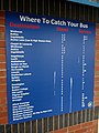 Bus Station, Skegness - geograph.org.uk - 2258938.jpg 480 × 640; 67 KB
-
 Caravans turn right - geograph.org.uk - 789840.jpg 640 × 475; 130 KB
-
 Cast Iron Milepost, A152.jpg 1,024 × 768; 253 KB
-
 Chapel Lane, North Scarle - geograph.org.uk - 183639.jpg 640 × 427; 90 KB
-
 Claydyke Bank - geograph.org.uk - 782182.jpg 640 × 427; 86 KB
-
 Cleethorpes high tide sign, Sea Road - DSC07333.JPG 3,648 × 2,736; 3.59 MB
-
 Cleethorpes seafront signs - DSC07344.JPG 2,736 × 3,648; 3.55 MB
-
 Closed for the Queen's funeral (geograph 7285643).jpg 3,072 × 4,080; 2.85 MB
-
 Conservation Walks sign - geograph.org.uk - 494357.jpg 640 × 480; 148 KB
-
 Dawsmere Road - geograph.org.uk - 75394.jpg 640 × 428; 60 KB
-
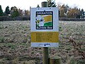 Operation Bumblebee - geograph.org.uk - 1129226.jpg 640 × 480; 108 KB
-
 County Boundary - geograph.org.uk - 191420.jpg 427 × 640; 112 KB
-
 Identity Tag - geograph.org.uk - 437085.jpg 640 × 480; 106 KB
-
 Laughton Forest Tuetoes Trail - geograph.org.uk - 65329.jpg 640 × 480; 153 KB
-
 HP Gas Pipeline Marker on Elsham Wolds - geograph.org.uk - 975387.jpg 640 × 584; 134 KB
-
 End of road - geograph.org.uk - 642789.jpg 640 × 480; 50 KB
-
 Engine peninsula-Guthram Gowt-geograph-1788354-by-Bob-Harvey.jpg 3,792 × 2,368; 1.56 MB
-
 Entering Owston Ferry - geograph.org.uk - 711611.jpg 640 × 480; 58 KB
-
 Entrance to Fen Farm - geograph.org.uk - 389664.jpg 640 × 427; 91 KB
-
 Public footpath sign at folly drain - geograph.org.uk - 494229.jpg 640 × 480; 94 KB
-
 Fire Hydrant, Westfield Park, Bourne-Geograph-2296182-by-Bob-Harvey.jpg 2,248 × 4,000; 5.96 MB
-
 Footpath to Winteringham - geograph.org.uk - 10816.jpg 640 × 480; 74 KB
-
 Former Town Hall, Horncastle - geograph.org.uk - 1409781.jpg 640 × 480; 82 KB
-
 Fox's Fold, Barton upon Humber - geograph.org.uk - 1526258.jpg 640 × 480; 99 KB
-
 Full English Breakfast - geograph.org.uk - 292996.jpg 640 × 480; 115 KB
-
 Fulney Lock, Spalding - geograph.org.uk - 188923.jpg 640 × 427; 114 KB
-
 Gate to Thurlby Slipe Nature Reserve - geograph.org.uk - 587841.jpg 640 × 427; 125 KB
-
 Gautby junction - geograph.org.uk - 520407.jpg 640 × 427; 80 KB
-
 Gipsey Bridge - geograph.org.uk - 463259.jpg 640 × 480; 86 KB
-
 Gorse Hill Lane fingerpost - geograph.org.uk - 331812.jpg 427 × 640; 78 KB
-
 Footbridge - geograph.org.uk - 285609.jpg 640 × 405; 152 KB
-
 Goxhill Airfield Entrance - geograph.org.uk - 57562.jpg 640 × 480; 102 KB
-
 Goxhill Haven Outfall - geograph.org.uk - 542213.jpg 640 × 480; 113 KB
-
 Goxhill Haven Outfall - geograph.org.uk - 557767.jpg 615 × 640; 116 KB
-
 Goxhill Haven Outfall - Landward Side - geograph.org.uk - 541462.jpg 480 × 640; 148 KB
-
 Goxhill Haven Outfall - Landward Side - geograph.org.uk - 665620.jpg 478 × 640; 106 KB
-
 Halifax closed for the Queen's funeral.jpg 1,200 × 1,800; 610 KB
-
 Heighington Post Office Sign - geograph.org.uk - 515585.jpg 640 × 281; 53 KB
-
 Entering Horkstow - geograph.org.uk - 1739655.jpg 1,000 × 642; 646 KB
-
 Looking towards South Ferriby - geograph.org.uk - 667353.jpg 480 × 640; 96 KB
-
 Rustic Signpost near Horkstow - geograph.org.uk - 1806387.jpg 758 × 1,000; 726 KB
-
 The Viking Way towards Turton's Covert - geograph.org.uk - 1356503.jpg 600 × 576; 430 KB
-
 Howe Lane Level Crossing, Goxhill - geograph.org.uk - 564332.jpg 640 × 480; 103 KB
-
 Humber Bridge Industrial Estate - geograph.org.uk - 62884.jpg 640 × 480; 103 KB
-
 In case you missed the other signs - geograph.org.uk - 1249506.jpg 640 × 480; 87 KB
-
 The Footpath to Nuncoatham Priory - geograph.org.uk - 572743.jpg 640 × 426; 145 KB
-
 Keep off the grass - geograph.org.uk - 392002.jpg 640 × 480; 272 KB
-
 Kingdom Hall Stamford - geograph.org.uk - 350785.jpg 640 × 480; 123 KB
-

-
 Leadenham House Sign - geograph.org.uk - 390383.jpg 480 × 640; 136 KB
-
 Level crossing at Holton Fish Pond - geograph.org.uk - 5714636.jpg 1,600 × 1,065; 536 KB
-
 Lincolnshire.jpg 1,181 × 797; 97 KB
-
 Macmillan Way sign - geograph.org.uk - 429870.jpg 477 × 640; 94 KB
-
 Mavis Enderby, I Love You^ - geograph.org.uk - 453544.jpg 640 × 426; 54 KB
-
 Mill signs - geograph.org.uk - 950897.jpg 640 × 480; 79 KB
-
 Sold Out^ - geograph.org.uk - 669764.jpg 640 × 480; 89 KB
-
 Navigation Wharf - geograph.org.uk - 390472.jpg 640 × 480; 114 KB
-
 Near Horkstow - geograph.org.uk - 1594304.jpg 640 × 640; 412 KB
-
 Keep Shut - geograph.org.uk - 753345.jpg 640 × 480; 109 KB
-
 New Lidl, Barton upon Humber (geograph 6201668).jpg 1,600 × 1,200; 2.24 MB
-
 North Lincolnshire sign.jpg 3,024 × 4,032; 3.47 MB
-
 On the flood bank at Wragg Marsh - geograph.org.uk - 184152.jpg 640 × 480; 126 KB
-
 Osgodby from the north - geograph.org.uk - 1059868.jpg 640 × 527; 127 KB
-
 Outskirts of Welton - geograph.org.uk - 215223.jpg 640 × 480; 111 KB
-
 Owersby Bridge (geograph 3505947).jpg 640 × 427; 127 KB
-

-
 Permissive footpath by the River Slea - geograph.org.uk - 782035.jpg 640 × 480; 118 KB
-
 Precise Directions - geograph.org.uk - 464517.jpg 640 × 480; 115 KB
-
 Prohibited anchorage - geograph.org.uk - 711636.jpg 640 × 480; 55 KB
-
 Public Bridleway to Ingoldsby Wood - geograph.org.uk - 405467.jpg 640 × 427; 123 KB
-
 Road Liable to Flooding - geograph.org.uk - 1421338.jpg 640 × 425; 79 KB
-
 Route 1 - geograph.org.uk - 742473.jpg 640 × 427; 70 KB
-
 Route of Walk - geograph.org.uk - 424627.jpg 480 × 640; 72 KB
-
 Santon Road Warning sign - geograph.org.uk - 1283484.jpg 640 × 480; 71 KB
-
 Anglian Water Reservoir - geograph.org.uk - 410146.jpg 640 × 480; 141 KB
-
 Show me the way to Windy Bottom - geograph.org.uk - 1259135.jpg 640 × 480; 106 KB
-
 Sign for Haxey Turbary Nature Reserve - geograph.org.uk - 494306.jpg 640 × 480; 139 KB
-

-
 Sign on Newark Road, North Hykeham, Lincolnshire, England - DSCF1452.JPG 4,000 × 3,000; 2.83 MB
-
 Sign posts at Denton Bridge - geograph.org.uk - 30124.jpg 640 × 480; 181 KB
-
 Signpost near North Kelsey Moor - geograph.org.uk - 310802.jpg 640 × 549; 187 KB
-
 Signpost to Saxby - geograph.org.uk - 536714.jpg 395 × 640; 80 KB
-
 Skellingthorpe - geograph.org.uk - 55295.jpg 640 × 480; 109 KB
-
 Notice at the end of the Public Footpath - geograph.org.uk - 865334.jpg 640 × 586; 476 KB
-
 Notice on Marsh Lane - geograph.org.uk - 864531.jpg 480 × 640; 367 KB
-
 Spa Trail - geograph.org.uk - 464449.jpg 640 × 480; 107 KB
-
 Spelling Mistake - geograph.org.uk - 165114.jpg 640 × 427; 73 KB
-
 St Martins Church Graveyard Stamford.jpg 3,975 × 2,650; 7.65 MB
-
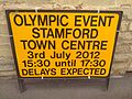 Stamford Olympic Event.jpg 2,048 × 1,536; 969 KB
-
 Stile in Hedge - geograph.org.uk - 429578.jpg 480 × 640; 92 KB
-
 Stop Valve sign and cover Geograph-2296717-by-Bob-Harvey.jpg 2,248 × 4,000; 3.42 MB
-
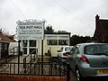 Tea Pot Hall, Bottesford.jpg 800 × 600; 240 KB
-
 The Line to Goxhill - geograph.org.uk - 694321.jpg 425 × 640; 86 KB
-
 The Line to Ulceby - geograph.org.uk - 694323.jpg 640 × 425; 103 KB
-
 The Signpost at Spot Height 98m - geograph.org.uk - 1395705.jpg 480 × 640; 111 KB
-
 The Square, Little Ponton (geograph 2078833).jpg 640 × 480; 122 KB
-
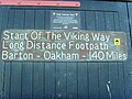 The Viking Way.jpg 3,072 × 2,304; 3.33 MB
-
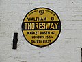 Thoresway AA Sign - geograph.org.uk - 1107046.jpg 640 × 480; 66 KB
-
 To Boston 6 - geograph.org.uk - 1186365.jpg 640 × 480; 106 KB
-
 Toothless wonder - geograph.org.uk - 1279672.jpg 640 × 480; 122 KB
-
 Torksey Lock from the Trent - geograph.org.uk - 209072.jpg 640 × 427; 46 KB
-
 UK Deeping St James.jpg 751 × 865; 136 KB
-
 UK SuttonBridge.jpg 1,200 × 1,363; 313 KB
-
 UK University of Lincoln logosign.jpg 2,048 × 1,360; 1.31 MB
-
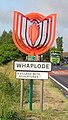
 UK Whaplode (Star).jpg 757 × 1,393; 193 KB
-
 UK Whaplode (Tulip).jpg 403 × 713; 69 KB
-

-
 Viking Way long distance footpath - geograph.org.uk - 301705.jpg 640 × 480; 113 KB
-
 Viking Way near Far Ings - geograph.org.uk - 1412019.jpg 640 × 425; 95 KB
-
 Wash Cows - geograph.org.uk - 602351.jpg 640 × 480; 81 KB
-
 Wasps Nest - geograph.org.uk - 521216.jpg 640 × 480; 76 KB
-
 Waterboard signposts - geograph.org.uk - 418669.jpg 640 × 480; 116 KB
-
 Welcome to Bottesford Infant School.jpg 4,928 × 3,264; 8.52 MB
-
 Welcome to Bottesford.jpg 3,264 × 4,928; 11.97 MB
-
 Welcome to Crowland - geograph.org.uk - 364523.jpg 640 × 427; 72 KB
-
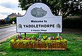 Welcome to Yaddlethorpe.jpg 4,701 × 3,264; 12.24 MB
-
 Well signed - geograph.org.uk - 375229.jpg 640 × 454; 75 KB
-
 When the Red Flag Flies.. - geograph.org.uk - 476361.jpg 640 × 480; 144 KB
-
 Which way now^ - geograph.org.uk - 255276.jpg 533 × 640; 122 KB
-
 Witham Bank East, Boston - geograph.org.uk - 777592.jpg 640 × 480; 66 KB
-
 Wolds Signpost - geograph.org.uk - 150502.jpg 640 × 426; 110 KB
-
 The A1077 at Wootton - geograph.org.uk - 1378442.jpg 640 × 389; 79 KB
-
 Weir Dyke Bridge - geograph.org.uk - 345012.jpg 640 × 360; 125 KB
-
 Protected Roadside Verge sign - geograph.org.uk - 1000014.jpg 390 × 640; 115 KB
-
 A15 passes Waddington airfield - geograph.org.uk - 419932.jpg 640 × 480; 133 KB
-
 Beware of the Ducks - geograph.org.uk - 693477.jpg 640 × 412; 99 KB
-
 Blending In - geograph.org.uk - 463085.jpg 640 × 480; 114 KB
-
 Bourne West Sub-station sign - geograph.org.uk - 399640.jpg 640 × 480; 58 KB
-
 Brackenborough Information - geograph.org.uk - 457516.jpg 640 × 409; 96 KB
-
 Confusing Sign^ - geograph.org.uk - 501039.jpg 640 × 480; 103 KB
-
 Eastern entrance to East Ferry - geograph.org.uk - 65343.jpg 640 × 480; 86 KB
-
 Farmland near Stoke Rochford - geograph.org.uk - 69376.jpg 640 × 480; 117 KB
-
 Fishing from this side only - geograph.org.uk - 589849.jpg 640 × 427; 74 KB
-
 Follow the Path - geograph.org.uk - 491955.jpg 640 × 480; 98 KB
-
 Footpath from Sleaford meets B1209 - geograph.org.uk - 360360.jpg 640 × 480; 148 KB
-
 Hameringham, On the Edge of the Wolds - geograph.org.uk - 453507.jpg 640 × 480; 96 KB
-
 Hards Lane sign - geograph.org.uk - 588017.jpg 640 × 480; 133 KB
-

-
 Keep to the Path - geograph.org.uk - 468104.jpg 640 × 480; 91 KB
-
 Military range sign - geograph.org.uk - 389979.jpg 480 × 640; 57 KB
-
 No Information - geograph.org.uk - 464397.jpg 640 × 480; 97 KB
-
 North Somercotes - geograph.org.uk - 444617.jpg 640 × 427; 80 KB
-
 Old railway signs - geograph.org.uk - 454686.jpg 640 × 480; 117 KB
-
 Parting of ways on the Lincolnshire Wolds - geograph.org.uk - 148273.jpg 640 × 427; 119 KB
-
 Penalty for not closing gate... - geograph.org.uk - 438591.jpg 640 × 480; 101 KB
-
 Permissive footpath sign - geograph.org.uk - 390797.jpg 640 × 480; 68 KB
-
 Plate on triangulation pillar - geograph.org.uk - 542019.jpg 599 × 640; 122 KB
-
 Prospect Street Play Area, Horncastle - geograph.org.uk - 619929.jpg 640 × 480; 90 KB
-

-
 Sand Syke Pumping Station - geograph.org.uk - 219519.jpg 640 × 480; 87 KB
-
 Sign - geograph.org.uk - 90659.jpg 640 × 480; 73 KB
-
 Sign at Lavington Lake - geograph.org.uk - 329791.jpg 640 × 427; 97 KB
-
 Sign at the end of Stonepit Lane - geograph.org.uk - 215713.jpg 480 × 640; 128 KB
-
 Sign on Clay Lane - geograph.org.uk - 439657.jpg 640 × 545; 97 KB
-
 Sign. - geograph.org.uk - 165912.jpg 640 × 480; 170 KB
-
 Stapleford House - geograph.org.uk - 439483.jpg 640 × 479; 106 KB
-
 Start of footpath from B1188 - geograph.org.uk - 420143.jpg 480 × 640; 121 KB
-
 T Junction - geograph.org.uk - 29012.jpg 640 × 481; 140 KB
-
 The Footpath Starts Here - geograph.org.uk - 548714.jpg 640 × 480; 146 KB
-

-
 Welcome to Swarby - geograph.org.uk - 373657.jpg 640 × 451; 93 KB
-
 Welton Hill - geograph.org.uk - 421347.jpg 640 × 427; 47 KB


_-_The_Old_School_01.jpg)


.jpg)


.jpg)


.jpg)


.jpg)


.jpg)
.jpg)


_-_geograph.org.uk_-_443642.jpg)


