Category:Signs in Shropshire
Jump to navigation
Jump to search
Ceremonial counties of England: Bedfordshire · Berkshire · Buckinghamshire · Cambridgeshire · Cheshire · Cornwall · Cumbria · Derbyshire · Devon · Dorset · Durham · East Riding of Yorkshire · East Sussex · Essex · Gloucestershire · Greater London · Greater Manchester · Hampshire · Herefordshire · Hertfordshire · Kent · Lancashire · Leicestershire · Lincolnshire · Merseyside · Norfolk · North Yorkshire · Northamptonshire · Northumberland · Nottinghamshire · Oxfordshire · Rutland · Shropshire · Somerset · South Yorkshire · Staffordshire · Suffolk · Surrey · Tyne and Wear · Warwickshire · West Midlands · West Sussex · West Yorkshire · Wiltshire · Worcestershire
City-counties: Bristol · City of London
Former historic counties:
Other former counties:
City-counties: Bristol · City of London
Former historic counties:
Other former counties:
Subcategories
This category has the following 13 subcategories, out of 13 total.
Media in category "Signs in Shropshire"
The following 95 files are in this category, out of 95 total.
-
 "Welcome to Severn Valley Country Park" - geograph.org.uk - 682322.jpg 480 × 640; 101 KB
-
 "Which way now" near the Tar Tunnel - geograph.org.uk - 1456715.jpg 640 × 480; 132 KB
-
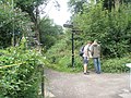
 'Start' of The Jack Mytton Way - geograph.org.uk - 1111137.jpg 640 × 480; 145 KB
-
 A 'Silkin Way' signpost - geograph.org.uk - 1182978.jpg 480 × 640; 129 KB
-

-
 Another part of RAF Shawbury - geograph.org.uk - 658196.jpg 640 × 480; 95 KB
-
 Aston Middle Lock - geograph.org.uk - 1002135.jpg 640 × 428; 121 KB
-
 At the entrance to Kingsley Farm - geograph.org.uk - 761494.jpg 640 × 480; 79 KB
-
 Attractive sign. - geograph.org.uk - 537413.jpg 427 × 640; 128 KB
-
 Bridge 72, Shropshire Union canal - geograph.org.uk - 1211168.jpg 457 × 640; 167 KB
-
 Bromlow vicinity - geograph.org.uk - 537889.jpg 640 × 480; 91 KB
-
 Catstree Cross Roads - geograph.org.uk - 440959.jpg 480 × 640; 98 KB
-
 Clee Liberty Common signboard - geograph.org.uk - 659812.jpg 480 × 640; 89 KB
-
 Coalbrookdale Station information - geograph.org.uk - 1386931.jpg 640 × 427; 79 KB
-
 Danger no bathing sign - geograph.org.uk - 783816.jpg 640 × 480; 114 KB
-
 Detail on the chemist's shop - geograph.org.uk - 1408796.jpg 455 × 640; 112 KB
-
 Disappearing Countryside - geograph.org.uk - 533383.jpg 427 × 640; 171 KB
-

-
 Entering Bucknell - geograph.org.uk - 655098.jpg 640 × 465; 47 KB
-
 Entering Chapel Lawn - geograph.org.uk - 654676.jpg 640 × 462; 67 KB
-
 Entering Hopton Castle from the south - geograph.org.uk - 655292.jpg 640 × 440; 40 KB
-
 Entering Moreton - geograph.org.uk - 697261.jpg 640 × 480; 114 KB
-
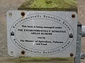 Environmentaly Sensitive Area - geograph.org.uk - 443514.jpg 640 × 480; 80 KB
-
 Fenemere signpost - geograph.org.uk - 567060.jpg 480 × 640; 110 KB
-
 Frankton Junction - geograph.org.uk - 1001909.jpg 428 × 640; 89 KB
-
 Harley fingerpost - geograph.org.uk - 740910.jpg 640 × 480; 81 KB
-
 Home-made road sign, Exfords Green - geograph.org.uk - 628792.jpg 640 × 480; 107 KB
-

-
 Irresistible^ A sign by the river. - geograph.org.uk - 695626.jpg 500 × 375; 98 KB
-
 Jack Mytton Way signpost - geograph.org.uk - 702326.jpg 452 × 640; 79 KB
-

-
 Local notices - geograph.org.uk - 671964.jpg 640 × 480; 99 KB
-

-
 Montgomery Canal at Frankton Junction - geograph.org.uk - 551956.jpg 640 × 480; 68 KB
-
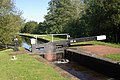
 Montgomery Canal, Frankton Locks - geograph.org.uk - 130746.jpg 640 × 429; 83 KB
-
 More MOD property - geograph.org.uk - 758374.jpg 640 × 480; 75 KB
-
 No carp sacks - geograph.org.uk - 429938.jpg 640 × 480; 93 KB
-
 No mistaking where you are. - geograph.org.uk - 714780.jpg 640 × 480; 113 KB
-
 Notice board at the Yield Gate - geograph.org.uk - 628908.jpg 640 × 480; 82 KB
-
 Oh well, I'll go another way - geograph.org.uk - 760080.jpg 640 × 480; 58 KB
-
 Pipeline marker post - geograph.org.uk - 769320.jpg 640 × 480; 85 KB
-
 Plain English^^ - geograph.org.uk - 488538.jpg 640 × 480; 193 KB
-
 Private access - no kidding^ - geograph.org.uk - 758341.jpg 640 × 480; 73 KB
-
 Road sign near Leebotwood. - geograph.org.uk - 869160.jpg 427 × 640; 81 KB
-
 School Lane Longden - geograph.org.uk - 419656.jpg 600 × 640; 96 KB
-
 Shawbury Airfield - geograph.org.uk - 608209.jpg 640 × 480; 84 KB
-
 Shropshire.jpg 1,177 × 796; 208 KB
-
 Sign at lane junction - geograph.org.uk - 725013.jpg 640 × 480; 139 KB
-
 Sign at Rudgewood - geograph.org.uk - 760060.jpg 640 × 480; 51 KB
-

-
 Sign of the times - geograph.org.uk - 574832.jpg 640 × 480; 76 KB
-
 Sign on Middleton Lane - geograph.org.uk - 204062.jpg 640 × 480; 132 KB
-
 Sign on the Monarch's Way - geograph.org.uk - 748091.jpg 640 × 480; 117 KB
-

-
 Signpost at Atchley - geograph.org.uk - 392542.jpg 640 × 480; 167 KB
-
 Signpost at Cantlop (Dec' 2007) - geograph.org.uk - 626983.jpg 640 × 480; 74 KB
-
 Signpost at Longden (view southwards) - geograph.org.uk - 419652.jpg 481 × 640; 93 KB
-
 Signpost at Plealey - geograph.org.uk - 419731.jpg 600 × 600; 96 KB
-
 Signpost for the Shropshire way - geograph.org.uk - 347835.jpg 480 × 640; 161 KB
-

-
 Signpost in Longden - geograph.org.uk - 419650.jpg 600 × 600; 96 KB
-
 Signpost to Garmston. - geograph.org.uk - 711878.jpg 640 × 480; 37 KB
-
 Signpost to Morrals Wood - geograph.org.uk - 491800.jpg 640 × 480; 118 KB
-
 Signpost, Red Lake - geograph.org.uk - 1126509.jpg 640 × 480; 145 KB
-

-
 Stay safe kids - geograph.org.uk - 2547576.jpg 640 × 480; 127 KB
-
 Stile on the Severn Way - geograph.org.uk - 741247.jpg 640 × 480; 71 KB
-
 Stoneacton - geograph.org.uk - 422356.jpg 640 × 480; 48 KB
-
 Take Notice - geograph.org.uk - 690526.jpg 403 × 640; 68 KB
-
 The Heart of Wales Line at Knighton - geograph.org.uk - 6226023.jpg 6,000 × 4,000; 3.1 MB
-
 The sign for The Talbot public house - geograph.org.uk - 1232343.jpg 420 × 640; 56 KB
-
 The sign says it all - geograph.org.uk - 706879.jpg 640 × 480; 65 KB
-
 This way to Acksea Farm - geograph.org.uk - 758365.jpg 640 × 480; 106 KB
-
 This way to Dinthill Cottage - geograph.org.uk - 758452.jpg 640 × 480; 65 KB
-
 This way to Greenhurst Farm - geograph.org.uk - 754380.jpg 640 × 480; 85 KB
-
 Little Nell's grave in St Bartholomew's churchyard, Tong, Shropshire.jpg 1,200 × 1,800; 1.98 MB
-
 Waymarked footbridge - geograph.org.uk - 748966.jpg 640 × 480; 126 KB
-
 Caution, uneven steps - geograph.org.uk - 1498749.jpg 480 × 640; 131 KB
-
 Down to the towpath - geograph.org.uk - 1003643.jpg 428 × 640; 44 KB
-

-
 Boycott Hall sign - geograph.org.uk - 207301.jpg 460 × 345; 77 KB
-

-
 English Frankton - geograph.org.uk - 226745.jpg 640 × 426; 112 KB
-
 Highlanders - geograph.org.uk - 221246.jpg 480 × 640; 75 KB
-

-
 Moreton Corbett signpost - geograph.org.uk - 100117.jpg 640 × 435; 143 KB
-
 Outskirts of Child's Ercall - geograph.org.uk - 227785.jpg 640 × 480; 101 KB
-
 Road sign at Cwm Collo - geograph.org.uk - 705732.jpg 640 × 480; 149 KB
-
 Showing the Way - geograph.org.uk - 287145.jpg 480 × 640; 131 KB
-
 Shropshire Way - geograph.org.uk - 157620.jpg 640 × 428; 150 KB
-
 Sign for footpath to Craig Llwyn - geograph.org.uk - 559753.jpg 640 × 480; 85 KB
-
 Signpost at Arscott - geograph.org.uk - 207305.jpg 460 × 345; 100 KB
-
 Teme Valley pastimes - geograph.org.uk - 227976.jpg 640 × 480; 103 KB
-
 The Rising Price Of Fuel - geograph.org.uk - 226151.jpg 480 × 640; 92 KB
-
 Tong Millennium - geograph.org.uk - 376184.jpg 600 × 450; 222 KB


_-_geograph.org.uk_-_626983.jpg)
_-_geograph.org.uk_-_419652.jpg)


_-_Notice_on_gate_to_unexcavated_area_-_geograph.org.uk_-_1935751.jpg)


