Category:Signs in Northumberland
Jump to navigation
Jump to search
Ceremonial counties of England: Bedfordshire · Berkshire · Buckinghamshire · Cambridgeshire · Cheshire · Cornwall · Cumbria · Derbyshire · Devon · Dorset · Durham · East Riding of Yorkshire · East Sussex · Essex · Gloucestershire · Greater London · Greater Manchester · Hampshire · Herefordshire · Hertfordshire · Kent · Lancashire · Leicestershire · Lincolnshire · Merseyside · Norfolk · North Yorkshire · Northamptonshire · Northumberland · Nottinghamshire · Oxfordshire · Rutland · Shropshire · Somerset · South Yorkshire · Staffordshire · Suffolk · Surrey · Tyne and Wear · Warwickshire · West Midlands · West Sussex · West Yorkshire · Wiltshire · Worcestershire
City-counties: Bristol · City of London
Former historic counties:
Other former counties:
City-counties: Bristol · City of London
Former historic counties:
Other former counties:
Subcategories
This category has the following 8 subcategories, out of 8 total.
Media in category "Signs in Northumberland"
The following 64 files are in this category, out of 64 total.
-
 0 The Alnwick Garden.jpg 2,816 × 2,435; 5.27 MB
-

-
 A sign at Goswick Links - geograph.org.uk - 1511843.jpg 640 × 420; 135 KB
-
 Bee sign - geograph.org.uk - 438513.jpg 480 × 640; 111 KB
-
 Berwick-upon-Tweed - geograph.org.uk - 300618.jpg 492 × 640; 65 KB
-
 Beware of the bull - too late^ - geograph.org.uk - 672475.jpg 640 × 480; 77 KB
-
 Beware of trains - geograph.org.uk - 609145.jpg 480 × 640; 110 KB
-
 Border Road Sign - geograph.org.uk - 2026667.jpg 1,024 × 681; 245 KB
-
 Castle Shuttle Sign - geograph.org.uk - 575283.jpg 640 × 480; 70 KB
-
 Day of the Triffids^ - geograph.org.uk - 725776.jpg 640 × 427; 139 KB
-

-
 H - geograph.org.uk - 1110554 (cropped).jpg 381 × 508; 36 KB
-
 H - geograph.org.uk - 1110554.jpg 480 × 640; 57 KB
-
 Holy Island - tidal warning sign - geograph.org.uk - 741637.jpg 640 × 480; 91 KB
-
 How many signs does it take^ - geograph.org.uk - 589782.jpg 640 × 480; 130 KB
-
 Kielder - Water and Forest Park - geograph.org.uk - 770190.jpg 640 × 423; 100 KB
-
 Lindisfarne Heritage Centre sign - geograph.org.uk - 741632.jpg 640 × 480; 93 KB
-
 Lord Crewe Arms, Blanchland. - geograph.org.uk - 132475.jpg 640 × 436; 151 KB
-
 Military Sign - geograph.org.uk - 528402.jpg 640 × 364; 129 KB
-
 Northumberland County.jpg 1,175 × 795; 132 KB
-
 Old trenches by the Bushman's Road - geograph.org.uk - 655820.jpg 640 × 480; 64 KB
-

-
 Sad notice at Walwick - geograph.org.uk - 1018621.jpg 640 × 480; 70 KB
-
 Services at Milkhope Centre - geograph.org.uk - 1581885.jpg 640 × 426; 129 KB
-
 Shop opening hours.jpg 1,496 × 2,256; 1.39 MB
-
 Shut the gate^ - geograph.org.uk - 609168.jpg 640 × 480; 83 KB
-
 Sign for Spartylea Methodist Chapel - geograph.org.uk - 3103220.jpg 640 × 480; 86 KB
-
 Signs on Twizel Viaduct - geograph.org.uk - 1205634.jpg 427 × 640; 117 KB
-
 St Cuthbert's Way - geograph.org.uk - 1438665.jpg 640 × 480; 102 KB
-
 Understated signpost - geograph.org.uk - 527808.jpg 640 × 480; 95 KB
-
 Warning sign - geograph.org.uk - 735349.jpg 640 × 427; 85 KB
-
 Warning sign - geograph.org.uk - 735365.jpg 640 × 427; 37 KB
-
 Warning sign - geograph.org.uk - 993736.jpg 480 × 640; 112 KB
-
 Welcome to Vindobala - geograph.org.uk - 2893688.jpg 800 × 600; 204 KB
-
 West Ditchburn farm sign - geograph.org.uk - 1123016.jpg 640 × 480; 74 KB
-
 A level crossing sign at Spittal - geograph.org.uk - 1508331.jpg 423 × 640; 133 KB
-
 A sign and lifebelt at Spittal Beach - geograph.org.uk - 1508346.jpg 640 × 427; 124 KB
-
 A sign at Borewell Farm - geograph.org.uk - 1508292.jpg 427 × 640; 128 KB
-
 Alwinton - geograph.org.uk - 780900.jpg 640 × 480; 102 KB
-
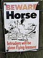 Anyone for flying lessons^ - geograph.org.uk - 1511867.jpg 481 × 640; 141 KB
-
 Approaching Matfen - geograph.org.uk - 271476.jpg 640 × 480; 101 KB
-
 Beware of flying golf balls - geograph.org.uk - 1511794.jpg 640 × 438; 119 KB
-
 Bull warning sign - geograph.org.uk - 749125.jpg 640 × 480; 76 KB
-
 Carved stone name sign for Coldtown - geograph.org.uk - 396796.jpg 640 × 480; 113 KB
-
 Decorative Sign - geograph.org.uk - 703923.jpg 640 × 480; 58 KB
-
 Dickies Den carpark - geograph.org.uk - 644653.jpg 480 × 640; 87 KB
-
 Don't even walk here - geograph.org.uk - 634941.jpg 640 × 480; 48 KB
-
 Eggs for Sale, Newham - geograph.org.uk - 428231.jpg 640 × 427; 79 KB
-

-
 Entrance to Scotch Coulthard - geograph.org.uk - 244666.jpg 640 × 480; 78 KB
-
 For Sale - geograph.org.uk - 507835.jpg 369 × 640; 67 KB
-
 Forest Signs - geograph.org.uk - 752362.jpg 640 × 411; 141 KB
-
 Harvesting Site - geograph.org.uk - 537222.jpg 640 × 427; 104 KB
-
 Kidland Forest - geograph.org.uk - 775842.jpg 640 × 480; 92 KB
-
 Leighton Hill - geograph.org.uk - 656782.jpg 427 × 640; 114 KB
-
 North Eastern Railway. Public Warning. - geograph.org.uk - 601746.jpg 480 × 640; 183 KB
-
 Notice on gate, Leazes Lane - geograph.org.uk - 630417.jpg 640 × 480; 145 KB
-

-
 Planning notice - geograph.org.uk - 705226.jpg 480 × 640; 50 KB
-
 Robinson Memorial Cairn - geograph.org.uk - 528493.jpg 640 × 480; 110 KB
-
 Save the Mole^ - geograph.org.uk - 154242.jpg 640 × 480; 152 KB
-
 Signpost on Salters Road, Usway Forest - geograph.org.uk - 529270.jpg 640 × 480; 121 KB
-
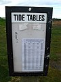 Tide Tables - geograph.org.uk - 411037.jpg 480 × 640; 75 KB
-
 Warning - geograph.org.uk - 411034.jpg 480 × 640; 93 KB


_-_geograph.org.uk_-_589765.jpg)
.jpg)


