Category:SVG maps of the history of Russia
Jump to navigation
Jump to search
Subcategories
This category has the following 2 subcategories, out of 2 total.
R
S
Media in category "SVG maps of the history of Russia"
The following 59 files are in this category, out of 59 total.
-
Teutonic Order 1466-es.svg 1,210 × 1,053; 1.79 MB
-
Astrakhan Khanate map cs.svg 744 × 1,052; 40 KB
-
Astrakhan Khanate map es.svg 744 × 1,052; 33 KB
-
Astrakhan Khanate map uz.svg 829 × 1,174; 1.06 MB
-
Astrakhan Khanate map.svg 744 × 1,052; 40 KB
-
Avar Khanate map.svg 446 × 456; 694 KB
-
Bolshoy Ussuriysky and Tarabarov AZ.svg 2,453 × 1,280; 487 KB
-
Bolshoy Ussuriysky and Tarabarov EN.svg 2,453 × 1,280; 487 KB
-
Bolshoy Ussuriysky and Tarabarov MK.svg 2,453 × 1,280; 396 KB
-
Bolshoy Ussuriysky and Tarabarov RU.svg 2,453 × 1,280; 428 KB
-
Caucasus Emirate.svg 875 × 680; 316 KB
-
Didzioji orda.svg 830 × 677; 40 KB
-
East Prussian Campaign (17—23 Aug 1914) - ru.svg 2,591 × 1,671; 1.8 MB
-
East Prussian Campaign (23—26 Aug 1914) - ru.svg 2,591 × 1,671; 1.79 MB
-
East Prussian Campaign (27—30 Aug 1914) - es.svg 2,591 × 1,671; 1.71 MB
-
East Prussian Campaign (27—30 Aug 1914) - ru.svg 2,591 × 1,671; 1.7 MB
-
Expansion territoriale de la Russie.svg 2,074 × 1,612; 948 KB
-
Expansión territorial de Rusia.svg 1,944 × 1,511; 948 KB
-
Golden Horde 1389 sr.svg 962 × 684; 155 KB
-
Golden Horde 1389-ar.svg 962 × 684; 148 KB
-
Golden Horde 1389-es.svg 962 × 684; 148 KB
-
Golden Horde 1389-HE.svg 962 × 684; 155 KB
-
Golden Horde 1389-ru.svg 960 × 684; 66 KB
-
Golden Horde 1389-tr.svg 962 × 684; 149 KB
-
Golden Horde 1389.svg 962 × 684; 146 KB
-
Grand Duchy of Lithuania 1462 within modern boundaries-en.svg 1,152 × 1,028; 792 KB
-
Great Horde.svg 830 × 677; 40 KB
-
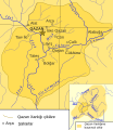
Kazan Khanate map Tatar.svg 800 × 920; 150 KB
-
Kievan Rus in 1237 (PL).svg 1,200 × 1,302; 235 KB
-
Kievan-rus-1015-1113-(hu).svg 2,166 × 2,659; 608 KB
-
Map Battle of Stalingrad he.svg 1,701 × 2,080; 525 KB
-
Map Battle of Stalingrad-ar.svg 1,699 × 1,806; 979 KB
-
Map Battle of Stalingrad-en.svg 1,699 × 1,806; 597 KB
-
Map Battle of Stalingrad-es.svg 1,686 × 1,797; 387 KB
-
Map Battle of Stalingrad-fr.svg 1,699 × 1,806; 168 KB
-
Map Battle of Stalingrad-hr.svg 1,697 × 1,824; 58 KB
-
Map Battle of Stalingrad-hu.svg 512 × 545; 66 KB
-
Map Battle of Stalingrad-it.svg 1,700 × 1,810; 137 KB
-
Map Battle of Stalingrad-lt.svg 1,752 × 1,851; 92 KB
-
Map Battle of Stalingrad-ru.svg 1,738 × 1,904; 73 KB
-
Map Battle of Stalingrad-vi.svg 1,711 × 1,807; 58 KB
-
Map of the Green Ukraine.svg 660 × 375; 47 KB
-
PrincipadoDeMoscú.svg 848 × 710; 1.11 MB
-
Principalities of Kievan Rus' (1054-1132) pl.svg 602 × 870; 1.34 MB
-
Russo–Lithuanian Wars-1500 campaign ro.svg 578 × 627; 196 KB
-
Siberian Khanate map English revised.svg 2,403 × 1,803; 89 KB
-
Siberian Khanate map English.svg 3,050 × 3,750; 113 KB
-
Siberian Khanate map Russian.svg 3,050 × 3,750; 113 KB
-
Siberian Khanate map Spanish.svg 2,403 × 1,803; 316 KB
-
Syanbi state-es.svg 2,042 × 1,445; 323 KB
-
Territorial Expansion of Russia.svg 1,944 × 1,511; 1.11 MB
-
The Russo-Turkish War in Caucasia, 1877-es.svg 831 × 546; 622 KB
-
The Russo-Turkish War in Caucasia, 1877.svg 831 × 546; 749 KB
-
Vexilographic maps of Pontic littoral by end of 13th-17th century.svg 1,640 × 895; 2.58 MB
-
Wielka Orda-es.svg 830 × 677; 106 KB
-
Wielka Orda.svg 830 × 677; 40 KB
-
Авар ханвал.svg 446 × 456; 694 KB
-
Авария (Аварское ханство).svg 446 × 456; 704 KB
-
Әстерхан ханлыгы картасы.svg 744 × 1,052; 33 KB


