Category:SVG maps of the history of Latvia
Jump to navigation
Jump to search
Subcategories
This category has only the following subcategory.
P
Media in category "SVG maps of the history of Latvia"
The following 26 files are in this category, out of 26 total.
-
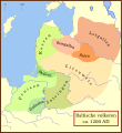
Balten 1200.svg 1,003 × 1,096; 338 KB
-
Baltic states territorial changes 1939-45 en.svg 1,198 × 1,302; 411 KB
-
Baltic states territorial changes 1939-45 es.svg 1,198 × 1,302; 411 KB
-
Baltijas valstu teritoriālās izmaiņas no 1939. līdz 1945. gadam.svg 1,278 × 1,389; 411 KB
-
Confederation of Livonia 1260-fr.svg 955 × 1,034; 1.36 MB
-
Confederazione Livone.svg 955 × 1,034; 621 KB
-
Courlnd in 1772.svg 1,146 × 1,008; 184 KB
-
Duchy of Courland & Semigallia 1740-es.svg 1,074 × 945; 468 KB
-
Duchy of Courland & Semigallia 1740.svg 1,074 × 945; 510 KB
-
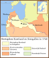
Hertogdom Koerland en Semgallen 1740 locator.svg 986 × 1,159; 399 KB
-
Inflanty 1260.svg 895 × 969; 984 KB
-
Księstwo Kurlandii i Semigalii w 1740 roku 1740.svg 1,074 × 945; 482 KB
-
Kurland 1740-hu.svg 1,074 × 945; 259 KB
-
Kurzemes un Zemgales hercogiste 1740 locator.svg 984 × 738; 183 KB
-
Kurzemes un Zemgales Hercogiste 1740.svg 1,074 × 945; 498 KB
-
Lijfland 1260-es.svg 955 × 1,459; 1.43 MB
-
Lijfland 1260.svg 955 × 1,459; 985 KB
-
Livland 1260.svg 955 × 1,034; 790 KB
-
Location map of Weissruthenien-fr.svg 1,414 × 2,248; 134 KB
-
Medieval Livonia 1260 hu.svg 1,273 × 1,379; 1.07 MB
-
Medieval Livonia 1260.svg 955 × 1,034; 734 KB
-
PBW June 1920-es.svg 2,014 × 1,567; 1.36 MB
-
PL-RU war 1919 phase II de.svg 2,705 × 2,112; 897 KB
-
Reichskommissariat Ostland (1942).svg 450 × 456; 506 KB
-
Republic of Latvia Provinces (1924-1940).svg 3,860 × 2,540; 6.4 MB
-
Vana-Liivimaa-es.svg 864 × 900; 2.55 MB


