Category:SVG maps of the Soviet Union
Jump to navigation
Jump to search
Subcategories
This category has the following 2 subcategories, out of 2 total.
Media in category "SVG maps of the Soviet Union"
The following 64 files are in this category, out of 64 total.
-
1989 Soviet election turnout by republic.svg 1,115 × 764; 88 KB
-
Academset USSR.svg 250 × 175; 73 KB
-
Central Chernozem Oblast administrative division map (1930).svg 1,688 × 1,219; 4.54 MB
-
Chornobyl raion (1923-1988) with modern Alienation Zone.svg 533 × 618; 326 KB
-
Communist block.svg 940 × 477; 1.82 MB
-
Communist countries.svg 860 × 440; 1.18 MB
-
European Soviet Union laea location map.svg 1,181 × 1,558; 2.37 MB
-
European Soviet Union.svg 1,217 × 1,653; 2.11 MB
-
Expansion territoriale de la Russie.svg 2,074 × 1,612; 948 KB
-
Expansión territorial de Rusia.svg 1,944 × 1,511; 948 KB
-
Former USSR Oil and Gas map.svg 1,530 × 990; 1.89 MB
-
Largest cities USSR 1989.svg 512 × 341; 853 KB
-
Location map of the USSR.svg 940 × 624; 2.08 MB
-
Map of USSR with SSR names.svg 328 × 203; 28 KB
-
Nachfolgestaatenudssr.svg 1,002 × 741; 870 KB
-
New Union Treaty.svg 1,115 × 764; 108 KB
-
Population distribution of Kurds in the USSR in 1989.svg 940 × 624; 2.08 MB
-
Republics of the Union of Soviet Socialist Republics (1922).png 2,560 × 1,626; 1.27 MB
-
Republics of the Union of Soviet Socialist Republics (1925).png 2,560 × 1,626; 1.28 MB
-
Republics of the Union of Soviet Socialist Republics (1929).png 2,560 × 1,626; 1.29 MB
-
Republics of the Union of Soviet Socialist Republics (1936).png 2,560 × 1,626; 1.35 MB
-
Republics of the USSR ur.svg 4,237 × 2,900; 690 KB
-
Republics of the USSR.svg 1,345 × 920; 103 KB
-
Soviet Influence (1960).svg 1,050 × 600; 1.42 MB
-
Soviet Influence (1970).svg 1,050 × 600; 1.42 MB
-
Soviet Influence (1980).svg 1,050 × 600; 1.42 MB
-
Soviet Influence (1990).svg 1,050 × 600; 1.42 MB
-
Soviet successor states (without disputed or occupied territories).png 2,560 × 1,699; 1.21 MB
-
Soviet Union (1940).svg 592 × 376; 253 KB
-
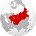
Soviet Union (1956-1991).svg 881 × 585; 4.6 MB
-
Soviet Union (European part) location map.svg 463 × 600; 568 KB
-
Soviet Union 1922.svg 592 × 376; 242 KB
-
Soviet Union 1924.svg 592 × 376; 236 KB
-
Soviet Union 1925.svg 592 × 376; 243 KB
-
Soviet Union 1929.svg 592 × 376; 237 KB
-
Soviet Union 1936.svg 592 × 376; 242 KB
-
Soviet Union 1989 with Warsaw Pact, modern borders.svg 1,405 × 601; 336 KB
-
Soviet Union location map (1937).svg 600 × 371; 1.08 MB
-
Soviet Union location map (1937, no rivers).svg 600 × 371; 1.08 MB
-
Soviet Union location map (no rivers).svg 600 × 371; 1.01 MB
-
Soviet Union location map (provinces).svg 600 × 371; 858 KB
-
Soviet Union location map.svg 600 × 371; 1.01 MB
-
Soviet Union on the globe (Soviet Union centered).svg 805 × 805; 412 KB
-
Soviet Union referendum, 1991 results.svg 881 × 585; 4.61 MB
-
SovietUnionRussia.svg 625 × 428; 219 KB
-
Subdivisions of the Soviet Union.svg 600 × 371; 885 KB
-
Territorial Expansion of Russia.svg 1,944 × 1,511; 1.11 MB
-
Territorial extent of the Union of Soviet Socialist Republics (1922-1940).png 2,560 × 1,626; 1.05 MB
-
Territorial extent of the Union of Soviet Socialist Republics (1944-1991).png 2,560 × 1,699; 946 KB
-
Union of Soviet Socialist Republics (1989).svg 550 × 550; 453 KB
-
Union of Soviet Socialist Republics (orthographic projection).svg 541 × 541; 453 KB
-
Union Republics of the Union of Soviet Socialist Republics (1944-1991).png 2,560 × 1,699; 1.3 MB
-
USSR in EurAsia.svg 1,181 × 1,050; 5.72 MB
-
USSR location map.svg 512 × 171; 1.76 MB
-
USSR Map (10-1990 - 12-1991).svg 251 × 200; 206 KB
-
USSR map.svg 250 × 175; 63 KB
-
USSR Republics numbered by alphabet.svg 1,345 × 942; 42 KB
-
USSR Republics numbered by Constitution.svg 1,345 × 942; 42 KB
-
USSR Republics numbered by Thai alphabet.svg 1,345 × 942; 45 KB
-
USSRmap.svg 940 × 477; 1.56 MB
-
Академсеть СССР.svg 250 × 175; 73 KB
-
Крупнейшие города СССР.svg 512 × 341; 853 KB
-
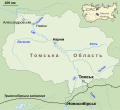
Назінська трагедія (карта).svg 1,374 × 1,259; 156 KB


