Category:SVG maps of the history of Pakistan
Jump to navigation
Jump to search
Media in category "SVG maps of the history of Pakistan"
The following 20 files are in this category, out of 20 total.
-
Balochistan districts 1973.svg 512 × 393; 284 KB
-
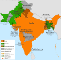
Dispartigo de Barato 1947.svg 1,189 × 1,170; 223 KB
-
East Pakistan (orthographic projection).svg 553 × 553; 329 KB
-
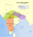
Indian Kanauj triangle map-es.svg 1,539 × 1,735; 1.8 MB
-
Indian Kanauj triangle map.svg 1,639 × 1,852; 389 KB
-
Kannauj-triangelet år 750-900.svg 1,639 × 1,852; 387 KB
-
Pakistan Ost- und West 1971 (2)-hu.svg 556 × 667; 899 KB
-
Pakistan Ost- und West 1971 (2).svg 556 × 667; 848 KB
-
Pakistan Ost- und West 1971-hu.svg 772 × 654; 702 KB
-
Pakistan Ost- und West 1971.svg 772 × 654; 667 KB
-
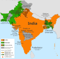
Partition of India 1947 en.svg 1,189 × 1,170; 724 KB
-
Partition of India 1947 es.svg 1,189 × 1,170; 215 KB
-
Partition of India 1947 fr.svg 1,189 × 1,170; 461 KB
-
Partition of India 1947 gu.svg 1,189 × 1,170; 222 KB
-
Partition of India 1947 it.svg 1,189 × 1,170; 162 KB
-
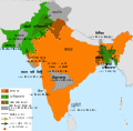
Partition of India 1947 mr.svg 1,189 × 1,170; 219 KB
-
Partition of India 1947-bn.svg 1,189 × 1,170; 231 KB
-
Partition of India 1947-hu.svg 1,189 × 1,170; 253 KB
-
Partition of India 1947-kn.svg 1,189 × 1,170; 229 KB
-
Partition of India 1947-pa.svg 1,189 × 1,170; 216 KB


