Category:SVG maps of the history of China
Jump to navigation
Jump to search
Subcategories
This category has the following 2 subcategories, out of 2 total.
A
P
- SVG locator maps of former provinces of China (1 P, 113 F)
Media in category "SVG maps of the history of China"
The following 161 files are in this category, out of 161 total.
-
742nian Tang.svg 1,000 × 850; 203 KB
-
An Lushan rebellion 1.-2.756, cs.svg 840 × 620; 248 KB
-
An Lushan rebellion 10.762 - 1.763, cs.svg 389 × 299; 193 KB
-
An Lushan rebellion 11.757 - 4.759, cs.svg 840 × 620; 224 KB
-
An Lushan rebellion 12.755 - 1.756, cs.svg 840 × 620; 253 KB
-
An Lushan rebellion 3.-7.756, cs.svg 840 × 620; 241 KB
-
An Lushan rebellion 4.759 - 10.762, cs.svg 840 × 620; 220 KB
-
An Lushan rebellion 7.756 - 11.757, cs.svg 840 × 620; 248 KB
-
Ancient North China Plain blank relief map.svg 1,734 × 1,369; 657 KB
-
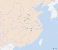
Battle of changping,长平之战.svg 512 × 418; 2.89 MB
-
Battle of Red Cliffs 208 extended map-en.svg 782 × 591; 762 KB
-
Battle of Red Cliffs 208 extended map-es.svg 782 × 591; 738 KB
-
Battle of Red Cliffs 208 extended map-fa.jpg 1,280 × 967; 564 KB
-
Battle of Red Cliffs 208 extended map-fr.svg 782 × 591; 755 KB
-
Battle of Red Cliffs 208 map-en.svg 843 × 480; 718 KB
-
Battle of Red Cliffs 208 map-es.svg 843 × 480; 645 KB
-
Battle of Red Cliffs 208 map-fr.svg 843 × 480; 710 KB
-
Buryatia - russian ostrog.svg 1,359 × 915; 171 KB
-
CaudillosMilitaresEnChina1925.svg 1,199 × 922; 1.1 MB
-
CaudillosMilitaresEnChina1925Alternativo.svg 1,124 × 1,034; 1.17 MB
-
Chaing Kai-shek's Strategy 1947-es.svg 1,124 × 865; 559 KB
-
China - Song Dynasty-mk.svg 840 × 825; 1.06 MB
-
China - Southern Song Dynasty-es.svg 840 × 825; 1.22 MB
-
China 1820 de.svg 964 × 732; 403 KB
-
China 1820 es.svg 964 × 732; 400 KB
-
China 1911 de.svg 964 × 732; 460 KB
-
China 1911 en.svg 964 × 732; 485 KB
-
China 1911 es.svg 964 × 732; 495 KB
-
China 763, cs.svg 481 × 580; 243 KB
-
China blank map (1936).svg 1,000 × 810; 237 KB
-
China in 1820.svg 1,288 × 999; 1.88 MB
-
China in 1911.svg 1,215 × 940; 1.9 MB
-
China in 1936.svg 1,215 × 940; 1.97 MB
-
China in 1946.svg 1,215 × 940; 2.11 MB
-
China in 1949.svg 1,181 × 940; 2.12 MB
-
China in 1950.svg 1,181 × 940; 2.16 MB
-
China in 1952.svg 1,181 × 940; 2.1 MB
-
China in 1954.svg 1,181 × 940; 1.99 MB
-
China in 1955.svg 1,181 × 940; 2.01 MB
-
China in 1966.svg 1,181 × 940; 2.01 MB
-
China in 1968.svg 1,181 × 940; 1.99 MB
-
China in 1979.svg 1,181 × 940; 2.02 MB
-
China opium growing areas 1908 AR.svg 835 × 940; 34 KB
-
China opium growing areas 1908 EN.svg 835 × 940; 27 KB
-
China, 610-es.svg 1,000 × 850; 211 KB
-
China, 610.svg 1,000 × 850; 211 KB
-
China, 742-es.svg 1,000 × 850; 179 KB
-
China, 742.svg 1,000 × 850; 168 KB
-
China, ten jiedushi 745, cs.svg 1,000 × 850; 233 KB
-
China-1900-en.svg 1,000 × 850; 226 KB
-
China-1900-es.svg 1,000 × 850; 204 KB
-
China-Historic macro areas.svg 1,438 × 1,047; 3.61 MB
-
China-Manchukuo-map (tr).svg 424 × 302; 313 KB
-
China-Manchukuo-map mk.svg 424 × 302; 383 KB
-
China-Manchukuo-map-es.svg 1,262 × 900; 600 KB
-
China-Manchukuo-map.svg 424 × 302; 281 KB
-
ChinaCivilianairlines map 1934 de.svg 2,000 × 3,048; 712 KB
-
Chinese Eastern Railway.svg 852 × 743; 43 KB
-
Chinese plain 5c. BC-cz.svg 568 × 384; 760 KB
-
Chinese plain 5c. BC-es.svg 568 × 384; 758 KB
-
Chinese plain 5c. BC-fr.svg 568 × 384; 759 KB
-
Chinese plain 5c. BC-mk.svg 568 × 384; 1.09 MB
-
Chinese plain 5c. BC-vi.svg 512 × 371; 385 KB
-
Cina roku 1365-es.svg 672 × 580; 1.03 MB
-
Cina roku 1365.svg 672 × 580; 1.14 MB
-
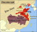
Cina v roce 1358.svg 672 × 580; 1.1 MB
-
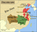
Cina v roce 1360.svg 672 × 580; 1.07 MB
-
Communist Offensives April-October 1949-es.svg 1,124 × 865; 571 KB
-
Communist Offensives November 1948-January 1949-es.svg 1,124 × 865; 565 KB
-
Communist Offensives September through November 1948-es.svg 1,124 × 865; 568 KB
-
Dauria and Amur region 1650-55 cz.svg 1,985 × 1,281; 162 KB
-
Dauria and Amur region 1652-58 cz.svg 1,985 × 1,281; 213 KB
-
Dauria and Amur region 1683-84 cz.svg 1,985 × 1,281; 200 KB
-
Dauria and Amur region 1685 cz.svg 1,985 × 1,281; 184 KB
-
Dauria and Amur region 1686-88 cz.svg 1,985 × 1,281; 189 KB
-
Dauria and Amur region 1689 cz.svg 1,985 × 1,281; 174 KB
-
East Asia 5000BP.svg 718 × 514; 44 KB
-
East Asian Empires.svg 1,467 × 1,050; 8 MB
-
Emperor Taizong's campaign against Xiyu states-es.svg 1,026 × 674; 591 KB
-
Emperor Taizong's campaign against Xiyu states-fr.svg 1,026 × 674; 629 KB
-
Emperor Taizong's campaign against Xiyu states.svg 1,026 × 674; 629 KB
-
Establishment of the Tang Dynasty-es.svg 1,053 × 621; 1.76 MB
-
Establishment of the Tang Dynasty.svg 1,053 × 621; 1.69 MB
-
First Sino-Japanese War-es.svg 622 × 813; 682 KB
-
GuerraDeProtecciónNacional19151916.svg 1,124 × 865; 1.1 MB
-
Japanese Empire - 1942.svg 1,100 × 837; 875 KB
-
Japanese Occupation of China 1940 de.svg 1,119 × 857; 217 KB
-
Japanese Occupation of China 1940.svg 1,119 × 857; 284 KB
-
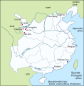
Map of China during Seaban of China (1661).svg 512 × 387; 242 KB
-
Map of East Asia (698 - 8th century)-es.svg 553 × 537; 86 KB
-
Map of East Asia (698 - 8th century).svg 553 × 537; 71 KB
-
Map of East Hebei Autonomous Council.svg 834 × 503; 75 KB
-
Map of Manchukuo divisions en.svg 651 × 726; 206 KB
-
Map of Manchukuo divisions zh-hans.svg 651 × 726; 237 KB
-
Map of Manchukuo divisions zh-hant.svg 651 × 726; 252 KB
-
Map of Qing dynasty 18c Chinese.svg 834 × 771; 189 KB
-
Map of Qing dynasty 18c-es.svg 834 × 771; 193 KB
-
Map of Qing dynasty 18c.svg 834 × 771; 207 KB
-
Map of Reformed, Provisional Gov of ROC and Mengjiang - zh-hant.svg 217 × 277; 256 KB
-
Map of Shaan-Gan-Ning.svg 415 × 441; 93 KB
-
MapaDeManchukúo.svg 808 × 953; 172 KB
-
Ming Empire cca 1580 (en).svg 2,304 × 2,344; 2.21 MB
-
Ming Empire cca 1580 (fr).svg 2,304 × 2,344; 2.19 MB
-
Ming Empire cca 1580 (ja).svg 2,304 × 2,344; 2.18 MB
-
Ming Empire cca 1580 (mk).svg 2,304 × 2,344; 2.33 MB
-
Ming Empire cca 1580 (nl).svg 2,304 × 2,344; 2.18 MB
-
Ming Empire cca 1580 (vi).svg 2,304 × 2,344; 2.18 MB
-
Ming Empire cca 1580 (zh-hant).svg 2,304 × 2,344; 2.18 MB
-
Ming Empire cca 1580 es.svg 2,304 × 2,344; 2.18 MB
-
Ming Empire cca 1580-hu.svg 2,304 × 2,344; 2.18 MB
-
Nanyue.svg 595 × 583; 107 KB
-
National market in the late Ming.svg 628 × 641; 167 KB
-
National Protection War map zh-tw.svg 512 × 394; 658 KB
-
Neolithic china.svg 2,000 × 1,722; 811 KB
-
OcupaciónJaponesaDeChina1940.svg 1,124 × 865; 1.05 MB
-
Poamuří kolonizace.svg 1,354 × 779; 174 KB
-
PrimeraFaseCentroExpediciónAlNorte.svg 1,833 × 1,216; 28.67 MB
-
PrimeraFaseSurExpediciónAlNorte.svg 1,860 × 1,374; 24.58 MB
-
Prince of Ning rebelion.svg 138 × 194; 197 KB
-
Prince of Ning rebellion cz.svg 499 × 577; 94 KB
-
Provincie říše Ming éry Jung-le.svg 628 × 641; 910 KB
-
Provincie říše Ming.svg 628 × 641; 634 KB
-
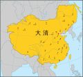
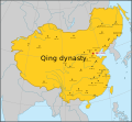
Qing Dynasty 1911 - cs.svg 1,004 × 763; 448 KB
-
Qing Dynasty blank map 1820.svg 850 × 709; 2.59 MB
-
Qing Dynasty blank map 1911.svg 1,004 × 763; 436 KB
-
Qingdongling map.svg 1,314 × 1,035; 34 KB
-
Region of xia.svg 728 × 608; 26 KB
-
RevoluciónDeXinhai1911.svg 1,124 × 865; 843 KB
-
Rise Tchang 700 nl CS.svg 556 × 537; 479 KB
-
ROC Administrative Subdivisions zh-hant.svg 677 × 535; 306 KB
-
ROC CY.svg 677 × 535; 370 KB
-
ROC-Timezones (zh TW).svg 735 × 585; 238 KB
-
ROC-Timezones.svg 735 × 585; 130 KB
-
ROC-TimeZones.svg 735 × 585; 343 KB
-
RP Chine administrative uk.svg 857 × 699; 269 KB
-
RutasDeAbastecimientoDelGobiernoDeChongqing.svg 1,125 × 897; 1.03 MB
-
Sino-russian border after treaty of Nerchinsk.svg 1,985 × 1,281; 196 KB
-
Sino-Russian border conflicts cz.svg 1,985 × 1,281; 222 KB
-
Sino-Russian border conflicts es.svg 1,985 × 1,281; 395 KB
-
Sino-Soviet split 1980.svg 940 × 477; 1.53 MB
-
Sui-610.svg 1,000 × 850; 219 KB
-
Syanbi state-es.svg 2,042 × 1,445; 323 KB
-
Tang Dynasty 700 CE-es.svg 556 × 537; 540 KB
-
Tang Dynasty 700 CE-pt.svg 556 × 537; 540 KB
-
Tang Dynasty 700 CE.svg 556 × 537; 537 KB
-
Tang Dynasty in the 8th century ja.svg 2,008 × 1,418; 160 KB
-
Tang outline map, 661.svg 1,288 × 757; 64 KB
-
TerritoriosDeLaCamarilladeAnhui1917.svg 1,123 × 910; 1.04 MB
-
Tillson Harrison last journey map.svg 933 × 621; 105 KB
-
Trade Offices of the Ming dynasty.svg 628 × 641; 118 KB
-
Wojna chinsko-japonska 1894-95.svg 622 × 814; 1.66 MB
-
Xia dynasty.svg 864 × 744; 906 KB
-
Yongli-itinerary-cropped.svg 585 × 231; 638 KB
-
Zh-DAYUAN map.svg 726 × 334; 526 KB
-
Říše Ming - obyvatelstvo 1393.svg 628 × 641; 469 KB
-
Říše Ming 1368-1387.svg 628 × 641; 469 KB
-
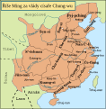
Říše Ming éry Chung-wu.svg 628 × 641; 469 KB
-
护国战争.svg 1,124 × 865; 583 KB
-
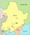
만주국.svg 808 × 953; 39 KB
