Category:SVG maps of the history of Ukraine
Jump to navigation
Jump to search
Subcategories
This category has the following 2 subcategories, out of 2 total.
P
Media in category "SVG maps of the history of Ukraine"
The following 29 files are in this category, out of 29 total.
-
ETHNIC MAP OF BESSARABIA IN 1930.svg 2,327 × 2,359; 1 MB
-
General District of Crimea (1942).svg 450 × 456; 486 KB
-
Generalplan Ost-en.svg 746 × 1,052; 292 KB
-
Generalplan Ost-es.svg 746 × 1,052; 1,012 KB
-
Generalplan Ost-fr.svg 746 × 1,052; 227 KB
-
Generalplan Ost-south-fr.svg 746 × 730; 172 KB
-
Generalplan Ost-south-Zamosc-fr.svg 746 × 730; 176 KB
-
Generalplan Ost.svg 746 × 1,052; 213 KB
-
Grand Duchy of Lithuania 1462 within modern boundaries-en.svg 1,152 × 1,028; 792 KB
-
Khotin Uprising on January 19, 1919.svg 756 × 553; 488 KB
-
Kingdom of Hungary counties (sk-Marmarošská).svg 1,772 × 1,166; 1.21 MB
-
Map of Ukraine (pro-Russian protests).svg 550 × 380; 729 KB
-
Map of Ukraine (pro-Ukraine protests).svg 550 × 380; 729 KB
-
Moldavian SSR in March–August 1944.svg 477 × 499; 339 KB
-
Regions of Ukraine by HDI (2017).svg 512 × 352; 494 KB
-
Reichskommissariat Ukraine (1942).svg 450 × 456; 480 KB
-
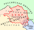
RepúblicaPopularDeUcraniaOccidental.svg 846 × 684; 225 KB
-
RepúblicaPopularDeUcraniaOccidentalNoviembre1918.svg 847 × 789; 121 KB
-
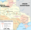
Rýchla divízia na východnom fronte (mapa).svg 1,332 × 913; 269 KB
-
Soviet annexation of Eastern Galicia and Volhynia during WWII.svg 912 × 738; 5.98 MB
-
Transnistria WW2.svg 1,300 × 3,200; 2.26 MB
-
Ukraine (1991-2014) location map.svg 1,546 × 1,038; 477 KB
-
Ukraine 2022-02-21.svg 1,546 × 1,038; 452 KB
-
Ukraine according to Russian claims (2022) location map (1917 highlighted).svg 1,367 × 931; 1.4 MB
-
Ukraine salary by region 2012.svg 550 × 400; 759 KB
-
Ukraine salary by region 2016.svg 550 × 400; 916 KB
-
Ukraine-Historical regions.svg 700 × 480; 280 KB
-
West Ukrainian People's Republic map.svg 540 × 480; 147 KB
-
Zaisťovacia divízia na východnom fronte (mapa) clean.svg 1,332 × 913; 267 KB


