Category:SVG maps of Chile
Jump to navigation
Jump to search
Countries of the Americas: Antigua and Barbuda · Argentina · The Bahamas · Barbados · Belize · Bolivia · Brazil · Canada · Chile · Colombia · Costa Rica · Cuba · Dominica · Dominican Republic · Ecuador · El Salvador · Grenada · Guatemala · Guyana · Haiti · Honduras · Jamaica · Mexico · Nicaragua · Panama · Paraguay · Peru · Saint Kitts and Nevis · Saint Lucia · Saint Vincent and the Grenadines · Suriname · Trinidad and Tobago · United States of America · Uruguay · Venezuela
Other areas: Anguilla · Aruba · Bermuda · British Virgin Islands · Cayman Islands · Curaçao · Dutch Caribbean · Falkland Islands · French Guiana · Greenland · Guadeloupe · Martinique · Puerto Rico · Saint Barthélemy · Saint-Martin · Saint Pierre and Miquelon · Sint Maarten
Other areas: Anguilla · Aruba · Bermuda · British Virgin Islands · Cayman Islands · Curaçao · Dutch Caribbean · Falkland Islands · French Guiana · Greenland · Guadeloupe · Martinique · Puerto Rico · Saint Barthélemy · Saint-Martin · Saint Pierre and Miquelon · Sint Maarten
Subcategories
This category has the following 11 subcategories, out of 11 total.
-
E
- Environmental maps of Chile (330 F)
H
L
R
S
- SVG flag maps of Chile (48 F)
- SVG maps of communes of Chile (337 F)
T
Media in category "SVG maps of Chile"
The following 46 files are in this category, out of 46 total.
-
Arica Department (Chile).svg 2,268 × 2,764; 146 KB
-
Atacama map.svg 217 × 304; 479 KB
-
Cardenal Caro Province map - numbered.svg 186 × 334; 39 KB
-
Chile adm location map (colored).svg 1,474 × 2,685; 1.04 MB
-
Chile adm location map.svg 1,474 × 2,685; 779 KB
-
Chile administrative divisions - ukr - colored.svg 512 × 1,150; 1.19 MB
-
Chile blank map.svg 400 × 2,000; 1.05 MB
-
Chile loc map 70px in one svg-object.svg 378 × 2,037; 687 KB
-
Chile loc map 70px.svg 378 × 2,037; 789 KB
-
Chile loc map.svg 962 × 2,092; 1.12 MB
-
Chile location map (+1998 agreement rectangle).svg 1,183 × 2,658; 917 KB
-
Chile location map (+claims).svg 1,183 × 2,658; 919 KB
-
Chile location map (1818).svg 1,710 × 2,679; 4.58 MB
-
Chile location map (1884-1929).svg 1,474 × 2,775; 439 KB
-
Chile location map.svg 1,183 × 2,658; 925 KB
-
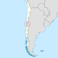
Chile Los Lagos location map.svg 1,419 × 1,497; 694 KB
-
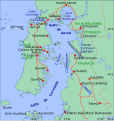
Chile.Quellon.svg 595 × 807; 161 KB
-
Chilicola charizard Distribution.svg 788 × 789; 2.38 MB
-
Chilicola mantagua - Distribution.svg 788 × 789; 2.38 MB
-
Chiloe Island be.svg 629 × 599; 252 KB
-
Chiloe0.svg 1,513 × 1,597; 782 KB
-
Concesiones en el Territorio de Aysén hacia 1920.svg 400 × 500; 1.15 MB
-
División electoral de Chile (1989-2013).svg 400 × 2,000; 964 KB
-
División electoral de Chile (2017).svg 400 × 2,000; 1,017 KB
-
Estados de excepción constitucional en Chile (octubre 2019).svg 400 × 2,000; 1.72 MB
-
ICJ Peru Chile judgment map4 (svg version).svg 3,036 × 2,176; 2.19 MB
-
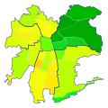
IDH Santiago.svg 600 × 600; 61 KB
-
Locator map of the Republic of Chile.svg 512 × 778; 1.2 MB
-
Macrobioclimas de Chile.svg 400 × 2,000; 982 KB
-
Map of Fitz Roy massif - 01.svg 5,081 × 5,396; 1.03 MB
-
Mapa Chile Apertura 2010.svg 270 × 600; 1,019 KB
-
Mapa de Chile (provincias).svg 400 × 2,000; 1.27 MB
-
Mapa de Chile (regiones).svg 400 × 2,000; 1.05 MB
-
Mapa de Chile por IDH (comunas).svg 962 × 2,092; 2.1 MB
-
Mapa de Chile por IDH.svg 962 × 2,092; 820 KB
-
Mapa de Chile.svg 400 × 2,000; 2.84 MB
-
Mapa Institutos Teletón.svg 270 × 600; 1.09 MB
-
Principales calles de Santiago.svg 600 × 600; 69 KB
-
Regions of Chile by HDI (2017).svg 512 × 1,889; 534 KB
-
Tacna Department (Chile) (1884-1911).svg 2,268 × 2,764; 121 KB
-
Tacna Department (Chile).svg 2,268 × 2,764; 146 KB
-
Tarata Department (Chile).svg 2,268 × 2,764; 146 KB
-
Territorial waters - Chile.svg 800 × 400; 750 KB
-
Tierra del Fuego adm location map.svg 1,616 × 1,600; 1.8 MB
-
Transantiago.svg 550 × 550; 49 KB
-
Visa policy of Chile.svg 863 × 443; 1.59 MB


