Category:SVG maps of Peru
Jump to navigation
Jump to search
Countries of the Americas: Antigua and Barbuda · Argentina · The Bahamas · Barbados · Belize · Bolivia · Brazil · Canada · Chile · Colombia · Costa Rica · Cuba · Dominica · Dominican Republic · Ecuador · El Salvador · Grenada · Guatemala · Guyana · Haiti · Honduras · Jamaica · Mexico · Nicaragua · Panama · Paraguay · Peru · Saint Kitts and Nevis · Saint Lucia · Saint Vincent and the Grenadines · Suriname · Trinidad and Tobago · United States of America · Uruguay · Venezuela
Other areas: Anguilla · Aruba · Bermuda · British Virgin Islands · Cayman Islands · Curaçao · Dutch Caribbean · Falkland Islands · French Guiana · Greenland · Guadeloupe · Martinique · Puerto Rico · Saint Barthélemy · Saint-Martin · Saint Pierre and Miquelon · Sint Maarten
Other areas: Anguilla · Aruba · Bermuda · British Virgin Islands · Cayman Islands · Curaçao · Dutch Caribbean · Falkland Islands · French Guiana · Greenland · Guadeloupe · Martinique · Puerto Rico · Saint Barthélemy · Saint-Martin · Saint Pierre and Miquelon · Sint Maarten
Subcategories
This category has the following 8 subcategories, out of 8 total.
-
F
H
L
R
T
Media in category "SVG maps of Peru"
The following 34 files are in this category, out of 34 total.
-
PER-ANC.svg 150 × 200; 522 KB
-
Blank map of Peru.svg 630 × 912; 74 KB
-
Copa Perú - Regions.svg 820 × 1,000; 1.7 MB
-
Flag-map of Peru (before and now).svg 689 × 1,003; 1.21 MB
-
ICJ Peru Chile judgment map4 (svg version).svg 3,036 × 2,176; 2.19 MB
-
IDH peru 2013.svg 820 × 1,000; 606 KB
-
Localization of Pui Pui Protection Forest.svg 512 × 624; 771 KB
-
Map of Peru White.svg 820 × 1,000; 970 KB
-
Map of Wari and Tiawaku.svg 267 × 365; 411 KB
-
Map of Wari in Latin America.svg 1,000 × 1,250; 257 KB
-
Map of Wari in Peru.svg 267 × 365; 154 KB
-
Mapa Chimor.svg 512 × 783; 77 KB
-
Mapa Sendero Luminoso.svg 820 × 1,000; 978 KB
-
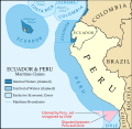
Maritime Claims of Ecuador and Peru.svg 1,864 × 1,819; 373 KB
-
Maritime Claims of Peru and Ecuador.svg 1,864 × 1,819; 660 KB
-
Maritime Claims of Peru.svg 1,168 × 1,513; 181 KB
-
Peru (Lithuanian).svg 561 × 621; 327 KB
-
Peru - (Template).svg 820 × 1,000; 1.6 MB
-
Peru - 1989 Regions (locator map, labeled, ES).svg 820 × 1,000; 1.16 MB
-
Peru - 2011 Region proposals (locator map, labeled ES).svg 820 × 1,000; 1.17 MB
-
Peru - HDI by region or department (2005).svg 820 × 1,000; 1 MB
-
Peru - Population by region or department (2007).svg 820 × 1,000; 1.6 MB
-
Peru - Population density by region or department (2007).svg 820 × 1,000; 1.6 MB
-
Peru -2005 Region proposals (locator map, labeled ES).svg 820 × 1,000; 1.31 MB
-
Peru Departments (red).svg 820 × 1,000; 1.64 MB
-
Peru general election, 2016 (first round).svg 820 × 1,000; 799 KB
-
Peru location map.svg 2,200 × 2,679; 15.72 MB
-
Peru-regions-multi-color-001.SVG 520 × 730; 180 KB
-
Peruvian departments by HDI (2017).svg 512 × 728; 89 KB
-
Perú 1821-1824.svg 867 × 1,184; 11 KB
-
Perú 1821-1942.svg 867 × 1,184; 419 KB
-
Provincias del Perú.svg 1,033 × 1,258; 19.76 MB
-
Provincias Perú Densidad 2007.svg 1,279 × 1,871; 781 KB
-
Regions-of-peru-blank-map-001.svg 820 × 1,000; 1.23 MB


