Category:SVG maps of Bolivia
Jump to navigation
Jump to search
Countries of the Americas: Antigua and Barbuda · Argentina · The Bahamas · Barbados · Belize · Bolivia · Brazil · Canada · Chile · Colombia · Costa Rica · Cuba · Dominica · Dominican Republic · Ecuador · El Salvador · Grenada · Guatemala · Guyana · Haiti · Honduras · Jamaica · Mexico · Nicaragua · Panama · Paraguay · Peru · Saint Kitts and Nevis · Saint Lucia · Saint Vincent and the Grenadines · Suriname · Trinidad and Tobago · United States of America · Uruguay · Venezuela
Other areas: Anguilla · Aruba · Bermuda · British Virgin Islands · Cayman Islands · Curaçao · Dutch Caribbean · Falkland Islands · French Guiana · Greenland · Guadeloupe · Martinique · Puerto Rico · Saint Barthélemy · Saint-Martin · Saint Pierre and Miquelon · Sint Maarten
Other areas: Anguilla · Aruba · Bermuda · British Virgin Islands · Cayman Islands · Curaçao · Dutch Caribbean · Falkland Islands · French Guiana · Greenland · Guadeloupe · Martinique · Puerto Rico · Saint Barthélemy · Saint-Martin · Saint Pierre and Miquelon · Sint Maarten
Subcategories
This category has the following 6 subcategories, out of 6 total.
Media in category "SVG maps of Bolivia"
The following 34 files are in this category, out of 34 total.
-
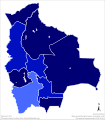
2020 Bolivian general election - Vote Strength.svg 872 × 990; 498 KB
-
Acuerdos de Charaña.svg 1,109 × 865; 242 KB
-
Bolivia (orthographic projection).svg 541 × 541; 314 KB
-
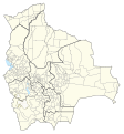
Bolivia adm location map.svg 1,342 × 1,488; 245 KB
-
Bolivia admin 2019.svg 710 × 763; 8.39 MB
-
Bolivia Blank Map.svg 2,000 × 2,208; 74 KB
-
Bolivia dentro del UNASUR.svg 775 × 900; 1.9 MB
-
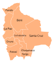
Bolivia departments en.svg 2,000 × 2,208; 78 KB
-
Bolivia departments mk.svg 2,000 × 2,208; 78 KB
-
Bolivia departments-ru.svg 2,000 × 2,208; 83 KB
-
Bolivia Russia Locator.svg 940 × 415; 1.52 MB
-
Bolivian departments by HDI (2017).svg 512 × 584; 190 KB
-
Ctenomys Verbreitung.svg 1,343 × 1,489; 313 KB
-
Flag-map of Bolivia, Wiphala & bandera de la flor de Patujú.svg 1,772 × 2,019; 236 KB
-
H1N1 Bolivia map by confirmed cases.svg 2,000 × 2,208; 74 KB
-
H1N1 Bolivia Map.svg 2,000 × 2,208; 74 KB
-
ICJ Peru Chile judgment map4 (svg version).svg 3,036 × 2,176; 2.19 MB
-
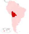
LocationBolivia.svg 1,000 × 500; 2.76 MB
-
Mapa de Bolivia (nuevos departamentos propuestos).svg 2,218 × 2,215; 634 KB
-
Mapa de localización Beni.svg 3,525 × 3,417; 8.73 MB
-
Mapa de localización Chuquisaca.svg 512 × 468; 3.31 MB
-
Mapa de localización Cochabamba (Bolivia).svg 512 × 544; 4.2 MB
-
Mapa de localización La Paz.svg 512 × 920; 8.72 MB
-
Mapa de localización Oruro.svg 512 × 436; 2.08 MB
-
Mapa de localización Pando.svg 512 × 353; 2.73 MB
-
Mapa de localización Potosí.svg 512 × 631; 5.35 MB
-
Mapa de localización Santa Cruz (Bolivia).svg 4,375 × 4,165; 10.72 MB
-
Mapa de localización Tarija.svg 512 × 325; 1.88 MB
-
Provinces of Bolivia.svg 5,382 × 6,174; 4.89 MB
-
Provincia de Chiquitos.svg 2,385 × 2,393; 256 KB
-
Provincias de Bolivia.svg 2,218 × 2,215; 645 KB
-
Punto Tripartito (Bolivia-Perú-Brasil).svg 1,209 × 845; 89 KB
-
Zona en que combatió Che Guevara-Bolivia.SVG 328 × 350; 296 KB


