Category:SVG maps of Colombia
Jump to navigation
Jump to search
Countries of the Americas: Antigua and Barbuda · Argentina · The Bahamas · Barbados · Belize · Bolivia · Brazil · Canada · Chile · Colombia · Costa Rica · Cuba · Dominica · Dominican Republic · Ecuador · El Salvador · Grenada · Guatemala · Guyana · Haiti · Honduras · Jamaica · Mexico · Nicaragua · Panama · Paraguay · Peru · Saint Kitts and Nevis · Saint Lucia · Saint Vincent and the Grenadines · Suriname · Trinidad and Tobago · United States of America · Uruguay · Venezuela
Other areas: Anguilla · Aruba · Bermuda · British Virgin Islands · Cayman Islands · Curaçao · Dutch Caribbean · Falkland Islands · French Guiana · Greenland · Guadeloupe · Martinique · Puerto Rico · Saint Barthélemy · Saint-Martin · Saint Pierre and Miquelon · Sint Maarten
Other areas: Anguilla · Aruba · Bermuda · British Virgin Islands · Cayman Islands · Curaçao · Dutch Caribbean · Falkland Islands · French Guiana · Greenland · Guadeloupe · Martinique · Puerto Rico · Saint Barthélemy · Saint-Martin · Saint Pierre and Miquelon · Sint Maarten
Subcategories
This category has the following 22 subcategories, out of 22 total.
Media in category "SVG maps of Colombia"
The following 20 files are in this category, out of 20 total.
-
Caribbean maritime boundaries map zh.svg 3,561 × 2,221; 2.87 MB
-
Caribbean maritime boundaries map.svg 3,561 × 2,221; 2.78 MB
-
Caribbean maritime boundaries map mk.svg 3,561 × 2,221; 5.52 MB
-
Mapa das Caraíbas (fronteiras marítimas).svg 3,561 × 2,221; 2.86 MB
-
Mapa del Mar Caribe (límites marinos)-fr.svg 3,587 × 2,221; 1.91 MB
-
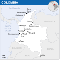
Colombia - Location Map (2013) - COL - UNOCHA.svg 254 × 254; 312 KB
-
Colombia disputed w1 countrymap.svg 1,000 × 1,000; 37 KB
-
Colombia protestas.svg 125 × 98; 10 KB
-
Colombia svg.svg 512 × 689; 762 KB
-
Colombia svg3.svg 512 × 689; 754 KB
-
Colombia2 svg.svg 512 × 689; 754 KB
-
H1N1 Colombia map by confirmed cases.svg 986 × 1,424; 140 KB
-
H1N1 Colombia map by confirmed deaths.svg 986 × 1,424; 138 KB
-
H1N1 Colombia map.svg 986 × 1,424; 140 KB
-
LaGuajiraMunicipios.svg 744 × 1,052; 26 KB
-
Lazo Negro Colombia.svg 100 × 137; 9 KB
-
Map of major Colombian volcanoes.svg 480 × 480; 171 KB
-
Mapa da Colômbia (OCHA).svg 254 × 254; 263 KB
-
Nueva Gran Colombia.svg 439 × 294; 164 KB
-
User-jyon-places-visited.svg 512 × 692; 404 KB


