Category:Maps of Chile
Jump to navigation
Jump to search
Use the appropriate category for maps showing all or a large part of Chile. See subcategories for smaller areas:
| If the map shows | Category to use |
|---|---|
| Chile on a recently created map | Category:Maps of Chile or its subcategories |
| Chile on a map created more than 70 years ago | Category:Old maps of Chile or its subcategories |
| the history of Chile on a recently created map | Category:Maps of the history of Chile or its subcategories |
| the history of Chile on a map created more than 70 years ago | Category:Old maps of the history of Chile or its subcategories |
Wikimedia category | |||||
| Upload media | |||||
| Instance of | |||||
|---|---|---|---|---|---|
| Category combines topics | |||||
 | |||||
Maps of regions are from north to south. Maps of Chile
Subcategories
This category has the following 49 subcategories, out of 49 total.
!
*
A
B
C
D
E
- ECHO Daily Maps of Chile (18 F)
F
- Floor plans of Chile (4 F)
G
H
- HDI maps of Chile (11 F)
I
J
L
M
- Mining maps of Chile (4 F)
N
- Nicanor Boloña (17 F)
O
P
R
- Road maps of Chile (35 F)
S
- Sanitary maps of Chile (7 F)
T
W
- Wine maps of Chile (6 F)
Pages in category "Maps of Chile"
The following 4 pages are in this category, out of 4 total.
Media in category "Maps of Chile"
The following 129 files are in this category, out of 129 total.
-
Chile (1823, orthographic projection).svg 550 × 550; 564 KB
-
Chile (1883, orthographic projection).svg 550 × 550; 448 KB
-
003 Chile.jpg 3,828 × 17,567; 3.41 MB
-
A map of northern Chile, with the location of Cerro Paranal indicated (eso9015b).jpg 1,182 × 1,734; 192 KB
-
A map of northern Chile, with the location of Cerro Paranal indicated (eso9015b).tif 1,182 × 1,734; 67 KB
-
Admiralty Chart No 1286 Canal Concepcion to Canal del Castillo, Published 1964.jpg 11,094 × 16,305; 30.85 MB
-
Admiralty Chart No 1287 Canal del Castillo to Estero San Esteban, Published 1964.jpg 11,087 × 16,270; 18.94 MB
-
Admiralty Chart No 3627 Anchorages between Golfo de Trinidad and Golfo de Penas, Published 1964.jpg 16,436 × 11,267; 30.19 MB
-
Arica Department (Chile).png 2,268 × 2,764; 178 KB
-
Cambio uso del suelo zona centro sur de chile 1550 a 2007.jpg 523 × 674; 62 KB
-
Caphorn1.en.svg 1,064 × 835; 288 KB
-
Caphorn1.svg 1,064 × 835; 184 KB
-
Casa Museo Artesanías de Chile - mapa.jpg 3,456 × 4,608; 4.04 MB
-
Channels and Fjords of Southern Chile marine ecoregion.png 453 × 453; 527 KB
-
Chile - DPLA - 2fbcee801d46dd97ea1f91d97e905810.jpg 2,556 × 3,274; 4.91 MB
-
Chile - DPLA - 3ebe43547d6a53d467300790e95852f5.jpg 2,396 × 3,116; 6.55 MB
-
Chile - DPLA - a63b0348cea51bee6c434abcb3a56063.jpg 2,552 × 3,268; 6.67 MB
-
Chile - DPLA - b2aa8374914061f85c4b272afae61d58.jpg 2,556 × 3,278; 5.33 MB
-
Chile - Physiography.jpg 1,610 × 2,143; 392 KB
-
Chile Administrative Map.jpg 1,841 × 3,104; 996 KB
-
Chile antipodes (en).png 1,093 × 1,643; 349 KB
-
Chile antipodes american area.png 556 × 897; 105 KB
-
Chile antipodes.png 1,093 × 1,643; 350 KB
-
Chile disputed w1 countrymap.svg 1,000 × 1,000; 30 KB
-
Chile DNI Solar-resource-map lang-ES GlobalSolarAtlas World-Bank-Esmap-Solargis.png 1,842 × 2,598; 888 KB
-
Chile fraccionado.jpg 1,616 × 803; 298 KB
-
Chile GHI Solar-resource-map GlobalSolarAtlas World-Bank-Esmap-Solargis.png 1,842 × 2,598; 853 KB
-
Chile GHI Solar-resource-map lang-ES GlobalSolarAtlas World-Bank-Esmap-Solargis.png 1,842 × 2,598; 846 KB
-
Chile nuevos corregimientos.jpg 439 × 526; 43 KB
-
Chile region VI.png 71 × 271; 5 KB
-
Chile region VII.png 71 × 271; 5 KB
-
Chile region VIII.png 71 × 271; 5 KB
-
Chile regions.png 106 × 406; 12 KB
-
Chile veg 1972.jpg 525 × 1,309; 98 KB
-
Chile veg-fr.png 252 × 628; 99 KB
-
Chile(Arabic).jpg 605 × 1,123; 232 KB
-
Chile(Chinese).jpg 605 × 1,123; 226 KB
-
Chile(Japanese).jpg 633 × 1,137; 212 KB
-
Chile(Korean).jpg 605 × 1,123; 225 KB
-
Chile(Thai).jpg 605 × 1,123; 206 KB
-
Chile, administrative divisions - ce - colored.svg 1,183 × 2,658; 1.98 MB
-
Chile- Administrative Divisions - DPLA - ab96df01a3645b440a476cb29790757c.jpg 2,554 × 3,272; 5.5 MB
-
Chile- Physiography - DPLA - 513e3ff08bce7ba8941019e662211b6e.jpg 2,554 × 3,278; 6.55 MB
-
Chile-15 Regiones.svg 229 × 1,067; 1,019 KB
-
Chilean Regions by GDP per capita 2014.png 940 × 1,509; 268 KB
-
ChileImageNav.png 417 × 1,111; 117 KB
-
Chilenav.png 128 × 537; 44 KB
-
Chili lokatie.png 460 × 533; 11 KB
-
Cl-cities1.png 320 × 742; 125 KB
-
Corregimientos chile aprox 2.jpg 220 × 667; 12 KB
-
Corregimientos chile aprox 3.jpg 248 × 744; 23 KB
-
Corregimientos chile aprox.png 220 × 667; 15 KB
-
Corregimientos chile aprox2.jpg 345 × 518; 30 KB
-
Diego ramirez map.png 733 × 1,301; 104 KB
-
Diezciudadesmasgrandesdechile.png 1,242 × 975; 222 KB
-
Distritos censales de Chiloé.png 2,000 × 2,755; 764 KB
-
Diócesis de Temuco.svg 539 × 665; 479 KB
-
ECDM 20150407 World Events.pdf 1,625 × 1,125; 364 KB
-
ECDM 20240422 South America.pdf 2,479 × 1,754; 965 KB
-
ECHO South America BaseMap A4 Portrait.png 2,481 × 3,509; 430 KB
-
Erdbeben-Karte Chile2015.png 1,000 × 1,024; 120 KB
-
ETH-BIB-Expedition 1897, Karte 1897 -4 Anden-Querungen--Dia 247-Z-00276.tif 2,945 × 3,438; 29.13 MB
-
ETH-BIB-Karte, Vulkane, Peteroa-Planchon, Descabezado-Dia 247-Z-00300.tif 2,920 × 3,414; 28.65 MB
-
ETH-BIB-Peulla-Todos, Santos-Puerto Montt (Vergleich- Vierwaldstättersee)-Dia 247-Z-00269.tif 3,624 × 2,867; 29.87 MB
-
Evolucion 21062015.gif 593 × 939; 553 KB
-
Fenomeno del Desierto Florido, Gajardo 1994.jpg 3,308 × 4,679; 2 MB
-
Fig-5-Map-of-the-wind-power-density-to-the-west-of-Cerro-Paranal.gif 567 × 426; 215 KB
-
FLII Chile.png 345 × 824; 97 KB
-
Frezier Voyage Perfils.jpg 1,791 × 1,203; 605 KB
-
Geographic ancestry distribution of Chile.png 1,983 × 2,428; 1.53 MB
-
Gud.jpg 457 × 960; 62 KB
-
Imagen1 Pais RegNuble-W800.jpg 2,125 × 2,750; 605 KB
-
Köppen–Geiger climate types in Chile.png 1,080 × 1,302; 504 KB
-
Location of Chile within South America.png 483 × 668; 28 KB
-
M 5.0 - 17km SE of Pucon, Chile.jpg 612 × 684; 98 KB
-
Map of Paranal Observatory.jpg 4,397 × 3,994; 1.26 MB
-
Mapa Araucanía.jpg 717 × 531; 270 KB
-
Mapa chauques.png 4,251 × 2,834; 1 MB
-
Mapa de Provincia de Santiago 1923.jpg 8,490 × 6,117; 14.74 MB
-
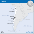
Mapa do Chile (OCHA).svg 254 × 254; 628 KB
-
Mapa Plaza Simón Bolívar 2023.png 4,200 × 2,550; 3.6 MB
-
Mapa ubicación Parque Tepuhueico.jpg 1,280 × 842; 172 KB
-
Mapa zonas naturales de Chile.png 2,756 × 4,548; 2.44 MB
-
Mapatomadevaldivia.PNG 797 × 510; 432 KB
-
Mapiteichon.jpg 457 × 960; 61 KB
-
MBCDSA.jpg 4,677 × 3,306; 6.1 MB
-
Mosaico en O'Higgins con Maipú - panoramio.jpg 2,816 × 2,112; 2.95 MB
-
NaturalregionsofChile.jpg 162 × 603; 44 KB
-
Norte Chico map.png 352 × 753; 200 KB
-
Norte Grande big.png 390 × 989; 289 KB
-
NUESTRO CHILE.jpg 298 × 181; 26 KB
-
Partidos chilenos2.jpg 462 × 588; 46 KB
-
PAT - Chile.gif 690 × 1,200; 178 KB
-
Patagonia verde chile.JPG 365 × 637; 30 KB
-
Patagonia Verde Chile.JPG 365 × 637; 31 KB
-
PDSANT.jpg 4,966 × 7,022; 2.7 MB
-
Pery and Chile map.png 251 × 330; 4 KB
-
Physical map of Chile.png 1,495 × 2,545; 5.42 MB
-
Piscosingani.jpg 447 × 460; 43 KB
-
Population density of Chile regions.png 2,075 × 5,312; 620 KB
-
Primeras provincias de Chile.jpg 578 × 996; 53 KB
-
Primero-blanco-azocar.svg 721 × 846; 1.43 MB
-
Provincias Chile 1925.png 288 × 667; 55 KB
-
Provincias Chile, 1925.jpg 288 × 667; 92 KB
-
Pueblos indigenas de Chile location map +relief.svg 1,183 × 2,658; 1.34 MB
-
Pueblos indigenas de Chile location map.svg 1,183 × 2,658; 682 KB
-
Pueblos indigenas de Chile.svg - beta.png 835 × 3,000; 1.28 MB
-
Reservasdecampamentos1.jpg 718 × 687; 113 KB
-
Roadmap for GalileoMobile expedition (iau0920a).jpg 4,000 × 2,250; 2.05 MB
-
Roadmap for GalileoMobile expedition (iau0920a).tiff 4,000 × 2,250; 9.06 MB
-
Southern Cone(Strict definition).png 541 × 541; 93 KB
-
Sucursales Banco de Talca 1982.png 2,000 × 10,000; 1.56 MB
-
Tacna Department (Chile).png 2,268 × 2,764; 178 KB
-
Tarata Department (Chile).png 2,268 × 2,764; 194 KB
-
Transportation map of Chile.png 1,842 × 3,108; 4.16 MB
-
Txu-oclc-224300691-se19-6 (cropped on Casiri).jpg 1,096 × 1,475; 1.42 MB
-
Vichuquén-Infiernillo-map.jpg 2,290 × 2,228; 1.45 MB
-
Zona Sur map.png 395 × 959; 475 KB
-
Zonas horarias de Chile.svg 213 × 640; 1.01 MB
-
Չիլիի-երկրի-քարտեզ.jpg 1,200 × 1,252; 76 KB


