Category:SVG maps of the history of Chile
Jump to navigation
Jump to search
Subcategories
This category has only the following subcategory.
Media in category "SVG maps of the history of Chile"
The following 132 files are in this category, out of 132 total.
-
1893 border protocol between Argentina & Chile.svg 694 × 589; 916 KB
-
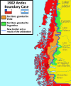
1902 Andes Boundary Case de.svg 537 × 645; 1.02 MB
-
1902 Andes Boundary Case.svg 1,430 × 1,720; 1.47 MB
-
Acuerdos de Charaña.svg 1,109 × 865; 242 KB
-
Aguas Blancas comuna 1927.svg 173 × 262; 251 KB
-
Andacollo comuna 1927.svg 82 × 162; 517 KB
-
Antofagasta comuna 1927.svg 173 × 262; 251 KB
-
Antofagasta división comunal 1927.svg 173 × 262; 251 KB
-
LocationKingdomAraucania.svg 1,000 × 500; 987 KB
-
Argentine and Chilean Antarctic claims (1946–present (as of 2023)).svg 728 × 845; 732 KB
-
Arica comuna 1928.svg 94 × 199; 156 KB
-
Arica Department (Chile).png 2,268 × 2,764; 178 KB
-
Arica Department (Chile).svg 2,268 × 2,764; 146 KB
-
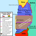
Atacama Desert Dispute between Bolivia and Chile (1825 - 1879).svg 1,500 × 1,500; 3.41 MB
-
Aymara-language-domain-en-001.svg 1,278 × 728; 2 MB
-
Aymara-language-domain-es-001.svg 1,278 × 728; 1.98 MB
-
Aysén location map (+claims, 1974-1995) Laguna del Desierto included.svg 300 × 397; 1.1 MB
-
Aysén location map (1974-1995) Laguna del Desierto Disputed.svg 300 × 397; 1.08 MB
-
Bandera mapa de Chile (Patria Nueva, 1817).svg 1,582 × 3,543; 3.2 MB
-
Bandera mapa de Chile (Patria Vieja, 1812).svg 1,582 × 3,543; 3.2 MB
-
Bandera mapa de la Capitanía General de Chile, 1775.svg 1,579 × 3,543; 1.35 MB
-
Bandera mapa de la Capitanía General de Chile, 1776.svg 1,575 × 3,543; 3.19 MB
-
Bandera mapa de la Capitanía General de Chile, 1785.svg 1,582 × 3,543; 3.45 MB
-
Belén comuna 1928.svg 93 × 198; 121 KB
-
Calama comuna 1927.svg 173 × 262; 251 KB
-
Capitanía General de Chile, 1775, mapa satelital.svg 1,710 × 2,684; 8.84 MB
-
Capitanía General de Chile, 1775.svg 1,710 × 2,684; 4.53 MB
-
Capitanía General de Chile, 1776.svg 1,710 × 2,684; 4.77 MB
-
Capitanía General de Chile, 1810 (Uti possidetis iuris).svg 1,710 × 2,684; 5.8 MB
-
Captaincy General of Chile, 1775.svg 1,710 × 2,684; 4.5 MB
-
Capture of Valdivia-es.svg 797 × 510; 102 KB
-
Catalina comuna 1927.svg 173 × 262; 251 KB
-
Chile disputed w1 countrymap.svg 1,000 × 1,000; 30 KB
-
Chile location map (+claims until 1994).svg 1,183 × 2,658; 975 KB
-
Chile location map (+claims, 1775).svg 1,710 × 2,679; 2.2 MB
-
Chile location map (+claims, 1776).svg 1,710 × 2,679; 3.06 MB
-
Chile location map (+claims, 1818).svg 1,710 × 2,679; 3.31 MB
-
Chile location map (+claims, 1825).svg 1,710 × 2,679; 3.32 MB
-
Chile location map (+claims, 1850).svg 1,710 × 2,679; 3.34 MB
-
Chile location map (+claims, 1865).svg 1,710 × 2,679; 3.35 MB
-
Chile location map (+claims, 1866).svg 1,710 × 2,679; 3.1 MB
-
Chile location map (+claims, 1881).svg 1,710 × 2,679; 3.29 MB
-
Chile location map (+claims, 1899).svg 1,183 × 2,679; 1.19 MB
-
Chile location map (+claims, 1900).svg 1,183 × 2,679; 1.04 MB
-
Chile location map (+claims, 1903).svg 1,183 × 2,679; 1.01 MB
-
Chile location map (+claims, 1904).svg 1,183 × 2,679; 1 MB
-
Chile location map (1818).svg 1,710 × 2,679; 4.58 MB
-
Chile location map (1884-1929).svg 1,474 × 2,775; 439 KB
-
Chilean Central Valley (Historical).svg 300 × 570; 75 KB
-
Codpa comuna 1928.svg 93 × 198; 121 KB
-
Combarbalá comuna 1927.svg 82 × 162; 517 KB
-
Conflicto del Beagle.svg 1,355 × 772; 1.9 MB
-
Coquimbo comuna 1927.svg 82 × 162; 517 KB
-
Coquimbo división comunal 1927.svg 82 × 162; 517 KB
-
Corregimiento de Copiapó en la Capitanía General de Chile.svg 1,710 × 2,679; 2.26 MB
-
Cuestión de Tacna y Arica.svg 3,954 × 3,837; 1.03 MB
-
Cuyo en la Capitanía General de Chile.svg 1,710 × 2,679; 2.53 MB
-
Departamento de Arica, Chile.svg 3,093 × 2,937; 787 KB
-
Disputa antártica entre Argentina y Chile (1946-presente).svg 728 × 845; 782 KB
-
Disputa de la Laguna del Desierto.svg 1,205 × 1,063; 2.62 MB
-
Disputa limítrofe de Alto Palena.svg 1,772 × 2,776; 1.29 MB
-
Disputa limítrofe del desierto de Atacama entre Bolivia y Chile (1825 - 1879).svg 1,500 × 1,500; 3.5 MB
-
Establecimientos del Imperio español en la Patagonia atlántica.svg 570 × 958; 4.31 MB
-
Flag map of Chile, 1818.svg 1,582 × 3,543; 2.84 MB
-
Flag map of Chile, 1881.svg 1,517 × 3,780; 1.75 MB
-
General Lagos comuna 1928.svg 94 × 199; 156 KB
-
Huara comuna 1928.svg 94 × 199; 156 KB
-
Illapel comuna 1927.svg 82 × 162; 517 KB
-
Iquique comuna 1928.svg 94 × 199; 156 KB
-
La Higuera comuna 1927.svg 82 × 162; 517 KB
-
La Serena comuna 1927.svg 82 × 162; 517 KB
-
Laguna del Desierto dispute.svg 1,205 × 1,063; 2.65 MB
-
Lagunas comuna 1928.svg 93 × 198; 120 KB
-
Laudo limítrofe entre Argentina y Chile de 1902.svg 1,430 × 1,720; 1.51 MB
-
Litigio de la Puna de Atacama.svg 414 × 491; 677 KB
-
Los Vilos comuna 1927.svg 82 × 162; 517 KB
-
Límites Campo de Hielo Patagónico Sur antes de 1994.svg 935 × 1,641; 2.62 MB
-
Límites Campo de Hielo Patagónico Sur.svg 935 × 1,641; 2.73 MB
-
Macro regiones del reino de Chile.svg 1,710 × 2,679; 2.63 MB
-
Magallanes y Antártica Chilena location map (South American part) (+claims, 1974).svg 1,535 × 1,550; 1.15 MB
-
Mapa de Chile (1928).svg 400 × 2,000; 1.32 MB
-
Mapa de Chile (1928, provincias).svg 400 × 2,000; 935 KB
-
Mapa de Chile (1929).svg 400 × 2,000; 1.3 MB
-
Mapa de Chile (1929, provincias).svg 400 × 2,000; 923 KB
-
Mejillones comuna 1927.svg 173 × 262; 251 KB
-
Mincha comuna 1927.svg 82 × 162; 518 KB
-
Monte Patria comuna 1927.svg 82 × 162; 518 KB
-
Negreiros comuna 1928.svg 93 × 198; 120 KB
-
Ovalle comuna 1927.svg 82 × 162; 518 KB
-
Paiguano comuna 1927.svg 82 × 162; 518 KB
-
Parte sudamericana del Reino de Chile, 1776.svg 1,576 × 3,543; 833 KB
-
Pica comuna 1928.svg 93 × 198; 120 KB
-
Pisagua comuna 1928.svg 93 × 198; 120 KB
-
Pozo Almonte comuna 1928.svg 93 × 198; 120 KB
-
Protocolo de límites de 1893 entre Argentina y Chile.svg 694 × 589; 929 KB
-
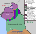
Provincia de Tacna, Chile (1884-1925).svg 2,268 × 2,764; 285 KB
-
Provincia de Tacna, Chile (1925-1929).svg 2,268 × 2,764; 252 KB
-
Pueblos indigenas de Chile 2.svg 559 × 1,064; 1.28 MB
-
Pueblos indigenas de Chile-ver.svg 820 × 2,721; 1.23 MB
-
Pueblos indigenas de Chile.svg 3,000 × 835; 1.29 MB
-
Pueblos indígenas de la Patagonia Austral.svg 1,535 × 1,550; 881 KB
-
Puna de Atacama dispute.svg 414 × 491; 649 KB
-
Punitaqui comuna 1927.svg 82 × 162; 518 KB
-
Putre comuna 1928.svg 93 × 198; 120 KB
-
Pérdidas territoriales de iure de la República de Chile.svg 1,800 × 2,808; 3.84 MB
-
Resultados Plebiscito 1988 por comuna.svg 400 × 2,000; 2.73 MB
-
Resultados Plebiscito 1988 por provincia.svg 400 × 2,000; 1.13 MB
-
Resultados Plebiscito 1988 por región.svg 400 × 2,000; 961 KB
-
Salamanca comuna 1927.svg 82 × 162; 518 KB
-
Samo Alto comuna 1927.svg 82 × 162; 518 KB
-
Sierra Gorda comuna 1927.svg 173 × 262; 251 KB
-
Southern Patagonian Ice Field border.svg 935 × 1,641; 2.64 MB
-
Southern Patagonian Ice Field dispute before 1994.svg 935 × 1,641; 2.45 MB
-
Tacna Department (Chile) (1884-1911).svg 2,268 × 2,764; 121 KB
-
Tacna Department (Chile).png 2,268 × 2,764; 178 KB
-
Tacna Department (Chile).svg 2,268 × 2,764; 146 KB
-
Tacna province (1884-1925) Chile location map.svg 2,268 × 2,764; 146 KB
-
Tacna province (1925-1929) Chile location map.svg 2,268 × 2,764; 80 KB
-
Tacna-Arica Dispute (1883-1929).svg 3,954 × 3,837; 1 MB
-
Taltal comuna 1927.svg 173 × 262; 251 KB
-
Tarapacá antigua división por comunas 1928.svg 93 × 198; 120 KB
-
Tarata Department (Chile).png 2,268 × 2,764; 194 KB
-
Tarata Department (Chile).svg 2,268 × 2,764; 146 KB
-
Territorial losses of the Republic of Chile de jure.svg 1,800 × 2,808; 3.75 MB
-
Toco comuna 1927.svg 173 × 262; 251 KB
-
Tocopilla comuna 1927.svg 173 × 262; 251 KB
-
Tratado de Ancón.svg 4,591 × 6,024; 547 KB
-
Treaty of Ancón.svg 4,606 × 6,024; 513 KB
-
Vicuña comuna 1927.svg 82 × 162; 518 KB
-
アルゼンチンとチリの南極請求(1946年~現在(2023年時点)).svg 512 × 594; 603 KB


