
Category:Political maps of Georgia
Subcategories
This category has the following 3 subcategories, out of 3 total.
E
I
Media in category "Political maps of Georgia"
The following 12 files are in this category, out of 12 total.
-
 Caucasus Political.png 10,299 × 7,807; 5.87 MB
-
 Cities and towns in Georgia by population size.svg 1,019 × 590; 1.23 MB
-
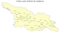 Cities and towns in Georgia.svg 1,019 × 590; 1.03 MB
-
 Georgia cities01.png 1,461 × 767; 43 KB
-
 Georgia country map.png 635 × 326; 17 KB
-
 Georgia country.png 635 × 326; 17 KB
-
 Georgia map.png 635 × 326; 17 KB
-
 Georgia-vector-map.jpg 3,000 × 1,968; 329 KB
-
 Georgia-vector-map.png 3,000 × 1,968; 298 KB
-
 Georgia-vector-map.svg 9,000 × 5,904; 228 KB
-
 Map of ethnic Georgians significant distribution in Turkey.svg 550 × 325; 1.46 MB
-
 Карта-Грузии.gif 635 × 326; 11 KB


