Category:Political maps of Jordan
Jump to navigation
Jump to search
Subcategories
This category has the following 3 subcategories, out of 3 total.
Media in category "Political maps of Jordan"
The following 3 files are in this category, out of 3 total.
-
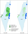
Palestine map pre 1967 and post-Oslo-en.png 500 × 600; 53 KB
-
Palestine map pre 1967 and post-Oslo-nl.png 500 × 600; 54 KB
-
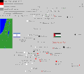
Samaria, Jordan-Israel border.gif 1,704 × 1,506; 109 KB


