
Category:Political maps of Singapore
Subcategories
This category has the following 3 subcategories, out of 3 total.
Media in category "Political maps of Singapore"
The following 12 files are in this category, out of 12 total.
-
 Base Map of Singapore.png 1,114 × 696; 427 KB
-
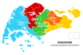
 CDC map of Singapore 2015.svg 2,383 × 1,684; 1.78 MB
-
 CDC map of Singapore 2020.svg 2,876 × 1,907; 289 KB
-
 Central Singapore CDC map 2015.svg 2,383 × 1,684; 1.76 MB
-
 Map of the CDC Districts of Singapore.png 949 × 508; 100 KB
-
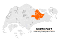 North East CDC map 2015.svg 2,383 × 1,684; 1.78 MB
-
 North West CDC map 2015.svg 2,383 × 1,684; 1.78 MB
-
 Singapuri ringkonnad.png 949 × 508; 114 KB
-
 South East CDC map 2015.svg 2,383 × 1,684; 1.77 MB
-
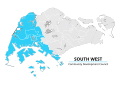 South West CDC map 2015.svg 2,383 × 1,684; 1.79 MB
-
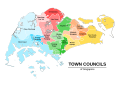 Town Councils map of Singapore 2015.svg 2,383 × 1,684; 1.93 MB
-
 Town Councils map of Singapore 2020.svg 2,876 × 1,907; 290 KB


