Category:Political maps of Bosnia and Herzegovina
Jump to navigation
Jump to search
Subcategories
This category has the following 4 subcategories, out of 4 total.
Media in category "Political maps of Bosnia and Herzegovina"
The following 75 files are in this category, out of 75 total.
-
5 kantona.PNG 1,594 × 1,686; 153 KB
-
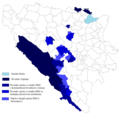
Alliance of Serb municipalities map 1.PNG 1,792 × 1,704; 112 KB
-
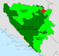
B-H entitásai opt hu.svg 1,471 × 1,392; 48 KB
-
BA-political-BRA.png 640 × 448; 24 KB
-
Balkans2010.png 1,128 × 1,040; 135 KB
-
BiH blank with entities.png 500 × 500; 7 KB
-
BiH blank.png 500 × 500; 7 KB
-
BiH Croat coridors.png 1,809 × 1,752; 138 KB
-
Bih outline map.png 1,068 × 1,074; 50 KB
-
BiH19913+2.PNG 1,857 × 1,767; 102 KB
-
Bosnia and Herzegovina administrative subdivision map.png 1,600 × 1,520; 108 KB
-
Bosnia and Herzegovina districts blank.png 1,000 × 995; 10 KB
-
Bosnia and Herzegovina location map-2.svg 1,063 × 1,014; 160 KB
-
Bosnia and Herzegovina location map.svg 1,063 × 1,014; 141 KB
-
Bosnia-Herzegovina map modern.png 1,068 × 1,074; 64 KB
-
Bosnien-herzegowina 2-1225x1200.png 1,225 × 1,200; 371 KB
-
Bosnjakistan.png 558 × 429; 52 KB
-
Carte de la Grande Bosnie.png 625 × 480; 256 KB
-
Cetiri entiteta.png 660 × 635; 171 KB
-
Clare 4 .jpg 1,028 × 1,096; 135 KB
-
Croat selfrule 2001 structure.png 1,809 × 1,752; 136 KB
-
Croat selfrule 2001.png 1,809 × 1,752; 112 KB
-
Decriminalization of same-sex intercourse in Bosnia and Herzegovina.svg 1,063 × 1,014; 252 KB
-
Distrikt Bosanska Posavina.png 1,055 × 514; 39 KB
-
Economic region of Herzegovina.png 1,600 × 1,520; 129 KB
-
FBiH alternativ.png 500 × 500; 7 KB
-
Federation BiH.png 1,000 × 995; 42 KB
-
Federation of Bosnia and Herzegovina location map.jpg 2,144 × 2,046; 464 KB
-
Granice Hercegbosne.png 1,809 × 1,752; 141 KB
-
Greater Bosnia.jpg 867 × 813; 50 KB
-
Herzegbosnia RS borders.png 1,809 × 1,752; 168 KB
-
HRS proposition.png 1,809 × 1,752; 117 KB
-
Hrvatske opcine u BiH.png 2,000 × 1,752; 186 KB
-
Izmjene Washington Kontakt-grupa Dayton.png 5,000 × 1,752; 266 KB
-
Jedan kroz tri.png 1,780 × 1,686; 227 KB
-
Karta novog uredjenja BiH po prijedlogu Bakira Izetbegovica.png 923 × 877; 518 KB
-
Karte von Bosnien und Herzegowina.png 330 × 355; 19 KB
-
Kontaktna-dayton.png 1,809 × 1,752; 151 KB
-
Kontaktna.png 1,809 × 1,752; 149 KB
-
M bih03.jpg 700 × 615; 49 KB
-
Map Bih entities Belarusian.svg 1,471 × 1,392; 101 KB
-
Map Bih entities.png 1,103 × 1,044; 67 KB
-
Map Bih entities lat.png 1,103 × 1,044; 66 KB
-
Map Bih entities cyr.png 1,103 × 1,044; 67 KB
-
Map Bih entities (ru).png 1,103 × 1,044; 67 KB
-
Map Bih entities mk.png 1,103 × 1,044; 74 KB
-
Map Bih entities-he.png 1,103 × 1,044; 53 KB
-
Bosnia herzegovina division 2.PNG 1,103 × 1,044; 67 KB
-
Bosnia herzegovina division 3.PNG 1,103 × 1,044; 73 KB
-
Mappa-Bosnia-Erzegovina.png 330 × 355; 19 KB
-
Maritime space of Bosnia and Herzegovina.png 945 × 707; 315 KB
-
Municipality Location in BH small.png 405 × 385; 79 KB
-
New municipalities in BiH at time of Dayton.png 2,500 × 1,752; 139 KB
-
New municipalities in BiH not connected to Dayton.png 2,500 × 1,752; 128 KB
-
New municipalities in BiH.png 2,500 × 1,752; 153 KB
-
Owen stoltenberg-dayton.png 1,809 × 1,752; 172 KB
-
PAT - Bosnia-Herzegovina.gif 890 × 950; 363 KB
-
Political devisions of Bosnia and Herzegovina.gif 1,600 × 1,520; 711 KB
-
Polutok Klek i granica.JPG 434 × 300; 32 KB
-
Republika Srpska location map.svg 512 × 489; 128 KB
-
Rjesenje za federaciju.png 929 × 1,047; 335 KB
-
Savrsena podjela.png 502 × 481; 142 KB
-
Serb Republic.png 1,000 × 995; 42 KB
-
Suggested BiH division before ww2.png 1,809 × 1,752; 109 KB
-
Treći entitet.png 1,220 × 1,100; 123 KB
-
Tri entiteta i dva distrikta.PNG 1,780 × 1,686; 244 KB
-
Tri entiteta plus tri distrikta.PNG 976 × 927; 343 KB
-
Tri kantona.png 451 × 429; 54 KB
-
Tri plus tri.png 925 × 876; 512 KB
-
United Bosnia.png 400 × 400; 7 KB
-
Zmajevi lokacija.png 692 × 658; 50 KB
-
Босния и Герцеговина административное деление.png 792 × 796; 30 KB
-
Босния и Герцеговина.png 627 × 651; 215 KB
-
Поділ Боснії і Герцеговини.png 682 × 599; 99 KB
-
보스니아 헤르체고비나의 행정구역 지도.png 1,103 × 1,044; 55 KB


