Category:Political maps of the Philippines
Jump to navigation
Jump to search
Subcategories
This category has the following 6 subcategories, out of 6 total.
E
I
M
Media in category "Political maps of the Philippines"
The following 119 files are in this category, out of 119 total.
-
Current Philippine provincial governors map.png 2,000 × 3,120; 165 KB
-
Current Philippine Provincial Governors Map.svg 2,067 × 3,120; 661 KB
-
Home provinces of Philippine Presidents.PNG 2,000 × 3,120; 237 KB
-
Legislative districts of the Philippines 2007.PNG 2,000 × 3,120; 246 KB
-
Metro Manila in the Philippines.png 2,762 × 5,362; 345 KB
-
Metro manila map (1).png 500 × 900; 38 KB
-
Number of barangays per province.png 2,000 × 3,120; 132 KB
-
Number of barangays per province.svg 4,200 × 6,105; 952 KB
-
Ph Bangsamoro Autonomous Region.png 3,654 × 2,076; 703 KB
-
Ph bicol.png 481 × 570; 37 KB
-
Ph cagayan valley.png 396 × 1,048; 38 KB
-
Ph CALABARZON.png 465 × 449; 42 KB
-
Ph caraga.png 342 × 551; 34 KB
-
Ph central luzon.png 536 × 467; 44 KB
-
Ph central visayas.png 451 × 500; 34 KB
-
Ph cordillera.png 306 × 515; 26 KB
-
Ph davao region.png 1,144 × 1,838; 270 KB
-
Ph eastern visayas.png 402 × 580; 37 KB
-
Ph fil abra.png 1,308 × 1,505; 362 KB
-
Ph fil agusan del norte.png 1,768 × 2,651; 437 KB
-
Ph fil agusan del sur.png 2,752 × 2,752; 865 KB
-
Ph fil aklan.png 2,736 × 2,189; 666 KB
-
Ph fil albay.png 2,971 × 1,980; 747 KB
-
Ph fil antique.png 2,413 × 3,777; 697 KB
-
Ph fil apayao.png 672 × 1,094; 154 KB
-
Ph fil aurora.png 1,854 × 2,739; 457 KB
-
Ph fil basilan.png 3,210 × 2,373; 435 KB
-
Ph fil bataan.png 2,177 × 3,048; 519 KB
-
Ph fil batanes.png 625 × 1,016; 45 KB
-
Ph fil batangas.png 1,624 × 1,343; 302 KB
-
Ph fil benguet.png 1,824 × 2,736; 511 KB
-
Ph fil biliran.png 531 × 469; 58 KB
-
Ph fil bohol.png 2,736 × 2,161; 671 KB
-
Ph fil bukidnon.png 1,094 × 1,407; 325 KB
-
Ph fil bulacan.png 941 × 722; 221 KB
-
Ph fil cagayan.png 1,098 × 1,668; 276 KB
-
Ph fil camarines norte.png 2,839 × 2,271; 548 KB
-
Ph fil camarines sur.png 4,096 × 2,730; 1.46 MB
-
Ph fil camiguin.png 281 × 234; 21 KB
-
Ph fil capiz.png 3,252 × 2,098; 827 KB
-
Ph fil catanduanes.png 2,177 × 3,048; 430 KB
-
Ph fil cavite.png 1,848 × 1,612; 361 KB
-
Ph fil cebu.png 2,764 × 4,096; 1.4 MB
-
Ph fil davao de oro.png 1,768 × 2,651; 409 KB
-
Ph fil davao del norte.png 1,768 × 2,651; 390 KB
-
Ph fil davao del sur 2013.png 1,500 × 3,779; 510 KB
-
Ph fil davao del sur.png 1,000 × 1,328; 205 KB
-
Ph fil davao occidental.png 625 × 1,469; 117 KB
-
Ph fil davao oriental.png 1,633 × 2,905; 371 KB
-
Ph fil dinagat islands.png 469 × 782; 87 KB
-
Ph fil eastern samar.png 1,095 × 2,111; 304 KB
-
Ph fil guimaras.png 1,469 × 1,888; 297 KB
-
Ph fil ifugao.png 859 × 625; 143 KB
-
Ph fil ilocos norte.png 1,259 × 1,836; 303 KB
-
Ph fil ilocos sur.png 2,802 × 4,202; 1.2 MB
-
Ph fil iloilo.png 3,383 × 3,147; 2.02 MB
-
Ph fil isabela.png 2,082 × 2,046; 417 KB
-
Ph fil kalinga.png 938 × 625; 124 KB
-
Ph fil la union.png 1,824 × 2,736; 474 KB
-
Ph fil laguna.png 2,520 × 2,592; 545 KB
-
Ph fil lanao del norte.png 2,330 × 1,664; 560 KB
-
Ph fil lanao del sur.png 1,156 × 1,031; 362 KB
-
Ph fil leyte.png 1,941 × 2,780; 816 KB
-
Ph fil Maguindanao del Norte.png 1,202 × 1,829; 171 KB
-
Ph fil Maguindanao del Sur.png 1,909 × 1,113; 237 KB
-
Ph fil Maguindanao.png 1,417 × 1,319; 327 KB
-
Ph fil marinduque.png 2,103 × 2,103; 280 KB
-
Ph fil masbate.png 2,465 × 2,990; 825 KB
-
Ph fil misamis occidental.png 2,554 × 3,575; 1.07 MB
-
Ph fil misamis oriental.png 2,350 × 1,880; 420 KB
-
Ph fil mountain province.png 938 × 531; 122 KB
-
Ph fil negros occidental.png 2,527 × 3,538; 1.28 MB
-
Ph fil negros oriental.png 938 × 1,720; 297 KB
-
Ph fil north cotabato.png 2,752 × 2,752; 913 KB
-
Ph fil northern samar.png 3,140 × 1,766; 687 KB
-
Ph fil nueva ecija.png 2,177 × 3,048; 540 KB
-
Ph fil nueva vizcaya.png 2,135 × 2,668; 659 KB
-
Ph fil occidental mindoro.png 2,490 × 3,435; 663 KB
-
Ph fil oriental mindoro.png 1,682 × 2,613; 390 KB
-
Ph fil palawan.png 3,462 × 2,308; 577 KB
-
Ph fil pampanga.png 1,949 × 1,716; 537 KB
-
Ph fil pangasinan.png 2,095 × 1,550; 599 KB
-
Ph fil quezon.png 1,986 × 2,780; 915 KB
-
Ph fil quirino.png 938 × 907; 141 KB
-
Ph fil rizal.png 2,271 × 3,180; 993 KB
-
Ph fil romblon.png 1,979 × 1,976; 170 KB
-
Ph fil samar.png 2,360 × 2,623; 934 KB
-
Ph fil sarangani.png 2,350 × 1,880; 456 KB
-
Ph fil siquijor.png 470 × 314; 36 KB
-
Ph fil sorsogon.png 4,096 × 2,926; 1.04 MB
-
Ph fil south cotabato.png 2,839 × 2,271; 667 KB
-
Ph fil southern leyte.png 986 × 939; 180 KB
-
Ph fil sultan kudarat.png 2,665 × 1,778; 496 KB
-
Ph fil sulu.png 4,126 × 2,026; 310 KB
-
Ph fil surigao del norte.png 1,250 × 937; 286 KB
-
Ph fil surigao del sur.png 1,017 × 1,878; 326 KB
-
Ph fil tarlac.png 3,452 × 3,451; 1.14 MB
-
Ph fil tawi-tawi.png 2,623 × 3,031; 519 KB
-
Ph fil zambales.png 1,986 × 2,780; 202 KB
-
Ph fil zamboanga del norte.png 3,147 × 3,305; 564 KB
-
Ph fil zamboanga del sur (with zamboanga city).png 3,092 × 2,350; 752 KB
-
Ph fil zamboanga del sur.png 1,679 × 1,888; 342 KB
-
Ph fil zamboanga sibugay.png 1,836 × 1,521; 249 KB
-
Ph ilocos.png 295 × 647; 26 KB
-
Ph MIMAROPA.png 1,210 × 1,216; 75 KB
-
Ph northern mindanao.png 458 × 458; 40 KB
-
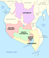
Ph SOCCSKSARGEN.png 361 × 490; 28 KB
-
Ph western visayas.png 857 × 779; 52 KB
-
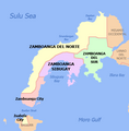
Ph zamboanga peninsula.png 450 × 458; 28 KB
-
Philippine legislative districts per province.png 2,000 × 3,120; 237 KB
-
Philippine provinces by income classification.svg 4,200 × 6,105; 920 KB
-
Philippines Base Map v2.png 749 × 1,004; 334 KB
-
Philippines Base Map.png 2,891 × 2,167; 297 KB
-
Philippines legislative districts.png 2,050 × 3,120; 213 KB
-
Sangguniang Panlalawigan regular members.png 2,000 × 3,120; 115 KB
-
Sangguniang Panlalawigan seat allocation.png 2,000 × 3,120; 151 KB
-
Sangguniang Panlalawigan with IPMR.png 2,000 × 3,120; 107 KB
-
Socsksargen.png 1,846 × 2,183; 475 KB
-
South Cotabato Labelled Map.png 800 × 588; 161 KB


