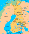
Category:Political maps of Finland
Jump to navigation
Jump to search
Subcategories
This category has the following 4 subcategories, out of 4 total.
E
I
T
Media in category "Political maps of Finland"
The following 10 files are in this category, out of 10 total.
-
Finland. LOC 96687507.jpg 2,520 × 3,272; 933 KB
-
Finland. LOC 96687507.tif 2,520 × 3,272; 23.59 MB
-
Finland.gif 481 × 576; 42 KB
-
Finska mapa.jpg 276 × 599; 68 KB
-
Maanmittauslaitos yleiskartta 1-1M.jpg 7,297 × 11,880; 36.27 MB
-
Maanmittauslaitos yleiskartta 1-1M.png 7,297 × 11,880; 5.55 MB
-
Maanmittauslaitos yleiskartta 1-4.5M.jpg 4,606 × 6,626; 17.56 MB
-
Map of Finland.png 832 × 1,440; 929 KB
-
N.º de Ministros por Región.png 452 × 621; 53 KB
-
Politically independent Central European states during Cold war.svg 450 × 456; 475 KB


