Category:OpenStreetMap maps of the United States
Jump to navigation
Jump to search
Countries of the Americas: Argentina · The Bahamas · Bolivia · Brazil · Canada · Chile · Colombia · Costa Rica · Cuba · Dominican Republic · Ecuador · El Salvador · Guatemala · Haiti · Jamaica · Mexico · Nicaragua · Panama · Paraguay · Peru · Saint Kitts and Nevis · Trinidad and Tobago · United States of America · Uruguay · Venezuela
Other areas: Bermuda · Cayman Islands · French Guiana · Greenland · Puerto Rico · United States Virgin Islands
Other areas: Bermuda · Cayman Islands · French Guiana · Greenland · Puerto Rico · United States Virgin Islands
Subcategories
This category has the following 49 subcategories, out of 49 total.
Media in category "OpenStreetMap maps of the United States"
The following 18 files are in this category, out of 18 total.
-
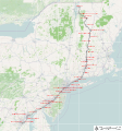
Amtrak Cardinal.svg 1,200 × 497; 617 KB
-
Amtrak Lake Shore Limited.svg 1,200 × 366; 699 KB
-
Amtrak Maple Leaf.png 800 × 527; 542 KB
-
Amtrak Maple Leaf.svg 800 × 527; 443 KB
-
Amtrak Northeast Regional.svg 1,301 × 980; 1.15 MB
-
Amtrak Vermonter.svg 1,200 × 1,285; 1.46 MB
-
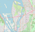
French Island map.webp 2,594 × 2,376; 605 KB
-
Lac Memphrémagog.png 390 × 769; 276 KB
-
Location map American Samoa (central).png 841 × 882; 179 KB
-
Location map US Virgin Islands Saint Croix.png 914 × 965; 113 KB
-
Open Street Map of the United States.webp 4,262 × 2,366; 474 KB
-
OpenRailwayMap of Northeastern US and Southeastern Canada.png 1,920 × 962; 1.51 MB
-
OpenStreetMap image of Augusta National Golf Club.png 1,332 × 1,288; 1.48 MB
-
OpenStreetMap image of Sharp Park Golf Course.png 1,882 × 1,086; 1.42 MB
-
OpenStreetMap Solar Eclipse of May 20, 2012.png 953 × 554; 221 KB
-
OpenTrailStash Screenshot 2023-02-21.png 1,471 × 995; 1.58 MB
-
Southern Airways Flight 49.png 472 × 670; 247 KB
-
TF-Canyonlands NP 01.jpg 9,600 × 5,400; 16.35 MB


