Category:OpenStreetMap maps of Ohio
Jump to navigation
Jump to search
States of the United States: Alabama · Alaska · Arizona · California · Colorado · Connecticut · Florida · Georgia · Hawaii · Illinois · Indiana · Iowa · Kansas · Kentucky · Louisiana · Maine · Maryland · Massachusetts · Michigan · Minnesota · Mississippi · Missouri · Montana · Nebraska · Nevada · New Hampshire · New Jersey · New Mexico · New York · North Carolina · Ohio · Oklahoma · Oregon · Pennsylvania · Rhode Island · South Carolina · Tennessee · Texas · Utah · Vermont · Virginia · Washington · West Virginia · Wisconsin · Wyoming – Washington, D.C.
Puerto Rico · United States Virgin Islands
Puerto Rico · United States Virgin Islands
Subcategories
This category has only the following subcategory.
C
Media in category "OpenStreetMap maps of Ohio"
The following 16 files are in this category, out of 16 total.
-
Alliance Amtrak Map.png 1,225 × 630; 257 KB
-
BWC NRHP Southareahistoricdistrict.png 617 × 395; 29 KB
-
Cleveland, OH.png 1,200 × 793; 337 KB
-
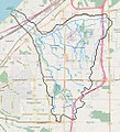
Euclid creek watershed.jpg 911 × 1,006; 448 KB
-
Euclid golf allotment.jpg 781 × 601; 92 KB
-
Location map United States Cleveland.png 610 × 388; 300 KB
-
Map Columbus (Ohio).jpg 2,165 × 1,835; 1.06 MB
-
Mohican River watershed.jpg 1,245 × 865; 359 KB
-
Newburgh Township and Union-Miles Park.jpg 3,076 × 2,868; 3.16 MB
-
OSM map comparison.png 550 × 891; 332 KB
-
Park OSM map.jpg 1,482 × 1,024; 199 KB
-
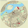
Perrysburg map.png 864 × 864; 926 KB
-
Scioto River Watershed.jpg 1,056 × 841; 248 KB
-
Stadium square HD.jpg 960 × 707; 288 KB
-
Transport OSM map.jpg 898 × 545; 122 KB
-
Union-Miles Park annexation overlap.jpg 3,076 × 2,868; 3.22 MB


