Category:OpenStreetMap maps of New York (state)
Jump to navigation
Jump to search
States of the United States: Alabama · Alaska · Arizona · California · Colorado · Connecticut · Florida · Georgia · Hawaii · Illinois · Indiana · Iowa · Kansas · Kentucky · Louisiana · Maine · Maryland · Massachusetts · Michigan · Minnesota · Mississippi · Missouri · Montana · Nebraska · Nevada · New Hampshire · New Jersey · New Mexico · New York · North Carolina · Ohio · Oklahoma · Oregon · Pennsylvania · Rhode Island · South Carolina · Tennessee · Texas · Utah · Vermont · Virginia · Washington · West Virginia · Wisconsin · Wyoming – Washington, D.C.
Puerto Rico · United States Virgin Islands
Puerto Rico · United States Virgin Islands
Subcategories
This category has only the following subcategory.
N
Media in category "OpenStreetMap maps of New York (state)"
The following 24 files are in this category, out of 24 total.
-
Arbor Hill Historic District-Ten Broeck Triangle map.png 685 × 798; 175 KB
-
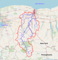
Cattaraugus Creek Watershed.jpg 1,477 × 847; 410 KB
-
Center Square-Hudson Park Historic District map.png 545 × 674; 391 KB
-
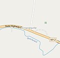
Cropseyville OSM.jpg 827 × 804; 131 KB
-
ETC, Owego Map Open Street Map.png 1,482 × 799; 295 KB
-
Genesee River Watershed.png 856 × 877; 621 KB
-
Irondequoit Creek Watershed.png 1,051 × 833; 805 KB
-
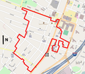
Lafayette Park Historic District map.svg 845 × 546; 149 KB
-
LongIsland2022OSM.png 6,666 × 3,048; 15.32 MB
-
Map - Clarence NY.png 3,000 × 4,017; 2.06 MB
-
Map - Clarence NY.svg 1,235 × 1,653; 2.64 MB
-
Map of Ardsley, New York.png 1,028 × 822; 581 KB
-
Niagara outcome.png 1,903 × 1,542; 1.79 MB
-
Old Albany Post Road map.png 249 × 694; 70 KB
-
Old bridge and Route 52 overpass.jpg 3,024 × 4,032; 3.94 MB
-
Popolopen creek.png 1,081 × 839; 1.21 MB
-
Radially concentric created streets in New York City.svg 1,799 × 1,216; 8.07 MB
-
Route of Peekskill Valley Railroad on OpenStreetMap.jpg 1,197 × 665; 245 KB
-
Sawkill watershed.png 1,118 × 786; 1.52 MB
-
Silvermine River watershed.png 896 × 838; 1.28 MB
-
South End-Groebeckville Historic District map.png 1,000 × 875; 531 KB
-
ThousandIslands2022OSM.png 6,018 × 4,243; 12.13 MB
-
Trump NGCW.png 780 × 755; 166 KB
-
WTSS broadcast area map FCC.png 693 × 622; 349 KB


