Category:OpenStreetMap maps of Hawaii
Jump to navigation
Jump to search
States of the United States: Alabama · Alaska · Arizona · California · Colorado · Connecticut · Florida · Georgia · Hawaii · Illinois · Indiana · Iowa · Kansas · Kentucky · Louisiana · Maine · Maryland · Massachusetts · Michigan · Minnesota · Mississippi · Missouri · Montana · Nebraska · Nevada · New Hampshire · New Jersey · New Mexico · New York · North Carolina · Ohio · Oklahoma · Oregon · Pennsylvania · Rhode Island · South Carolina · Tennessee · Texas · Utah · Vermont · Virginia · Washington · West Virginia · Wisconsin · Wyoming – Washington, D.C.
Puerto Rico · United States Virgin Islands
Puerto Rico · United States Virgin Islands
Media in category "OpenStreetMap maps of Hawaii"
The following 15 files are in this category, out of 15 total.
-
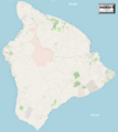
HawaiiBigIsland2021OSM.png 7,630 × 8,533; 9.98 MB
-
Honolulu districts map.png 1,649 × 691; 695 KB
-
Honolulu, HI.png 666 × 374; 190 KB
-
Kauai Plantation Railway OpenStreetMap.png 845 × 650; 93 KB
-
Kilauea topographic map protected area-fr.svg 3,543 × 2,480; 5.38 MB
-
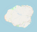
Location Map Kauai.png 1,904 × 1,637; 467 KB
-
Location map Lahaina Banyan Court Park.png 638 × 724; 87 KB
-
Location map Lahaina.png 856 × 995; 219 KB
-
Location map Maui.png 2,045 × 1,631; 511 KB
-
Location Map Molokai-Lanai.png 2,051 × 1,895; 310 KB
-
Map of Hawaii.png 1,818 × 2,078; 851 KB
-
Map of Oahu 2.png 2,051 × 1,895; 1.04 MB
-
Maui2022OSM.png 9,241 × 6,950; 42.77 MB
-
Oahu2021OSM.png 4,089 × 3,243; 4.18 MB
-
Route of the Hawaii State Route 465.png 1,834 × 1,190; 587 KB


